
A “dramatic drop in temperatures” is on the cards for Saturday as a “southerly buster” is set to blow through New South Wales as thunderstorm roll through the country.
News24 meteorologist Tamsin Green said Saturday will continue to see a “gusty southerly change” move up the coast through New South Wales, bringing with it chilly conditions, gusty winds, showers and thunderstorms.
“Across Queensland, we’re looking at a widespread threat of thunderstorms, a fairly widespread threat, but the thunderstorms themselves will be quite isolated,” Green said.
“That threat will be across large portions of the state but away from really the northern peninsula.
“But, across the west, out towards Mount Isa, we could be seeing those thunderstorms and further south through central and southern Queensland.”
Green said even Brisbane and the Gold Coast could see a few thunderstorms, but the risk was “fairly low”.
In the state’s centre areas, particularly inland of Bundaberg, there could be a higher chance of severe thunderstorms where they could be producing “giant hail” in excess of five centimetres.
“We’re also looking at the threat of thunderstorms extending through New South Wales, courtesy of this cool change, this gusty southerly change known as a southerly buster, moving up the New South Wales coast,” Green said.
“Further inland should be staying mainly dry, and as those southerly winds whip round after staying warm and sunny ahead of it, temperatures will be dropping quite dramatically.”
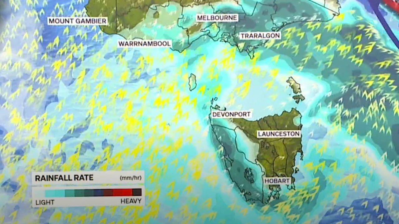
Victoria, meanwhile, could see some snow falling down to around 800 metres above sea level.
Southerly winds are also expected to “take the edge off” some of the higher temperatures, making it feel “much more wintry” outside.
Down in Tasmania, there is a threat of showers mainly across the west but it could be extending statewide with a chance of snow through the morning around 500 metres above sea level.
Over to South Australia, it is looking mainly fine and dry, courtesy of high pressure, “dominating” the weather pattern.
“Southerly winds will be taking the edge off those temperatures for you as well, below average for the time of year,” Green said.
Western Australia is also in for more thunderstorms which are set to extend all the way from the south, through the interior, and up towards the Kimberley and the Pilbara.
Meanwhile, the Top End is in for more heat, especially across the south near Uluru and Alice Springs, both nudging close to 40C.
“The threat of those thunderstorms also quite widely developing through the afternoon and evening,” Green added.
“Though I’d say they’re a bit more likely generally Tennant Creek northwards and across the western Top End.”
National forecast for Saturday
Sydney
A sunny morning is set to turn into a rainy and stormy afternoon, with storms and drizzle into the evening.
Low of 16C. High of 29C.
Melbourne
Rain is expected throughout the day.
Low of 9C. High of 15C.
Brisbane
A partly cloudy morning is set to lead into an afternoon of showers, before they ease in the evening.
Low of 19C. High of 31C.
Canberra
Morning sun is expected to be shortlived, before showers and rain continue throughout the day and into the evening.
Low of 7C. High of 21C.
Adelaide
A partly cloudy day on the cards, with some sunshine.
Low of 11C. High of 20C.
Hobart
Showers persist througout the day, before easing in the evening.
Low of 7C. High of 14C.
Perth
Plenty of sunshine throughout the day, with warm and dry conditions.
Low of 15C. High of 28C.
Darwin
Hot and humid with isolated storms.
Low of 27C. High of 34C.
Read related topics:Australian Weather