
An ongoing heatwave along Australia’s eastern seaboard will fuel further extreme weather this weekend, and its longevity is now breaking long-standing records.
Both Sydney and Brisbane are on track for their hottest-ever springs, with temperatures comfortably above all previous years dating back to the 1800s.
The heat will also combine with high humidity to spark another round of severe thunderstorms across Queensland and north-east New South Wales, while further south, a dry heat this weekend has triggered ongoing fire weather warnings from Sydney and the Hunter to the Central West.
But while the east is sweating, the south will shiver, and the first day of summer will even bring snow to the ranges.
Loading…Unprecedented spring heat lingers this weekend
The current heatwave developed last week across the outback before spreading to Australia’s east coast.
This result saw maximum temperatures up to 14 degrees Celsius above average this week, and many locations, including Sydney, recorded their warmest November day in five years.
While the interior has now welcomed cooler and cloudier weather, westerly winds are still driving warm air to the east coast.
Sydney’s highs are forecast to reach 32C to 34C on Saturday, which, combined with gusty winds and low humidity, will generate extreme fire danger — meaning blazes will be fast moving and difficult to control.
The first in a series of cold fronts will drop Sydney’s temperatures from Sunday onwards. However, Brisbane’s maximums will not fall below 30C until Wednesday — likely to extend the city’s run of consecutive days above 30C to 10, the earliest spell of continuous 30C heat since 1918.
The recent heat along Australia’s east coast continues the persistently above-average temperatures since September, setting all-time records for the season.
Sydney’s mean temperature this spring, the average of all minimums and maximums, has exceeded 20C for the first time since the Observatory Hill station opened in 1858, a substantial 3C above the long-term average.
Brisbane has averaged 23C, also a record (data to 1887), and around 2C above the long-term average.
Daytime highs have been particularly high, especially in Sydney, where the season mean of 25.5C is only 0.2C below the summer average, while Brisbane’s maximums at 28.4C are less than 1C off the summer average.
The number of hot days this spring was also well above normal in both cities:
Brisbane is on track for 25 days above 30C, more than double the average.Sydney is on track for 12 days above 30C, around triple the average.Wind, rain and hail threat this weekend
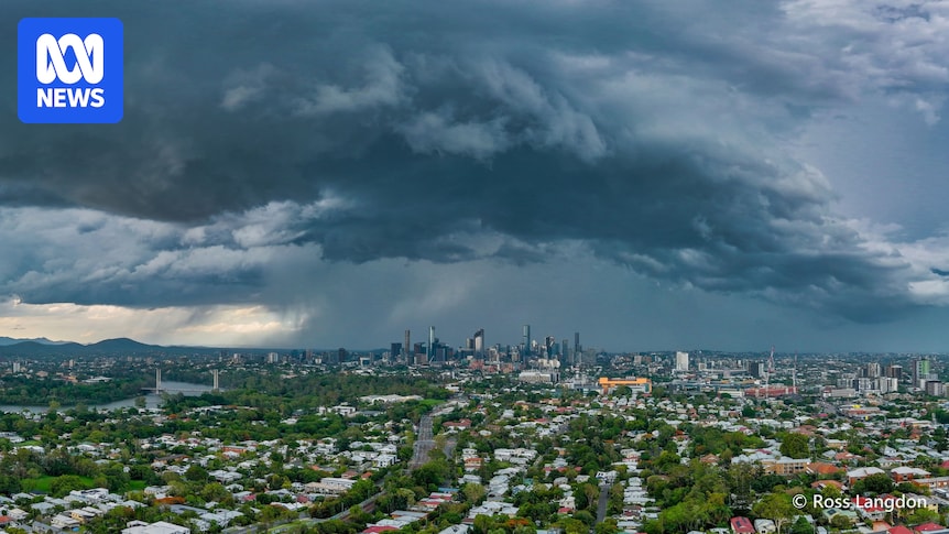
Another impact of the heat has been a daily dose of thunderstorms, and this week’s outbreak has been one for the history books.
South-east Queensland was hammered by giant hail well over 10 centimetres in diameter on Monday, while much of NSW was lashed by gales on Tuesday and Wednesday.
The atmosphere on Saturday is again primed for thunderstorms along the eastern seaboard due to humid, warm air at the surface and a deep trough extending from the tropics to the Tasman Sea.
This pattern supports the formation of a long band of severe thunderstorms stretching about 2,000km from the Gulf of Carpentaria to the NSW north coast.
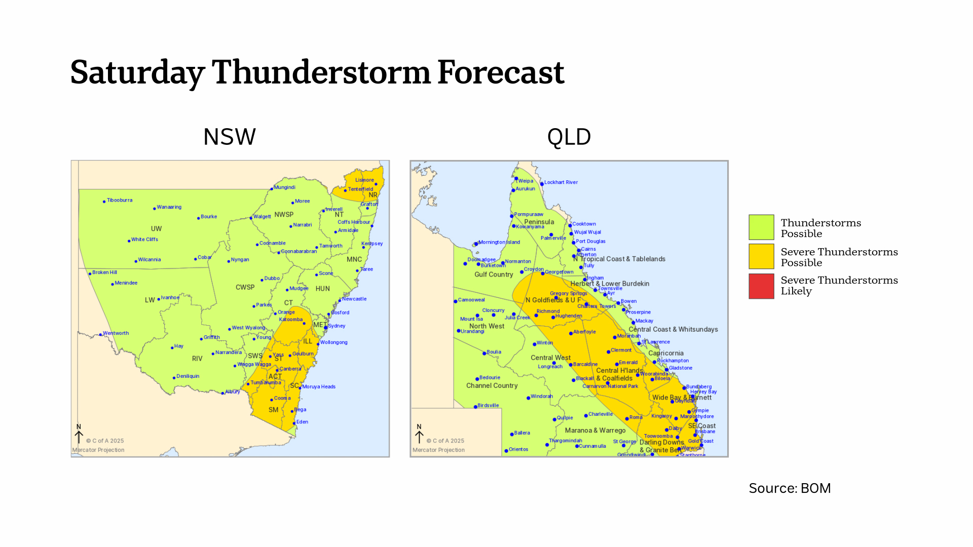
A risk of severe thunderstorms on Saturday stretches from north Queensland to NSW with warnings possible for wind, hail and heavy rain. (ABC News)
The main threat from storms on Saturday is heavy rain in the tropics, where storms will be slow-moving, and damaging winds in the south under a powerful westerly jet stream.
However, heavy falls and possibly pockets of hail are also possible around south-east Queensland on Saturday afternoon, including around Brisbane.
The odd gusty storm is also likely on Saturday over south-east NSW near a separate weather system.
A drier air mass will spread through NSW and southern Queensland on Sunday, although humid and stormy weather will continue across the tropics.
East sizzles while summer starts with snow in south
So why has summer arrived early along the east coast, when southern capitals like Adelaide and Hobart have shivered through their coldest November in decades?
The contrast is a direct result of a change in the speed and direction of the winds.
Compared to normal, there has been a deviation to westerly winds this spring — an anomaly which can be traced back to a rapid warming over the South Pole in September.
This warming weakened the polar vortex and allowed the belt of westerlies, which spins around Antarctica, to expand north, much like an ice skater extending their limbs to slow down.
For east coast cities, a westerly airstream arrives from the interior and is a warm breeze in spring. However, westerlies for the southern coastline are cool since they blow off the Southern Ocean.
This contrast will be on full display during the coming days. At a similar latitude, Adelaide’s temperatures will be about 10C below Sydney’s.
Loading…
Embedded in the westerlies are a series of cold fronts, trailed by waves of polar air, which, like the westerly winds, are tracking unusually north for this time of year.
Snow will commence on the highest peaks of Tasmania and the mainland on Sunday, ahead of the coldest air’s arrival on Monday, the first day of summer.
Modelling indicates Monday’s snow levels should be lower to around 1,300 metres on the mainland alps and 1,000m in Tasmania.