
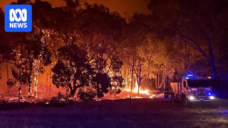
Multiple emergency level bushfires in the southern half of WA are stretching services to capacity, but affected residents have been unable to access critical information about the fires thanks to a website and app failure.
An emergency warning has been issued for part of Chittering and Bindoon, less than 70 kilometres north of Perth.
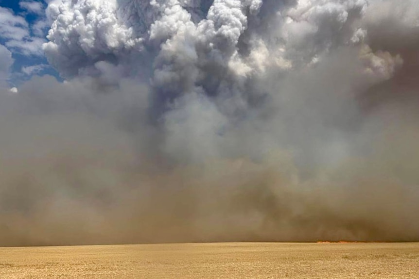
Residents in Nambeelup, about 16 kilometres east of Mandurah, had been urged to leave and there is an evacuation centre at the Murray Aquatic and Leisure Centre.
The warning level for that blaze was downgraded to a watch and act alert at 4:20pm.
Meanwhile, about 250 firefighters are responding to two separate emergency fires in the Midwest, near Warradarge and Mogumber.
Loading…
And at 5:45pm, DFES issued another emergency warning for a blaze burning in Boonanarring and Cullalla in the shires of Chittering and Gingin, with an evacuation centre set up at the Gingin Sports Centre.
There are a dozen further blazes at the watch and act level with residents being warned to prepare to leave or monitor conditions.
Website, app down
But at a time when five separate fires were burning at emergency level, the Emergency WA website crashed and was not able to show current bushfire or other warnings.
No details were available on outages and closures, incidents, natural hazards or prescribed burns for more than two hours.
The website appears to have since been restored.
In a statement DFES said the technical difficulties were caused by a data processing problem.
“DFES has asked the software provider to take immediate action to mitigate against recurrence,” the statement read.
“There was no impact to push notifications being issued and received on the Emergency WA app.”
The agency encouraged people to listen to local ABC radio to keep up to date or to call 13 3337.
Gingin shire president Linda Balcombe said being disconnected from Emergency WA’s real-time updates, as the region deals with multiple, dynamic fires was unsettling.
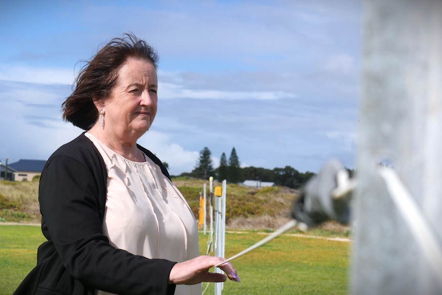
Linda Balcombe says the website outage was “unsettling”. (ABC Midwest & Wheatbelt: Piper Duffy)
“Once you lose any communication at all, it just scares people,” she said.
“They’re not sure what way the fire is going, because all of those maps give you a bit of a direction.”
Cr Balcombe said with warning and road closures constantly changing, delayed information could stop people being able to evacuate safety.
“If that system’s down for half an hour or more, that could really be the difference between whether they’re going to have to bunker down through the fire or get out.”
Lightning blamed
Department of Fire and Emergency Services (DFES) Assistant Commissioner Paul Carr confirmed the Nambeelup and Chittering blazes were likely sparked by lightning.
Eneabba was evacuated on Sunday when a blaze sparked by lightning was threatening lives and homes. (Supplied: Jackson Whooley)
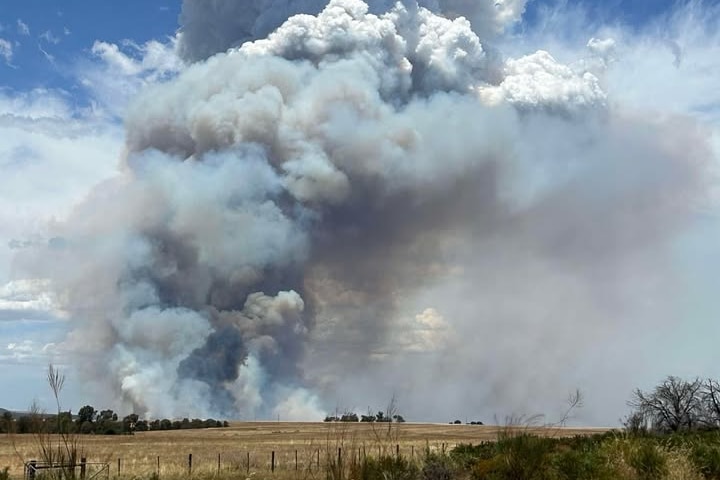
Meanwhile, the fire in Warradarge has razed at least 7,000 hectares of scrub and farmland since early Sunday morning.
Parts of Brand Highway have been closed, with flames burning on either side of the road.
Earlier, an emergency warning in place for Brigadoon and Gidgegannup, about 40 kilometres north east of Perth, was downgraded around 3:30pm.
Firefighters are continuing to strengthen containment lines, as the fire is stationary, however, uncontained and uncontrolled.
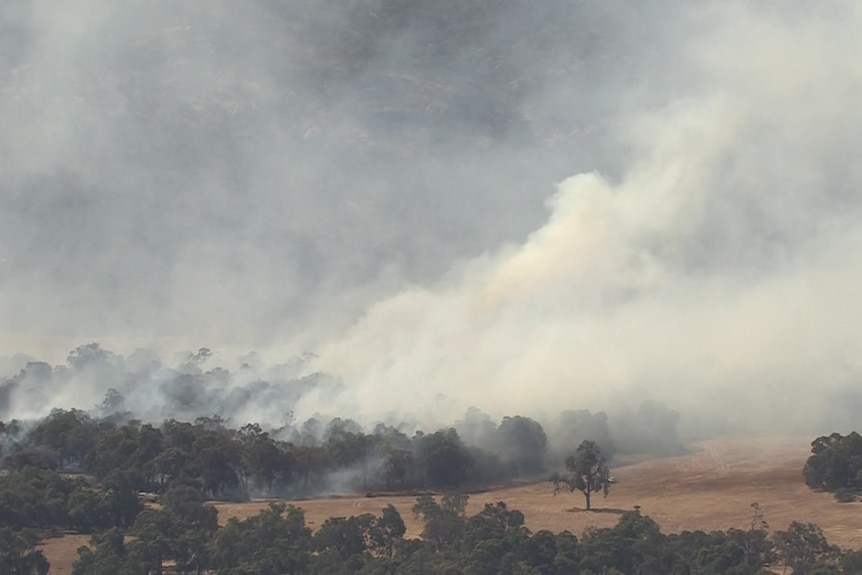
The Brigadoon fire seen from the air. (ABC News)
The Bureau of Meteorology has issued a severe thunderstorm warning for parts of the Central West, Central Wheatbelt and Great Southern Districts.
Senior meteorologist Jess Lingard told ABC Radio Perth thunderstorms were producing damaging wind gusts in the area, including potentially Dalwallinu, Dowerin, Wongan Hills, Beacon, Cunderdin and Kellerberin.
But she added there was “good news” because the west coast trough that is driving the current hot fire conditions will shift towards the east overnight and should produce milder conditions tomorrow.
Storms since Saturday night have caused widespread power outages, peaking at at 115,000 properties in the Perth metropolitan, the Midwest and the Wheatbelt regions.
Local emergency responders said telecommunications were impacted as a result.
A Telstra spokesperson said 31 sites were ‘down’ as of Monday afternoon, including Warradarge and Chittering.
The telco said it was doing its best to keep generators and batteries going, and it would be ‘out and about’ to finalise restoration as soon as possible.
By about 4pm Western Power said around 15,000 properties continued to be affected, with the utility still responding to 52 hazards across the network.
Power outages across the Midwest made it challenging for fire fighters to respond to an emergency level fire in Howatharra on Sunday. (Supplied: Andrew Vlahov)
Coorow shire president Guy Sims said the Warradarge blaze is having a large impact on bushland and crops.
“It’s nowhere near being under control and unfortunately it’s split in to sort of two fingers which is stretching the resources,” he told ABC Radio Perth.
An evacuation centre has opened at the Leeman Recreation Centre, but Mr Sims said attendance is low.
“That’s probably because the areas that impacted are farms and where people are physically able to, they’ll be out there fighting fires whether it’s on their own property or someone else’s.” he said.
Suspicious blaze
A fire that started on Saturday east of Perth appears to be deliberately lit.
The blaze in parts of Chittering, Julimar and Moondyne, was fanned by strong winds and spot fires jumping containment lines.
DFES incident controller Murray McBride said the fire, threatened properties.
It has now been downgraded to an advice level with firefighters still on the scene mopping up.