
As floodwaters continue to rise in the Northern Territory town of Katherine, the Bureau of Meteorology (BOM) predicts northern Australia will record one of its wettest seasons ever.
Residents in the small community 317 kilometres south-east of Darwin woke up to find their main street had been submerged by flooding — despite advice from authorities yesterday that the centre of town would not be inundated.
On ABC Radio Darwin this morning, NT Incident controller Shaun Gill said six aircraft were now helping evacuate the remote community of Palumpa by air.
Loading…
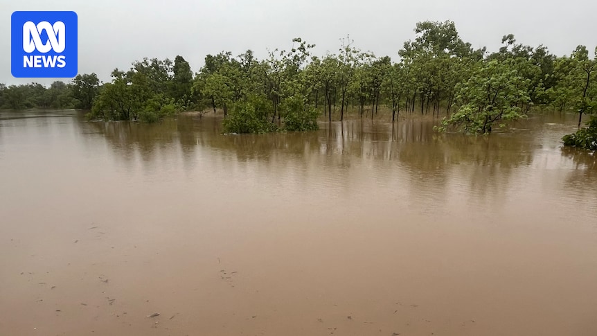
Katherine River reached the major flood level yesterday, with the weather bureau reporting floodwaters at Katherine Bridge passed 18.5 metres this morning.
BOM warned these kinds of “rapid river level rises” would continue as “further rainfall is expected during Saturday”.
BOM said “major flooding above the April 2006 flood level” — when the river peaked at 19 metres — was occurring this morning at the entrance to Nitmiluk Gorge.
Katherine’s flood emergency warning was triggered yesterday, with the local hospital evacuated and closed, the Stuart Highway cut off and emergency shelters set up.
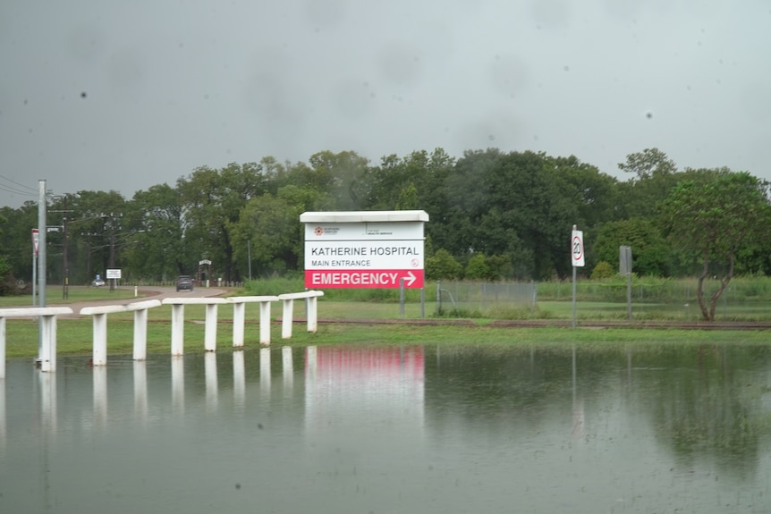
Katherine Hospital was evacuated, with 21 patients and up to 20 pregnant women transferred to Darwin by air. (ABC News: James Elton)
Daly River (Nauiyu) residents have also been affected, with authorities confirming plans are in place to evacuate the community today.
Locals in the remote Indigenous community only returned home late last month, after earlier rains caused Daly River to flood.
Meanwhile, flooding subsided in Beswick overnight, with an evacuation centre there — located on higher ground — opened to those in need yesterday.
It comes as a tropical low hovers over large parts of the Top End this weekend, with BOM forecasting this wet season could become the 10th wettest on record.
Tropical low 31U brings rainfall
BOM senior meteorologist Rebecca Patrick said the bureau was monitoring tropical low 31U, which had made landfall north-east of Katherine.
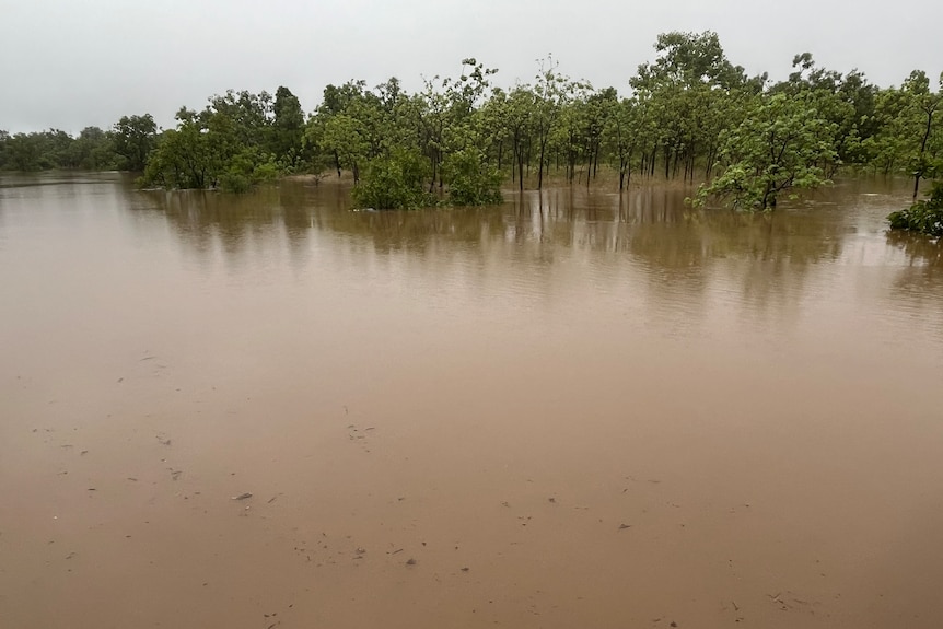
Katherine residents are facing major flood levels. (ABC News: James Elton)
She said, while there was a “low chance” of the weather system developing into a cyclone, heavy rainfall across the Top End was possible.
“As we see that tropical low move from the Gulf of Carpentaria across the Top End, we might see an increase in rainfall,” she said.
The BOM’s track map shows 31U is expected to sit near Katherine today, stretch in opposite directions to cover Daly River in the west and the remote community of Ngukurr in the east — splitting the weather system in two — on Sunday, before it is forecast to reform and dump rain as far north as Batchelor and southern parts of Darwin tomorrow afternoon.
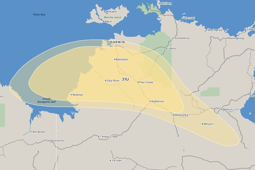
BOM’s latest track map predicts that tropical low 31U will be sitting over Katherine and Daly River on Sunday. (Supplied: Bureau of Meteorology)