
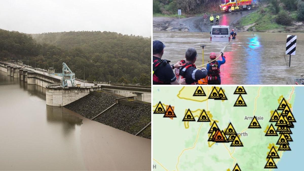
Sydney’s most critical dam will likely overflow today after days of relentless rain, tipped to spill around 15 billion litres of water.
Western Sydney residents downstream of Warragamba Dam are being warned to monitor river rises and flood warnings as the excess water gushes into Sydney.
The dam was at 98 percent of its more than 2000 gigalitre capacity at 9.30am on Friday, with more rainfall on the way.
“Rainfall of 90 mm has been received over the past few days in the Warragamba Dam catchment,” a WaterNSW spokesperson said.
“Smaller dams including Woronora, Cataract, Cordeaux, Nepean, Avon, Wingecaribee and Tallowa in Greater Sydney continue to spill.”
This will be the second time in three months that the dam – which provides 80 per cent of Sydney’s drinking water – has overflown, spilling 20 gigalitres on May 25.
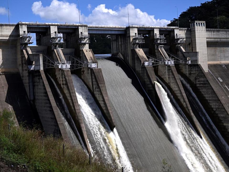
The Warragamba Dam has spilled over 50 times in 65 years.
Dozens of flood alerts across the state
The NSW State Emergency Service (SES) has issued 42 flood alerts as of 7am on Friday, with warnings stretching from Wollongong on the south coast to Goondiwindi at the Queensland-NSW border.
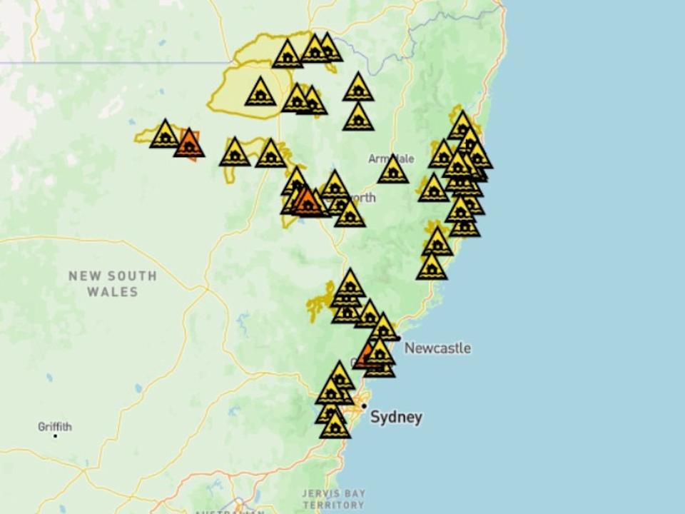
NSW SES has issued dozens of flood warnings. Picture: NSW SES
Alerts have been issued for residents at Gunnedah, in the NSW northwest, with those near Talibah Flats and Old Blue Vale Rd and Kelvin Rd told to “prepare to isolate”.
The warnings say there is a risk of major flooding by Friday evening.
“You should monitor the situation and prepare to be isolated by floodwater,” the SES warnings read.
“Consider the effects isolation will have on family, work, and educational commitments.
“You may be trapped without power, water, and other essential services and it may be too dangerous for NSW SES to rescue you.”
NSW SES has responded to more than 600 incidents and at least 10 flood rescues since the weather event began, all 10 rescues involving people driving onto flooded roads.
“We’re dealing with two different weather systems here, the first one, which occurred earlier this month, is still impacting areas along the Namoi and Barwon River, so those communities are experiencing flooding from previous events,” NSW SES Deputy Commissioner Debbie Platz told ABC News.
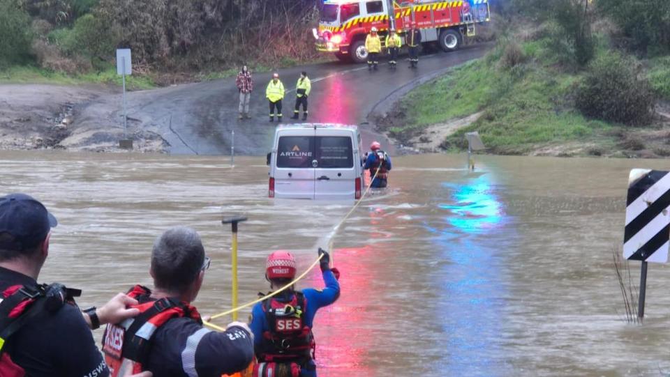
A man was rescued after becoming stranded on a flooded causeway in Wollondilly, southwest of Sydney, on Thursday. Picture: NSW Rural Fire Service
“Then the events of the last 48 hours, which is topping up all our river systems that are on the coastal catchments and in the north west plains areas.
“We had a number of houses in Sydney yesterday, about 60 in the Kurnell area, that had floodwaters into their properties that we were assisting with.
“Our other biggest area for incidents has been around the Port Macquarie area.”
Residents have been warned that their houses could still become inundated, even after the rain subsides.
“Some communities, particularly in low-lying areas around Gunnedah, have to prepare to isolate because the floodwaters are rising,” Ms Platz said.
“We could see inundation in the low areas, the catchments are really primed, and they’re rising quickly.”
Dangerous river rises
Isolated falls across the state have totalled more than 200mm in 48 hours, with areas of the Central Coast, North West Slopes, and the Hunter and Illawarra regions among the hardest hit.
The Namoi River at Gunnedah and Peel River at Tamworth are both tipped to flood, with the Namoi likely to exceed major flood levels of 7.9m.
Rivers around Sydney, including the Hawkesbury and Nepean, have already reached minor flood levels, with water inundating the Menangle Bridge southwest of Sydney.
Sydney has recorded its wettest August in 27 years, receiving more than 350mm of rain already this month. The total is about four times the average monthly rainfall for the city.
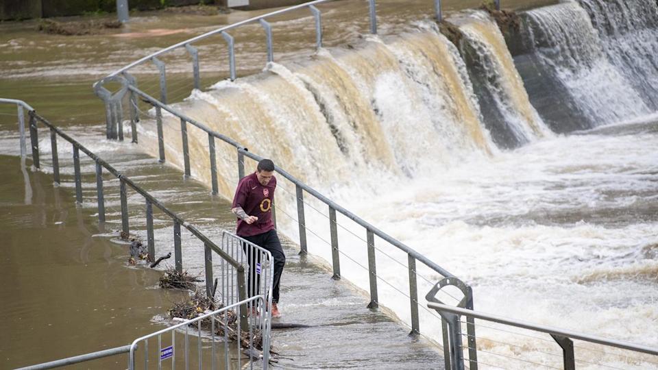
Water has overflowed at the Parramatta River. Picture: NewsWire / Jeremy Piper
In the 24 hours to 9amam on Friday, the highest falls included 165mm at Tallebudgera Creek on the Queensland/NSW border, 135mm at Kingscliff in the Northern Rivers and 80mm at Port Macquarie on the Central Coast.
Floodwaters has cut off roads in parts of the state, including the Princess Highway near Dunmore on the South Coast and Menangle Rd in Sydney.
End in sight for east coast
The relentless rain is predicted to finally ease from Friday afternoon, with just a few light showers around Sydney and Newcastle forecast for the rest of Friday.
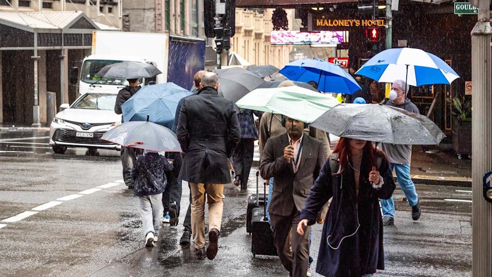
Sydney siders have suffered an unseasonably wet August. Picture: NewsWire / Monique Harmer
“We’re seeing this prolonged rainband finally shifting off the east coast and moving towards the ocean, drawing moisture out over the Tasman sea,” BOM senior meteorologist Angus Hines said.
“For those more populated areas of Sydney and the Illawarra, rainfall totals shouldn’t get above 10mm on Friday.”