
Your support helps us to tell the story
From reproductive rights to climate change to Big Tech, The Independent is on the ground when the story is developing. Whether it’s investigating the financials of Elon Musk’s pro-Trump PAC or producing our latest documentary, ‘The A Word’, which shines a light on the American women fighting for reproductive rights, we know how important it is to parse out the facts from the messaging.
At such a critical moment in US history, we need reporters on the ground. Your donation allows us to keep sending journalists to speak to both sides of the story.
The Independent is trusted by Americans across the entire political spectrum. And unlike many other quality news outlets, we choose not to lock Americans out of our reporting and analysis with paywalls. We believe quality journalism should be available to everyone, paid for by those who can afford it.
Your support makes all the difference.Read more
El Nino is set to intensify into one of the strongest events on record over the coming months, raising the risk of floods, drought and extreme heat well into 2027, experts have warned.
“El Nino is being supersized before our eyes,” said Antonio Guterres, the UN secretary-general.
“The science leaves no room for doubt: the planet is in uncharted waters, and those waters are heating up. Sea surface temperatures are rising, temperatures keep climbing, and the world is in the danger zone of extreme weather.
“The race now is between rising risks and our commitment to take climate action and protect people. We must win that race.”
Forecasts from the World Meteorological Organisation’s global network of climate centres put the likelihood that El Nino will persist through to February 2027 at close to 100 per cent, the organisation said in an update published on Thursday.
It said this was the first time a WMO El Nino update had been so unequivocal, reflecting strong agreement across its network of forecasting bodies.
 A view of Los Laureles reservoir with low water levels in Tegucigalpa, Honduras, on 2 September 2026 (AFP/Getty)
Celeste Saulo, the WMO’s secretary-general, said the scale of the response required matched the scale of the event itself. “This exceptional El Nino demands exceptional preparation and response,” she said.
“Never before in the 50-year history of the World Meteorological Organisation have we launched such a major mobilisation with National Meteorological and Hydrological Services who are on the front line of delivering the forecasts and services to save lives and livelihoods.
“El Nino in Spanish means boy child, but it has the potential to deliver a massive blow to communities and economies across the world. We are already seeing disruption and devastation from droughts and floods, and we expect these impacts to increase as El Nino intensifies,” she said.
“We have no time to lose.”
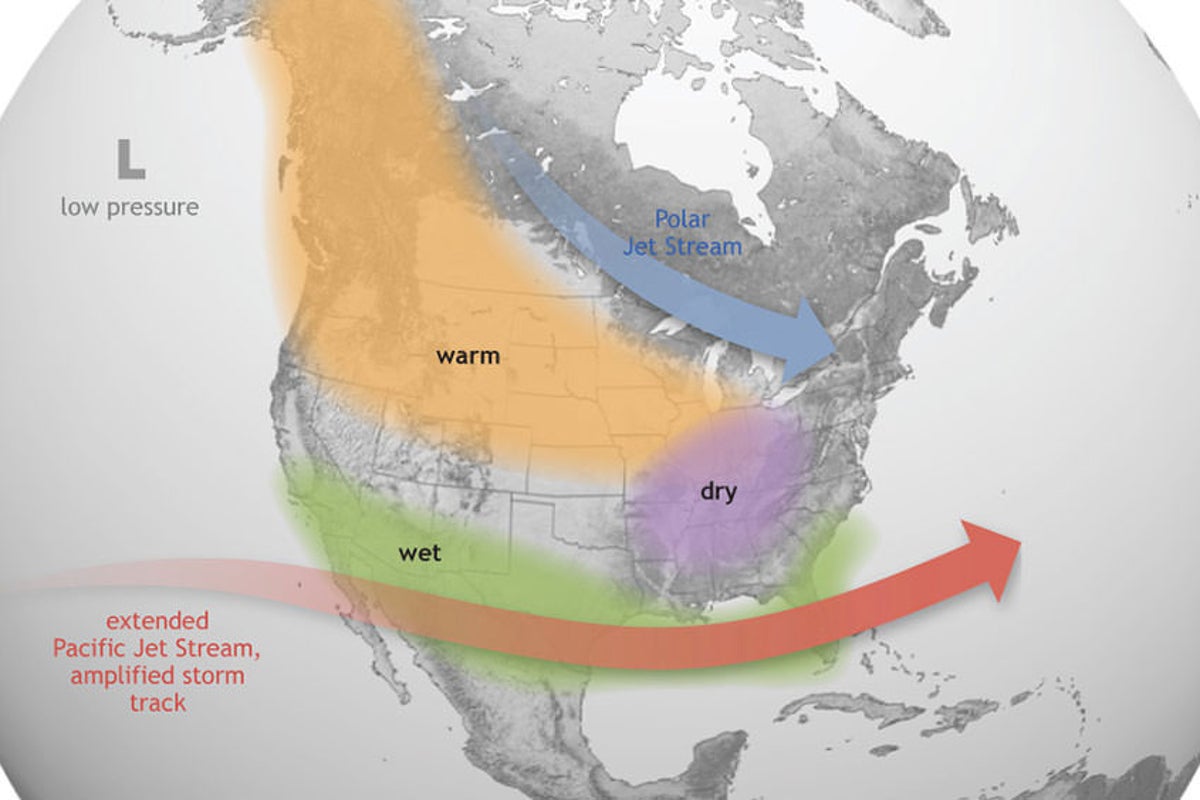
El Nino is a naturally occurring climate phenomenon, distinct from and not caused by climate change, though its impacts can be amplified by the warmer baseline conditions a warming planet creates. It typically develops between March and June and peaks between November and February, with its effects on global temperatures often most pronounced the following year.
 An ‘unprecedented’ El Nino event is set to bring storms and rain to the UK (PA)
The event is being driven by exceptionally warm conditions across the tropical Pacific Ocean. The Nino 3.4 index, the standard measure of sea surface temperature in the region at the heart of El Nino, rose from 1.5C above normal in May to July to 2C above normal in July, before climbing further to between 2.2C and 2.6C above average by mid-August.
Temperatures below the ocean surface have been even more extreme, with parts of the tropical Pacific running more than 8C above average during July and early August.
Global sea surface temperatures reached 21.1C on 22 August, the highest level on record and above the previous high of 21.09C set in 2024, according to the Copernicus Climate Change Service.
The timing was unusual, since ocean temperatures typically peak in March and April rather than August, and the reading also exceeded the previous highest value recorded for the month, 20.98C in 2023. Copernicus said the record was “consistent with the continued long-term warming of the global ocean and the emergence of an extreme El Niño event in the tropical Pacific.”
The organisation cautioned that a very strong El Nino does not produce the same effects everywhere, since its impact varies by region and season and can be reshaped by other climate patterns, including conditions in the Indian and Atlantic Oceans.
For September to November, the WMO’s forecasts point to a heightened likelihood of above-normal temperatures across almost all land areas globally, alongside rainfall patterns consistent with a strong Pacific El Nino.
A positive phase of the Indian Ocean Dipole is also expected to develop over the same period, in a pattern that can reinforce or offset typical El Nino effects depending on the region.
The impact is expected to reach UK shopping baskets.
Around a quarter of Britain’s food imports, worth an estimated £17bn in 2025, come from regions likely to be worst affected by El Nino, according to the Energy and Climate Intelligence Unit (ECIU), a UK-based think tank.
During the last El Nino, in 2023-24, the price of coffee imported to the UK from Brazil rose by 77 per cent, while cocoa bean prices from Ivory Coast doubled.
Gareth Redmond-King, head of the ECIU’s international programme, said the coming event would compound the damage the UK had already experienced this year.
“This devastating summer has shown very starkly what climate change is doing to our weather, with public services left struggling to cope, over 1,000 wildfires and suffocating heat through an unprecedented five heatwaves in the UK alone,” he said.
“Along comes probably the strongest El Niño we’ve yet faced. The heat it will add into our climate system, on top of human-driven temperature rises, look almost certain to push 2027 to be the hottest year on record.”