
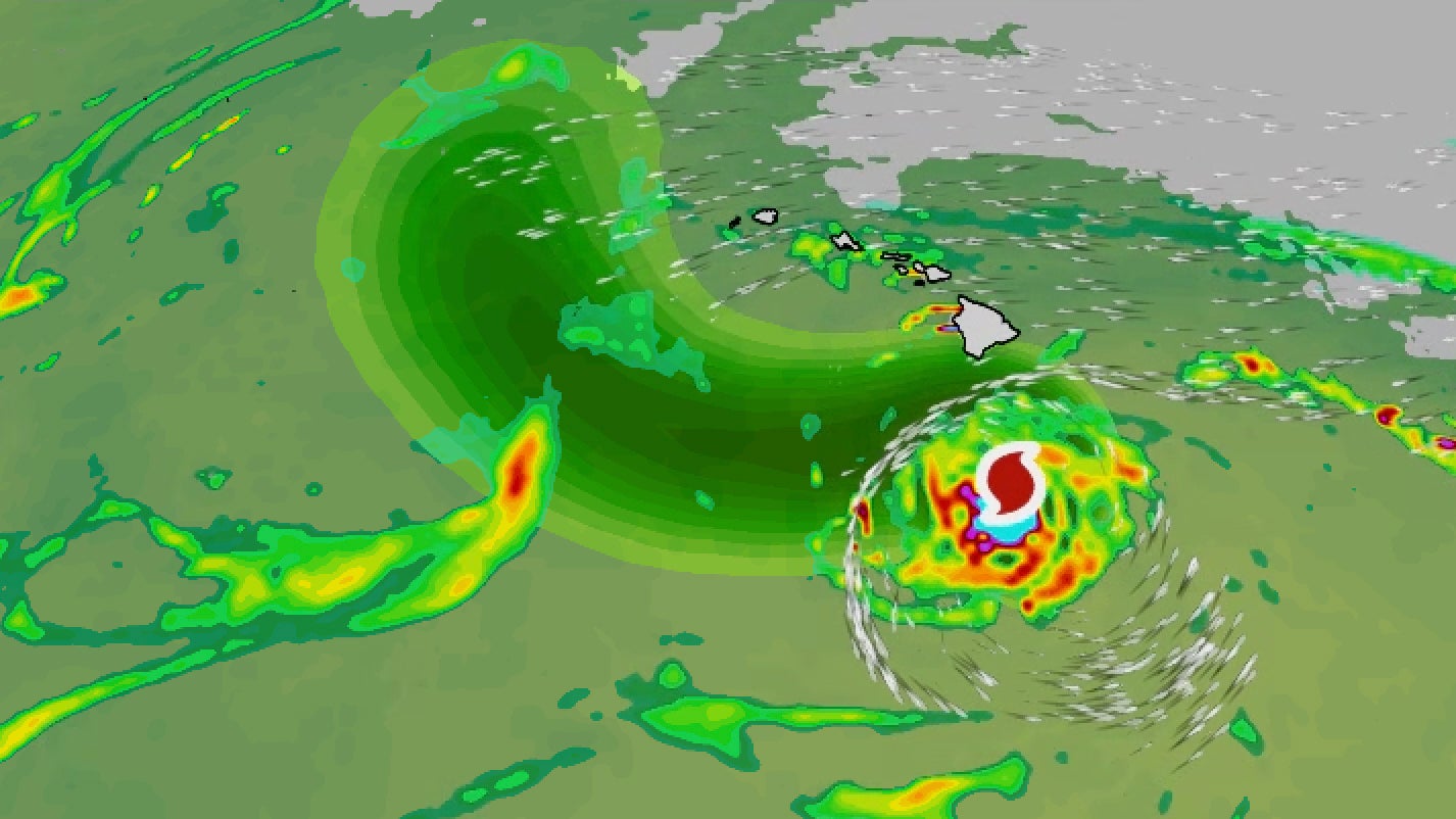
Hurricane Nolo is forecast to become a major hurricane by this weekend, possibly making it the strongest storm to pass this close to the Big Island since the late 1950s.
This will be Hawaii’s fourth tropical system of the 2026 hurricane season, and it is expected to once again bring heavy rain, life-threatening flooding and strong winds.
 Happening now
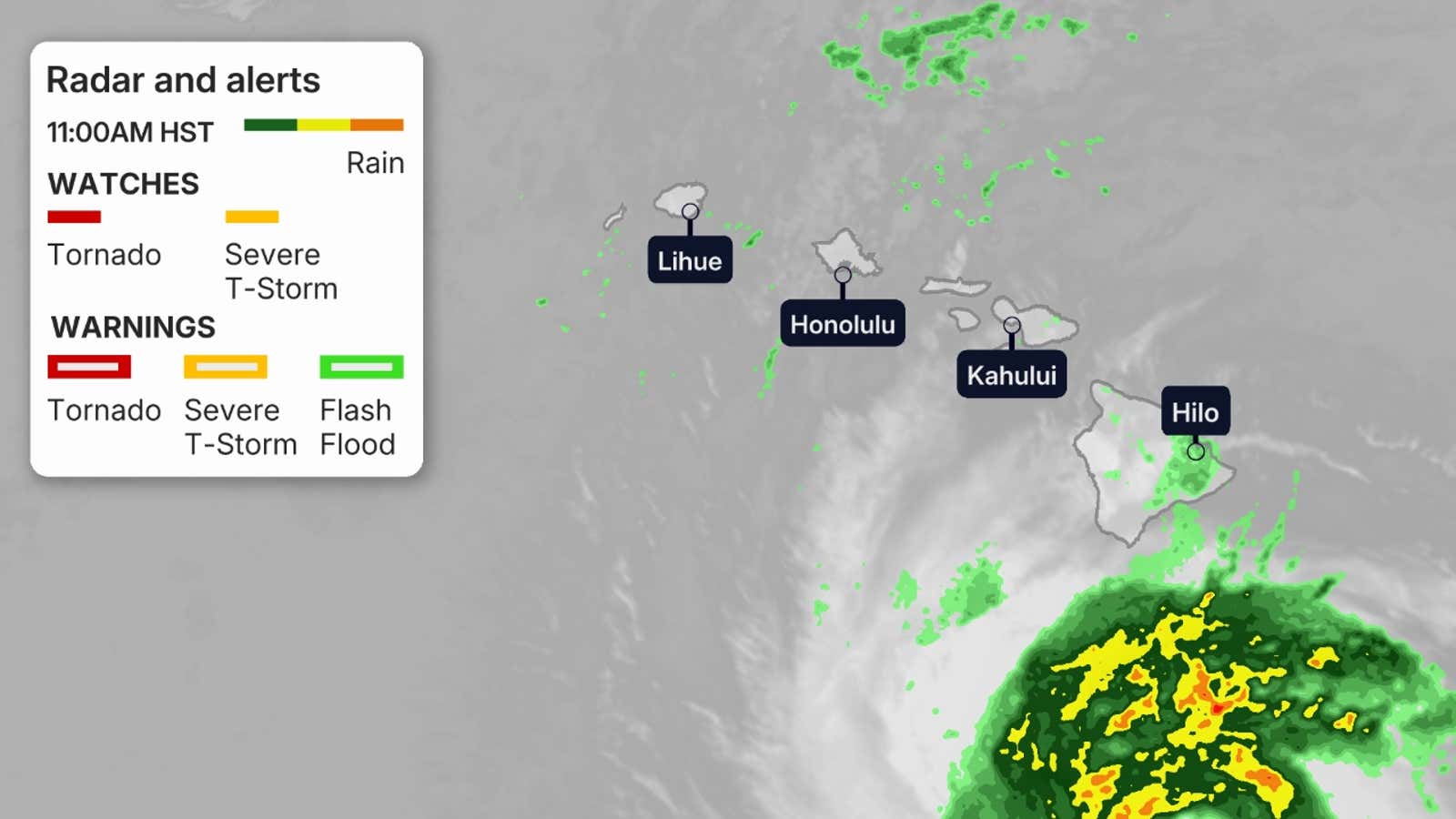
Nolo has intensified to a Category 2 hurricane as its shield of heaviest rain approaches the Big Island. That was based on a report from a U.S. Air Force Reserve Hurricane Hunter mission Friday morning, local time.

Weather in your inbox
By signing up you agree to the Terms & Privacy Policy. Unsubscribe at any time.
The storm is centered around 185 miles south of the Big Island, and is moving north-northeast at 5 mph.
Conditions will deteriorate throughout Friday into Saturday. Winds are already gusting over 30 mph in parts of the Big Island, and in some wind-prone areas of Maui County, Oahu and Kauai.
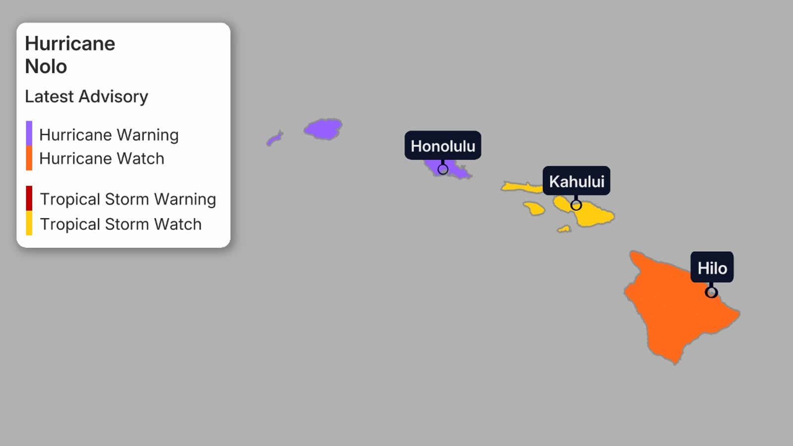
These are the current watches and warnings in effect, as seen on the map below:
Get More of Our News on Google
Set The Weather Company as a ‘Preferred Source’ to get quicker access to the news you value.
 Big Island: Hurricane watch and tropical storm warningMaui: Tropical storm watch
 What is the forecast?
Nolo will continue its slow northward trek Friday, before making a sharp turn westward on Saturday.
The storm will continue to strengthen, reaching major hurricane status (at least Category 3) by the weekend.
The current forecast cone from the National Hurricane Center is shown below.
(MORE: What a forecast cone really means)
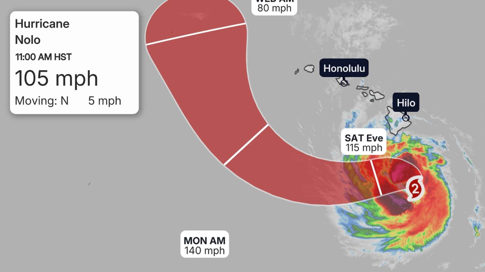
For now, the forecast keeps the core of Nolo — and thus the worst of its wind impacts — south of the Big Island when it makes its closest approach Saturday, before it then turns sharply westward.
But storms tend to wobble in the cone of uncertainty, so should the storm turn to the west later, there could be a ramp-up of winds as the storm makes its closest pass to the islands. That’s why a hurricane watch is still in effect for the Big Island.
A similar occurrence happened with Hurricane Lowell a couple of weeks ago, when the storm wobbled closer to the western Hawaiian Islands as it made its closest pass, bringing more intense rain and winds.
The biggest takeaway is this: Even if the Big Island stays outside the cone of uncertainty, significant impacts will still occur well beyond the cone.
At least parts of the main islands will see the triple threat of rain, winds and waves. This will happen regardless of how close Nolo’s center tracks to the Big Island.
Potential impacts
Flooding rainfall
This is the most certain and worrisome of the impacts from Nolo, regardless of how close it tracks.
As the storm passes south of the islands, it is expected to bring heavy rainfall to parts of the Big Island, Maui, Lanai, Molokai and Kahoolawe. Flood watches remain in effect in those areas.
Locally heavy rain from Nolo’s outer bands could fall both in advance, and some time after the closest approach of the storm.
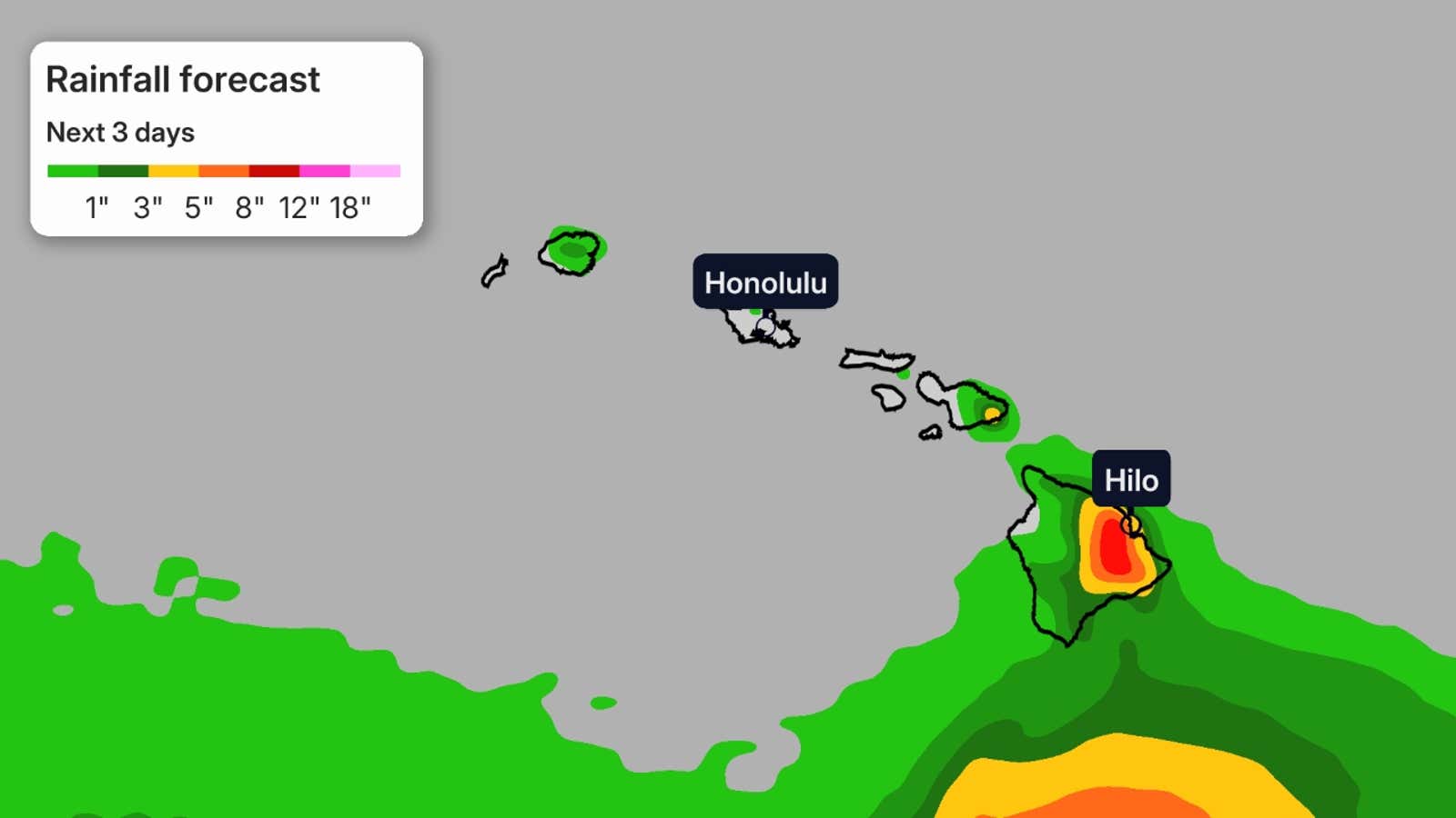
Here are the peak rainfall forecasts from NOAA’s Weather Prediction Center. These peak totals are most possible over mountain slopes:
Parts of the Big Island: Up to 25 inchesParts of Maui: Up to 10 inchesRest of islands: Up to 6 inches
This could lead to life-threatening, potentially catastrophic flash flooding and mudslides on the Big Island and life-threatening flooding and mudslides on Maui, according to the National Hurricane Center.
The Big Island and parts of Maui County were hit hard by flooding, mudslides and strong winds from Hurricane Lala in mid-August, and some places just recently got power restored.
Winds
The map below shows the chance of at least tropical-storm-force winds (39 mph or higher) from Nolo.
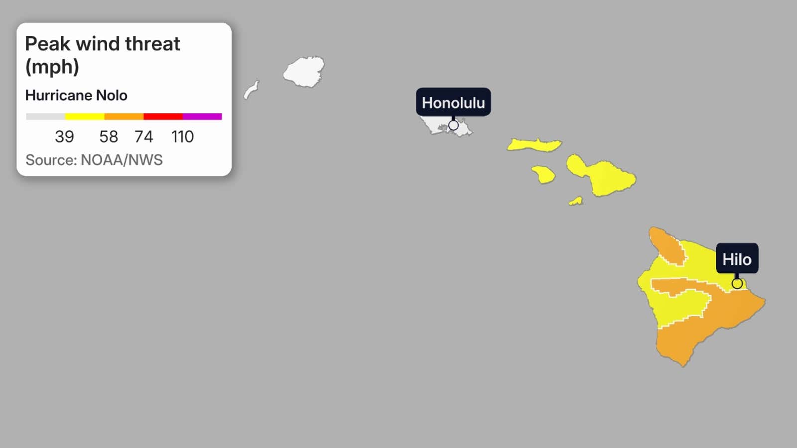
Given the forecast track, the best chance of winds capable of at least some tree damage and power outages is expected across the southern portion of the Big Island.
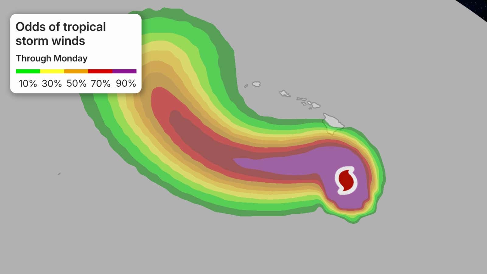
As alluded to before, we cannot completely rule out a threat of hurricane-force-winds in parts of the Big Island, depending on how close the center of Nolo tracks. These winds may be capable of more serious damage to homes and businesses.
In addition, wind gusts will likely be stronger both at the tops of and downwind of mountain slopes in the entire island chain.
Coastal flooding, high surf
Larger swells are expected to arrive from the storm Friday, which will lead to dangerous surf and rip currents.
Nolo’s approach will also bring a threat of coastal flooding to parts of the Big Island.
A storm surge of 1 to 3 feet is also likely around the Big Island.
Big Island’s strongest hurricane in decades?
Only one other major (Category 3 or stronger) hurricane has tracked within 150 miles of the Big Island, according to NOAA’s hurricane database.
That was August 1959’s Hurricane Dot, which went on to slam into Kauai after brushing south of the Big Island.
So, Nolo could be the strongest Big Island impact from a hurricane in 67 years.
Fourth potential flood event
This system will become the fourth to at least graze Hawaii, bringing flooding and winds to most of the state.
We first had Hurricane Lala in mid-August, whose eyewall grazed the southern end of the Big Island. Torrential rain hit, and gusty winds caused power outages to skyrocket.
(MORE: Lala Recap)
Next up was Tropical Storm Moke, which tracked farther south than Lala but still hit parts of the Big Island with rain and winds from its outer bands. Moke’s impacts were less significant, but flooding still occurred because the ground was still saturated from Lala.
Then there was Hurricane Lowell, a powerful hurricane that reached Category 5 strength at its peak. The storm weakened before making its closest pass, but it slammed the western islands with wind, rain and waves.
(MORE: Lowell Recap)
Zombie storm
This system originally formed as Tropical Depression Fifteen-E on Sept. 13 well southeast of Hawaii.
The system then fizzled as it traveled west, moving into strong wind shear that disrupted its structure.
But the system continued its trek west and now has moved into areas with less shear, allowing for its second life.