
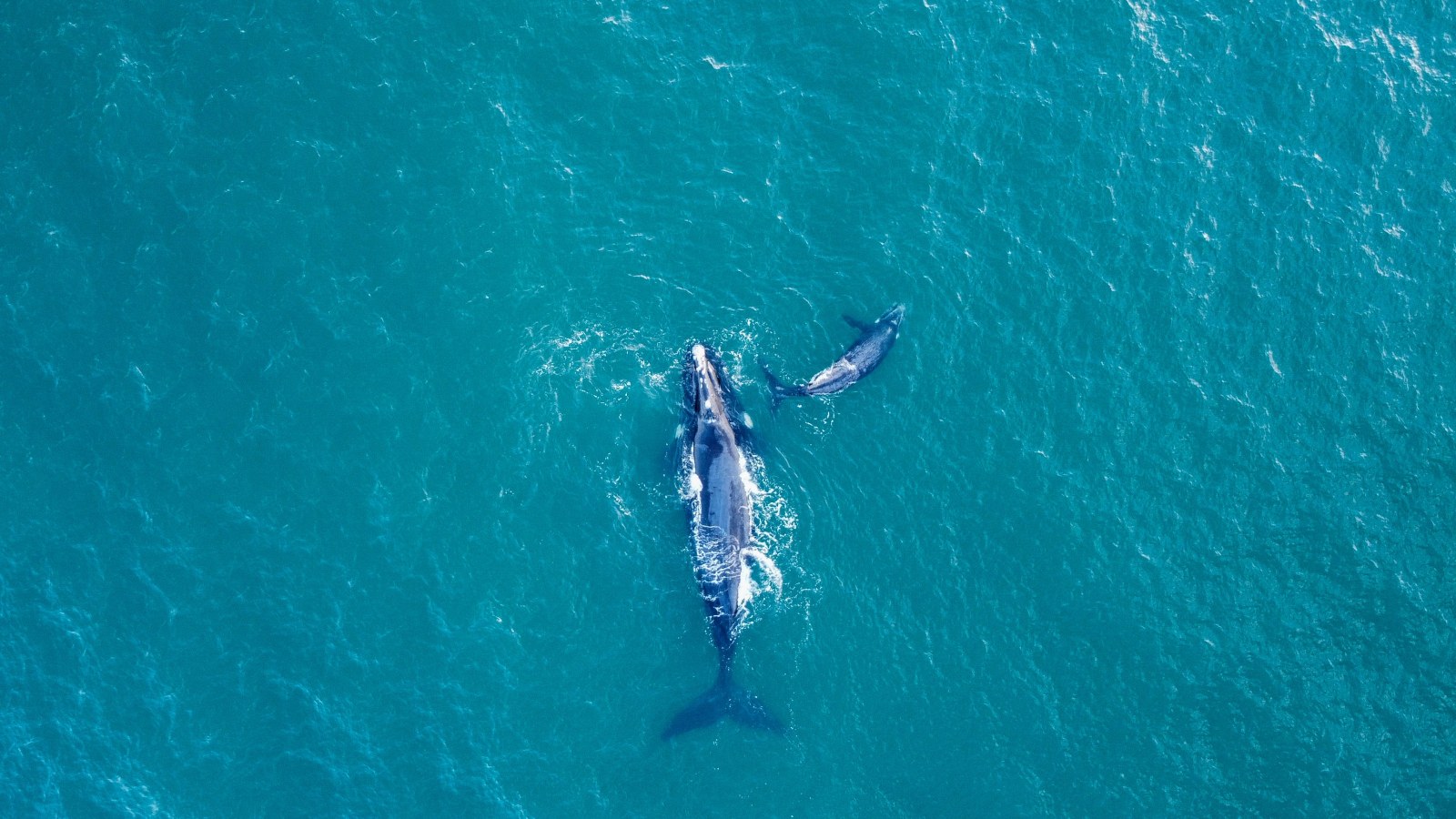
Southern right whales leaving New Zealand’s subantarctic Auckland Islands split onto two very different routes to their feeding grounds, yet the two groups arrived at about the same time, according to a satellite-tagging study in Proceedings of the Royal Society B. The whales that took a long detour toward Antarctica simply left about a month earlier.
The University of Auckland team found the detour trips averaged 64 days, compared with 42 days for whales that swam directly west, a difference of about three weeks. Both groups reached waters south of Australia in early October on average, near the seasonal peak of phytoplankton growth.
The work matters beyond New Zealand. It shows that a single whale population can use more than one migration strategy, a kind of flexibility that could help large whales cope as ocean conditions shift with a warming climate.
Two Routes to the Same Destination
The researchers attached satellite tags to 25 whales between 2020 and 2022 at the Auckland Islands, or Maungahuka, where the species gathers to breed from roughly May to September. Twenty-one tags sent enough data to map the outbound journey, and 16 kept transmitting until the whales reached their feeding grounds, according to Earth.com’s summary of the paper.
Ten whales headed straight west or northwest. Eleven swam south or southwest toward Antarctica before turning northwest, tracing an L-shape on the map.
The detour whales left in late July on average, while direct travelers left in late August. Direct-route whales swam slightly faster, but the difference was small, and the statistics were mixed.
Timing the Plankton Bloom
Southern right whales feed mainly by skimming tiny drifting animals from the water, and those prey depend on the phytoplankton blooms that ripple through the Southern Ocean each spring. Arriving as food peaks lets whales rebuild the fat reserves they burned during months of breeding and fasting.
The researchers suspect the whales time their arrival to that peak, but tracking data alone cannot prove it. The study did not measure prey directly at the feeding grounds.
Emma Carroll, an associate professor at the University of Auckland and a co-author, said the flexibility is a hopeful sign, since an adaptable population has “a better chance of coping with changing seas,” she said in the university’s announcement.
Clues to How Whales Find Their Way
The detours were not random — most turned north near the southern edge of the Antarctic Circumpolar Current, above shallower seafloor, and their turning points matched a particular range of the angle of Earth’s magnetic field. Sea ice appeared to be a weaker cue, since most whales turned well short of its edge.
Those matches suggest the whales may combine several navigation cues, including currents, seafloor features and magnetism. The study cannot show which cues the animals actually use.
There were hints of social travel, too. In 2020, two tagged whales followed closely matching paths for about 250 miles (400 kilometers), possibly close enough to hear each other, according to Earth.com’s account of the paper. Right whale mothers typically lead calves to the feeding grounds they themselves were taken to, so routes may be partly learned.
Individual choices also changed. Five whales were tracked over two migrations. Three detoured both times, and two switched from the direct route one year to the detour the next. One switcher was a female with a calf in the first year, and lead author Leena Riekkola compared the choice to a family road trip, where some travelers save energy and others make up for a late start.
A Small Sample with Big Open Questions
The limits are significant — the study tracked 21 whales on usable routes, all of them mature animals in good condition, and only two were mothers with calves. Body size, sex and condition did not clearly explain which route a whale chose, and some measurements were missing.
That leaves the central puzzle unsolved: why some whales choose the longer, slower path. One possibility is that it lets them avoid crowded areas or rough water, or rest more along the way. Another is that it reflects routes learned from their mothers. None of these ideas was tested directly.
The findings also carry a wider lesson for whale conservation. Southern right whales were hunted to near extinction in the 20th century and have been recovering. A different species, the North Atlantic right whale off the U.S. East Coast, remains among the most endangered large whales. Understanding how right whales plan migrations helps managers predict where they will be and when, which matters for reducing ship strikes and fishing-gear entanglements.
For U.S. readers, the most direct link is how this kind of tracking informs protection at home. Satellite tags reveal when and where whales cross busy waters, data that agencies use to set seasonal speed limits and fishing closures. The Auckland study suggests those protections should allow for whales that do not all follow one schedule or one path.
The researchers also acknowledged the Kaitiaki Roopū o Murihiku, the Indigenous guardians connected to the region. The study was supported by the Royal Society Te Apārangi, the Live Ocean Foundation, the International Whaling Commission’s Southern Ocean Research Partnership and others. More tags on younger whales and mothers with calves would be the next step. The bottom line is that detouring whales gave themselves a head start and arrived on time, but scientists still do not know why they take the long way.
What Readers Want to Know
What did the study find?
Southern right whales leaving New Zealand’s Auckland Islands took either a direct route or a long L-shaped detour, but both groups arrived at their feeding grounds at about the same time.
How did detouring whales still arrive on time?
They left about a month earlier. Their trips averaged 64 days, compared with 42 days on the direct route.
Why do some whales take the longer route?
Scientists do not know. Size, sex, and body condition did not explain it, and the study could not test motives directly.
How do the whales navigate?
Turning points matched ocean currents, seafloor features, and Earth’s magnetic field, but the study cannot prove which cues the whales use.
How many whales were tracked?
Twenty-five were tagged from 2020 to 2022, and 21 provided usable routes.
Why does migration timing matter?
Arriving when food peaks helps whales rebuild fat after breeding, which affects their survival and future calves.
© 2026 NatureWorldNews.com All rights reserved. Do not reproduce without permission.