
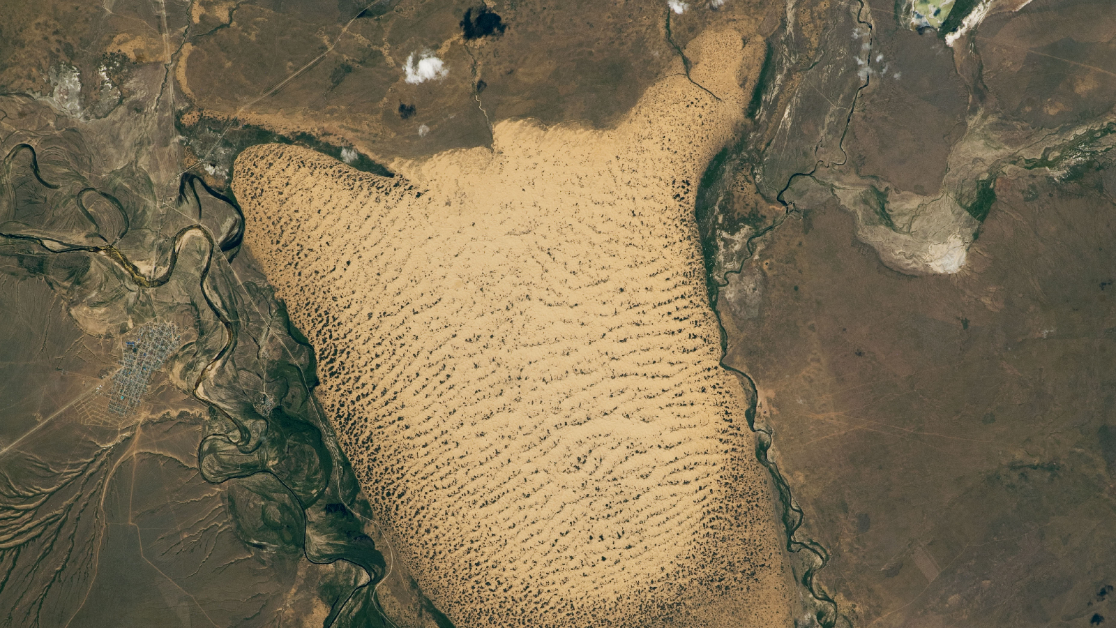
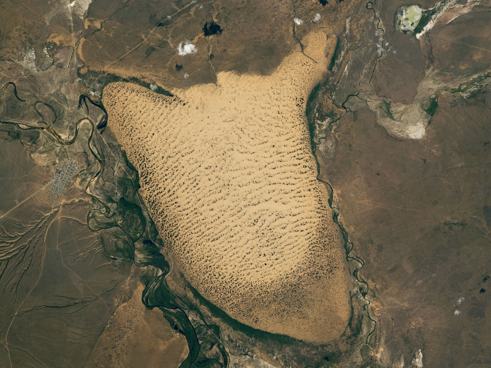
A large field of sand dunes located alongside the village of Oyyl in the Kazakh Steppe bears a striking resemblance to a giant slug. (Image credit: NASA/ISS program)
QUICK FACTS
Where is it? Oyyl dune field, Kazakhstan [49.0485097, 54.776320616]
What’s in the photo? A large field of sand dunes in the shape of a slug
Who took the photo? An unnamed astronaut on board the International Space Station
When was it taken? June 15, 2022
This intriguing astronaut photo shows off an oddly shaped field of dunes in Kazakhstan that strongly resembles a giant slug meandering across the landscape. The mollusk mimic is covered with clusters of vegetation, suggesting its sands are slowly being frozen in place.
The dune field is located around 175 miles (280 kilometers) northeast of the Caspian Sea in the western reaches of the Kazakh Steppe — a vast region of open grassland covering north Kazakhstan and parts of Russia. It is sandwiched between the village of Oyyl to the west (left in the image) and a large floodplain to the east (right in the image).
It covers an area of around 75 square miles (190 square kilometers), around three times the size of Manhattan, and measures approximately 13 miles (21 km) across at its widest point, according to NASA’s Earth Observatory.
You may like
Dune fields form in natural depressions, or sinks, within the surrounding landscape, normally in regions with high winds capable of depositing sand in these holes. In this case, the slug-shaped sink sits approximately 300 feet (90 meters) below the elevation of the surrounding landscape.
Most of the sand within this sink originates from the adjacent floodplain, as well as another floodplain located to the south (not shown in the image). Floodplains generate lots of sand when they dry out, as previously trapped coarse sediments get scattered across the land and blown away by the wind, according to National Geographic.
Related: See all the best images of Earth from space
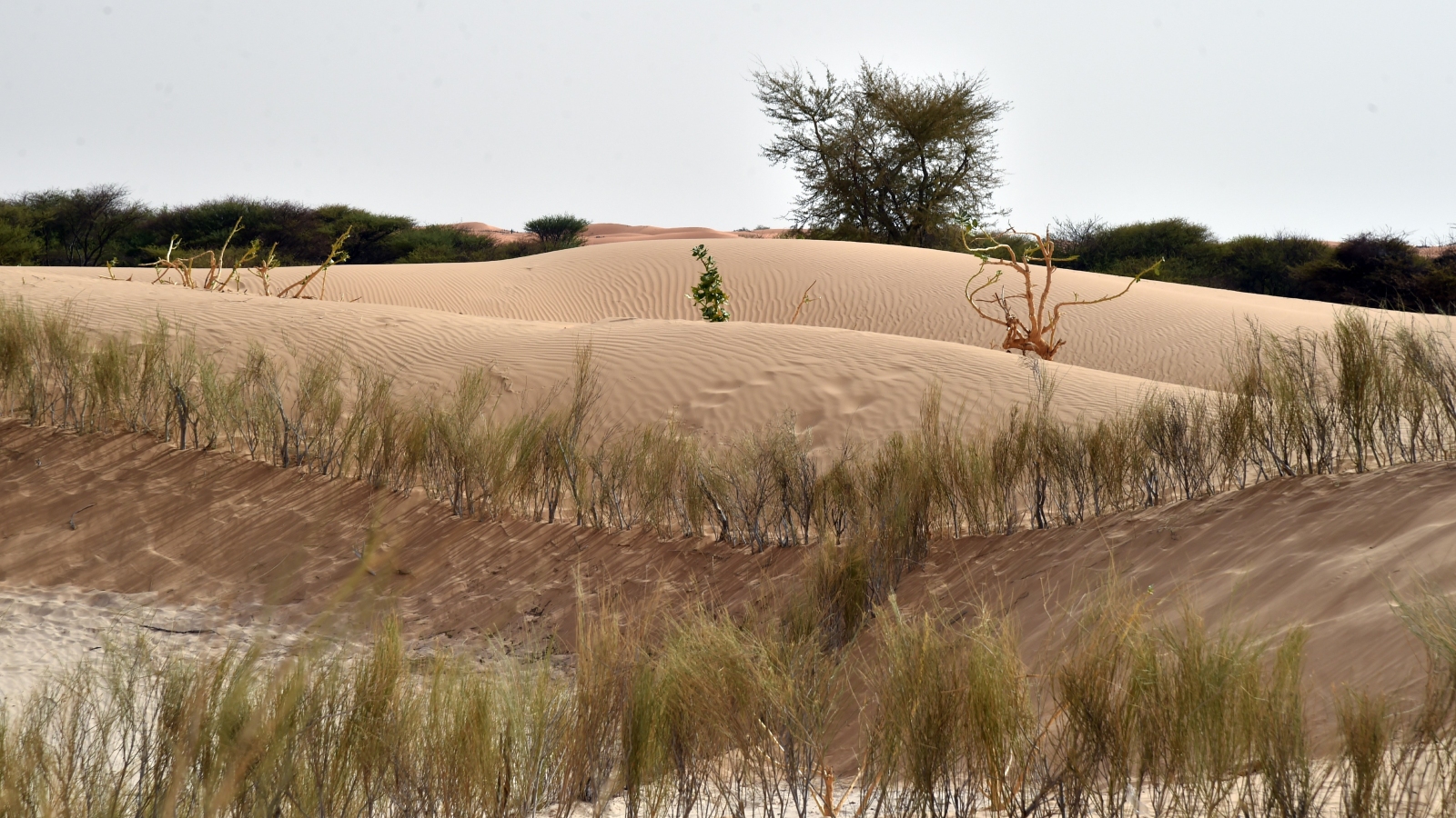
Vegetation growing along the dunes’ ridges is slowly fixing them in place, similar to these dunes (pictured) in Niger. (Image credit: ISSOUF SANOGO/AFP via Getty Images)
The parallel lines visible across the dunes are ridges of sand built up as the prevailing wind pushes the sand northward. Over time, the positions of these ridges subtly shift in the same direction.
The dark patches littered across the dune field are plants that have taken root in the ridges. If the concentration of this vegetation gets high enough, it can fix a ridge into place and prevent it from moving, similar to some of the dunes frozen in place along various coastlines across the globe.
Most of the vegetation is concentrated along the southern and western edges of the dune field, likely due to water coming from the Uil River, which snakes around the outskirts of Oyyl, according to the Earth Observatory.
Scientists are currently uncertain if the rest of the dune field will follow suit and become overrun by plant life in the future.