
 Source: Hong Kong Observatory
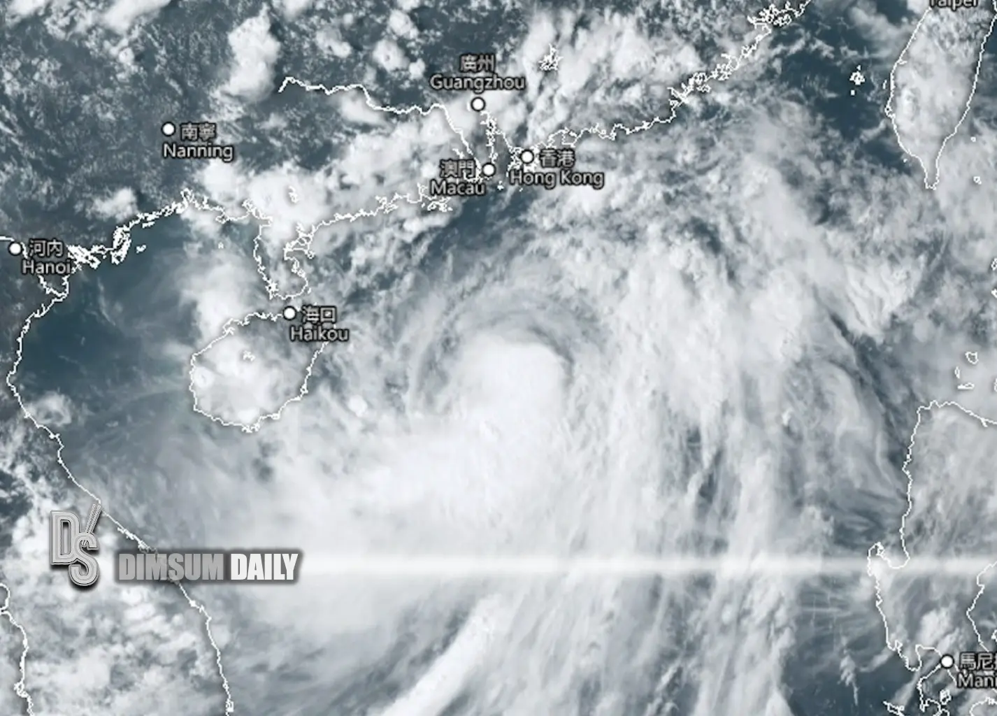
7th September 2025 – (Hong Kong) As Tropical Storm Tapah advances on a north-northwest course, the Hong Kong Observatory is vigilantly tracking its movement, contemplating the issuance of Gale or Storm Signal No. 8 between 9pm and midnight today. The storm has already begun affecting the Guangdong coast with thundery showers, indicating further intensification as it approaches the western coast of Guangdong within the next 24 hours.
Residents in Hong Kong should prepare for intermittent squally showers and thunderstorms today, accompanied by periods of heavy rainfall. Tomorrow’s forecast predicts the continuation of heavy squalls and initial windy conditions, leading to rough seas and swells. Individuals are advised to steer clear of coastal areas and refrain from water-related activities to avoid potential storm surges and flooding in low-lying coastal regions tomorrow morning.
The upcoming weather outlook anticipates strengthening southeasterly winds progressing to gale and storm force levels, coupled with overcast skies and sustained heavy showers and thunderstorms. Sea conditions are expected to be notably rough with significant swells. Temperatures will fluctuate between 26 and 29 degrees Celsius, with winds gradually shifting to southerly and weakening by the following day.