

Nunavut’s snows are later than usual
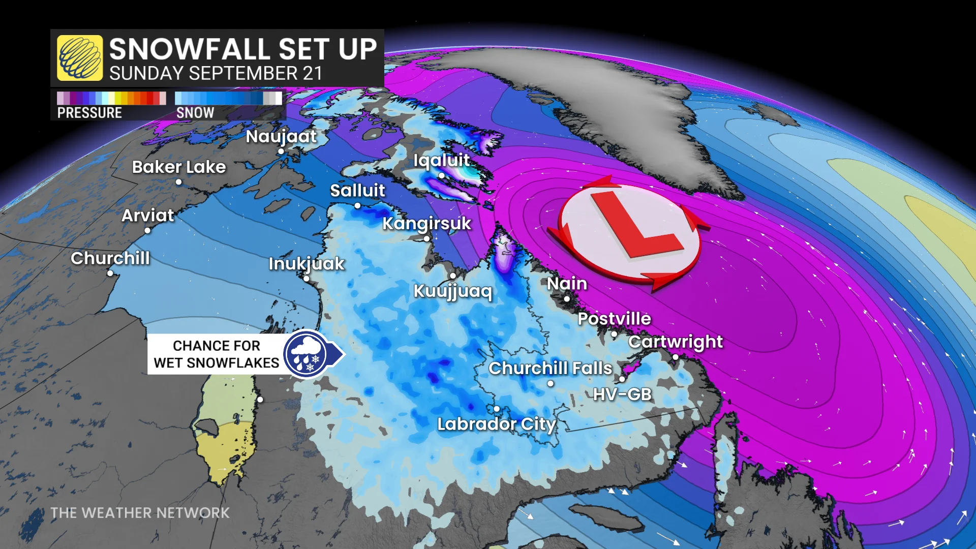
Moving east across the country, we find a strong low-pressure system spinning up just offshore of Baffin Island. Wind warnings have been issued for the region as winds could exceed 90 km/h at times on Friday and Saturday.
MUST SEE: Get winter-ready: How to prepare your vehicle for the cold weather ahead
Higher elevations along the Hall Peninsula could see significant snowfall during this event, with a rain-snow mix in the forecast for Iqaluit. Folks in Iqaluit typically average the season’s first snowfall on Sept. 6.
Northern Quebec and Labrador also in line for flakes
The same system swirling near Baffin Island will push chilly temperatures and precipitation over portions of northern Quebec and Labrador into the day Saturday.
A rain-snow mix is in the forecast with little accumulation expected. We could see wet snowflakes from Salluit down to Labrador City during the weekend, where the average date of the first snowfall is Sept. 15.
First snow gradually creeps southward as autumn settles in
Most of Northern Canada and the northern Prairies average their season’s first snowfall sometime during the month of September.
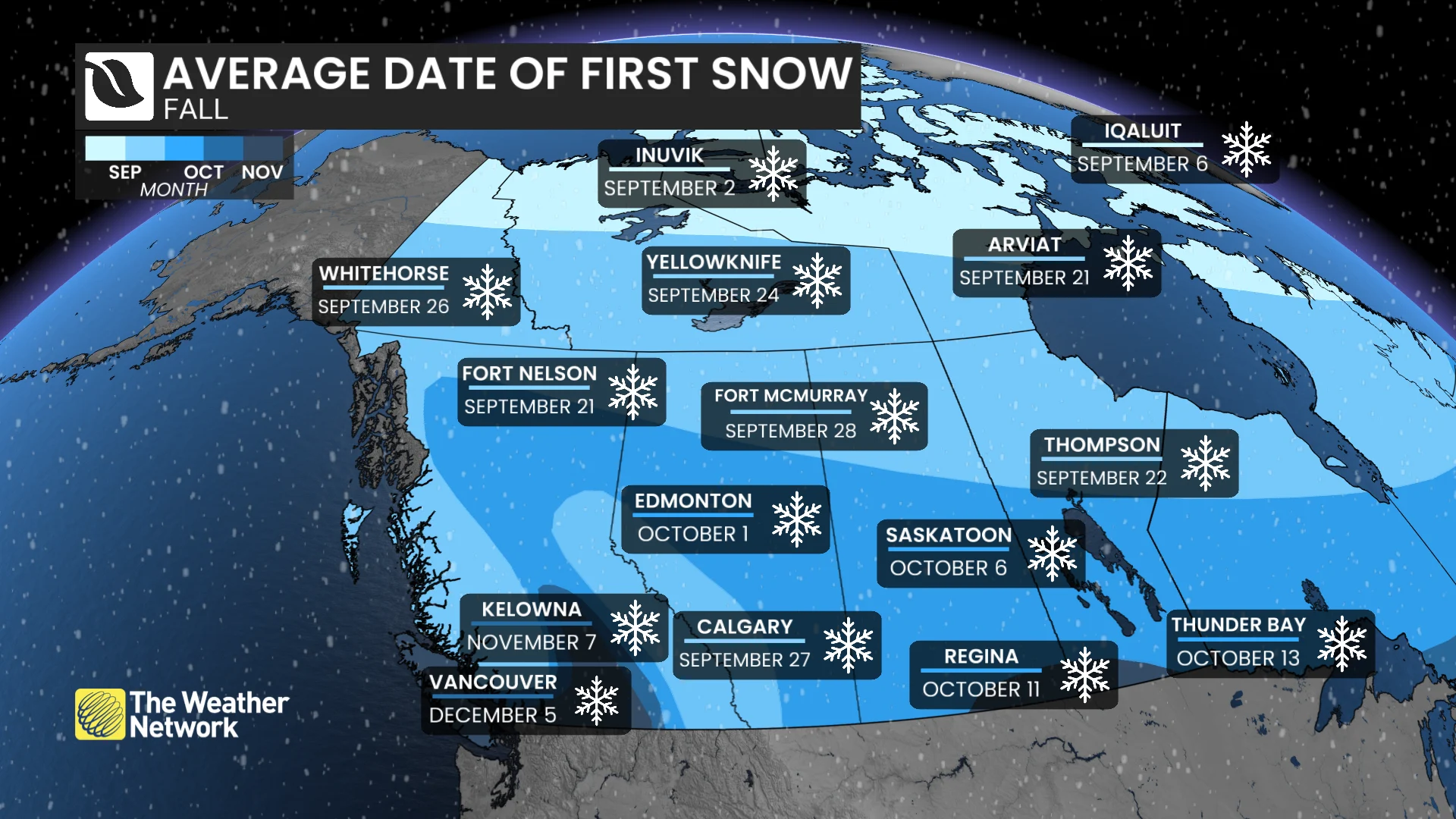
Wintry weather ekes southward with the changing seasons, with the season’s first snow typically appearing on the Prairies between the end of September and the middle of October.