
A team of scientists using detailed scans of the ocean floor around Earth’s southern polar region has revealed the most detailed map ever of Antarctica’s seafloor canyons and valleys, including 332 canyon networks that reach depths of over 4,000 meters.
The team said that improving the quality of the world’s seafloor maps fills in knowledge gaps about one of the planet’s most underexplored and inaccessible regions, while helping enhance computer models used to predict the effects of climate change as global temperatures continue to rise.
To date, only about 17% of the planet’s ocean floor has been mapped in high resolution, with scientists identifying around 10,000 submarine canyons worldwide. These maps are even more scarce in the remote parts of the planet, such as the North and South polar regions, due to the challenges of gathering the necessary data. This lack of data on seafloor composition and topography, including canyons that affect ocean water flow, has had a profound impact on scientific efforts to understand ocean dynamics both globally and locally.
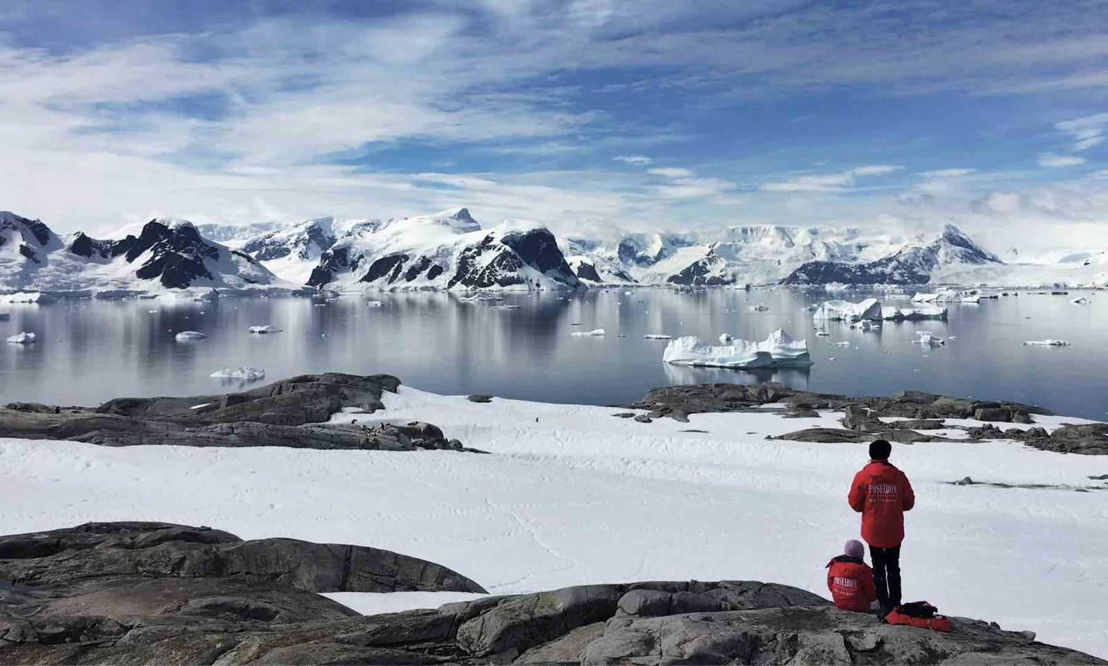
 The submarine canyons that form valleys carved into the seafloor play a decisive role in ocean dynamics. Image Credit: MARC CERDÀ – UNIVERSITY OF BARCELONA
According to a statement announcing the detailed map of Antarctica’s seafloor, the submarine canyon systems in this region are formed by high-speed “turbidity currents” that erode the valleys as they flow through them. Combined with the abundance of glacial sediments carried along by these currents, the team said they contribute to the formation of the large canyons seen today. While the region’s submarine canyons share similarities with others around the world, a key difference has been revealed through their mapping effort.
“Like those in the Arctic, Antarctic submarine canyons resemble canyons in other parts of the world,” the study’s co-lead author David Amblàs of the University of Barcelona explained. “But they tend to be larger and deeper because of the prolonged action of polar ice and the immense volumes of sediment transported by glaciers to the continental shelf.”
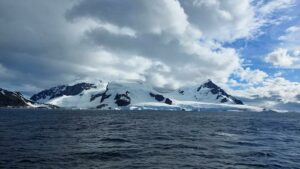
 The Antarctic canyons also facilitate water exchange between the deep ocean and the continental shelf. Image Credit: MARINE GEOLOGY
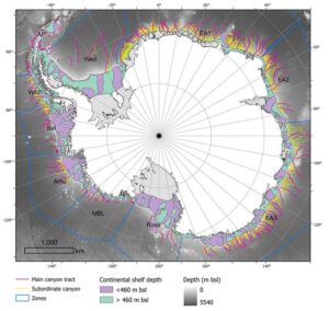
Hoping to change the equation, Amblàs and co-author Riccardo Arosio of University College Cork, developed a tool to take currently available data on the Antarctic seafloor and create a more detailed topographic map. According to the team’s statement announcing the map’s publication, they were able to take advantage of Version 2 of the International Bathymetric Chart of the Southern Ocean (IBCSO v2), which they describe as “the most complete and detailed map of the seafloor in this region.”
“Thanks to the high resolution of the new bathymetric database — 500 metres per pixel compared to the 1–2 kilometres per pixel of previous maps — we could apply semi-automated techniques more reliably to identify, profile and analyse submarine canyons,” Arosio explained.
In total, the team’s customized tool combines bathymetric data and a “semi-automated method for identifying and analyzing canyons” to describe a total of 15 “morphometric” parameters. The team said these data points revealed ultra-deep canyons and morphological differences in the seafloor topography between Antarctica’s east and west coasts. Amblàs said some of the canyons their tool unearthed were over 4,000 meters deep.
“The most spectacular of these are in East Antarctica, which is characterized by complex, branching canyon systems,” the researcher explained.
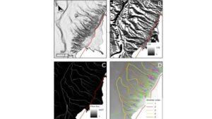
 A new high-resolution catalogue identifies 332 submarine canyon networks on the seafloor of the Antarctic continent. Image Credit:
MARINE GEOLOGY
The team also noted that the map of the Antarctica seafloor captured on the continent’s east coast showed how these systems often began with multiple heads near the continent’s edge. Amblàs said the systems of canyons ultimately merged into a single “main” channel that descends into the deep ocean, “crossing the sharp, steep gradients of the continental slope.”
“It was particularly interesting to see the differences between canyons in the two major Antarctic regions, as this hadn’t been described before,” Arosio noted. “East Antarctic canyons are more complex and branched, often forming extensive canyon–channel systems with typical U-shaped cross sections.”

The new map of Antarctica also showed that in contrast to the east coast, the continent’s west coast was more likely to have canyons that are shorter and steeper with V-shaped cross sections. Although more research into the coastal differences of these deep-sea canyons is needed, Arosio said the deeper eastern canyons suggest “prolonged development under sustained glacial activity and a greater influence of both erosional and depositional sedimentary processes.”
Amblàs said this morphological difference, which had been suggested by the area’s sedimentary records, offers support for the idea that the East Antarctica Ice Sheet started earlier and experienced more prolonged development than the shorter West Antarctica Ice Sheet. However, the researcher said that before their new map of the Antarctica seafloor was created, “it hadn’t yet been described in large-scale seafloor geomorphology.”
“The strength of the study lies in its combination of various techniques that were already used in previous work but that are now integrated into a robust and systematic protocol,” Arosio said in his conclusion “We also developed a GIS software script that allows us to calculate a wide range of canyon-specific morphometric parameters in just a few clicks”.
The study “The geomorphometry of Antarctic submarine canyons” was published in Marine Geology.
Christopher Plain is a Science Fiction and Fantasy novelist and Head Science Writer at The Debrief. Follow and connect with him on X, learn about his books at plainfiction.com, or email him directly at christopher@thedebrief.org.