
Geostationary orbit changed the game
That’s where geostationary orbit comes in handy. A spacecraft orbiting 35,786 kilometres above the equator will circle the planet at the exact rate Earth rotates on its axis, locking the vehicle over a fixed location on the ground.
Geostationary orbit provides a weather satellite the same view of Earth for its entire lifespan, allowing meteorologists to track weather systems as they happen.
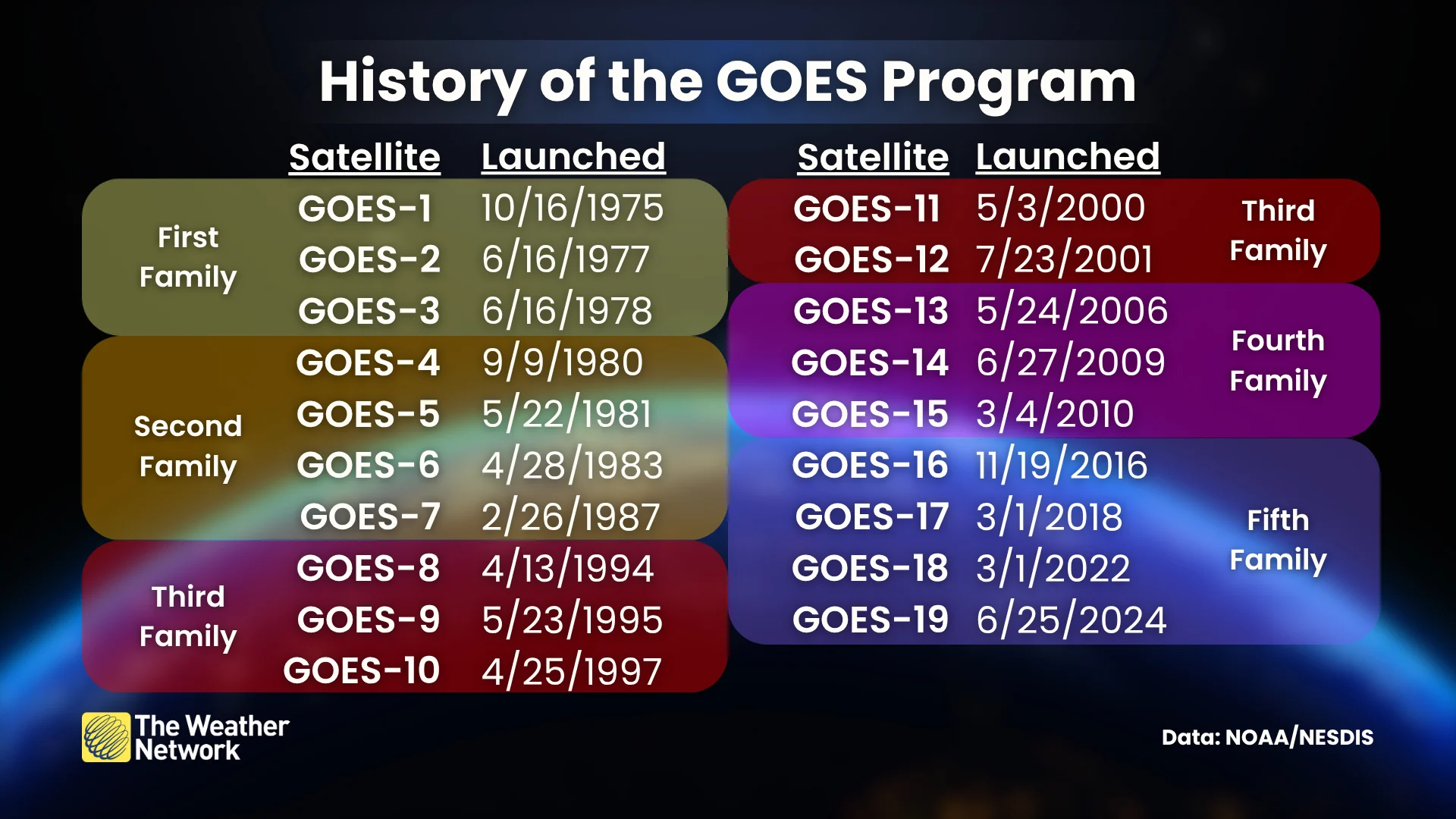
GOES-1 launched on October 16, 1975, inaugurating the GOES program for five decades of rigorous monitoring. The initial satellite collected basic imagery and environmental data.
RELATED: Satellites can ‘see’ the turbulence that your next flight may hit
Since then, we’ve benefited from five families of GOES satellites, each one more advanced than the last.
GOES 4-7 included the ability to take vertical soundings of the atmosphere, providing important information on temperatures and humidity. Imagery from the first seven GOES satellites was inconsistent due to technical limitations of the vehicles at the time.
GOES 8-12 improved their stabilization and electrical systems, affording each satellite the ability to send home more consistent and reliable imagery.