
Breadcrumb Trail Links
Residents living in the Sydenham River watershed are being asked to voluntarily cut water use by 10 per cent.
Published Oct 22, 2025 • 2 minute read
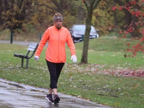 Brenda Wilkins gets ready for a run in light rain Wednesday at Canatara Park in Sarnia. Photo by Paul Morden /The ObserverArticle content
Residents of the Sydenham River watershed are being asked to voluntarily cut water use by 10 per cent following the declaration of Level 1 low water conditions by the St. Clair Region Conservation Authority.
Advertisement 2
This advertisement has not loaded yet, but your article continues below.
Article content
A Level 1 low water condition is declared under the Ontario low water response program when a watershed receives 80 per cent or less of the normal precipitation during a three-month period, said Emily De Cloet, flood forecasting and warning coordinator with the authority.
Article content
Recommended Videos
Article content
“At this point, it’s optional, but we’re asking people to just be cognizant of their water usage,” and cut back on uses that aren’t necessary, such as washing cars, watering lawns and power washing driveways, she said.
The authority covers areas of Lambton County, Chatham-Kent and Middlesex Country and includes the Sydenham River watershed, as well as smaller watersheds draining directly in southern Lake Huron, the St. Clair River and northeastern Lake St. Clair.
Advertisement 3
This advertisement has not loaded yet, but your article continues below.
Article content
The last time the watershed experienced a low water condition was in 2015, De Cloet said.
There are four levels in the provincial program, including normal conditions and Level 1 low water, she said.
“What it means is that we are seeing precipitation trends that are below what we would expect to be 80 per cent of normal,” De Cloet said.
The declaration is based on precipitation data collected throughout the watershed for July, August and September, as well as waterway flow data.
“Your inland rivers and creeks, you might notice that they’re lower,” De Cloet said. “And those are quite important for ground water recharge.”
READ: Great Lakes water levels are the lowest in a decade – but is it a crisis?
While some communities like Sarnia draw drinking water from Lake Huron, “there are residents who rely on ground water wells,” she said.
Advertisement 4
This advertisement has not loaded yet, but your article continues below.
Article content
De Cloet said there is no concern, at this point, about the supply of drinking water available in the watershed.
But reduced rainfall leads to low flows of water to replenish creeks, streams and wetlands.
“We are starting to see parts of the Sydenham River and creeks dropping off, De Cloet said.
Those levels have been observed below 70 per cent of normal flows at the conservation authority’s gauges, confirming the need to declare a level one low water condition, it said.
Other conservation authorities bordering the St. Clair Region, as well as in some other areas of the province, have also issued low water declarations, De Cloet said.
The area has received some rain this week “but the amount of rain we’re expecting is not enough” to change the declaration, she said.
“We’re looking at a much larger amount of rain needed to take us out of Level 1 and put us back to the normal expected conditions,” De Cloet said. “We definitely need more rain, more precipitation, over the next few months.”
Article content
Share this article in your social network