
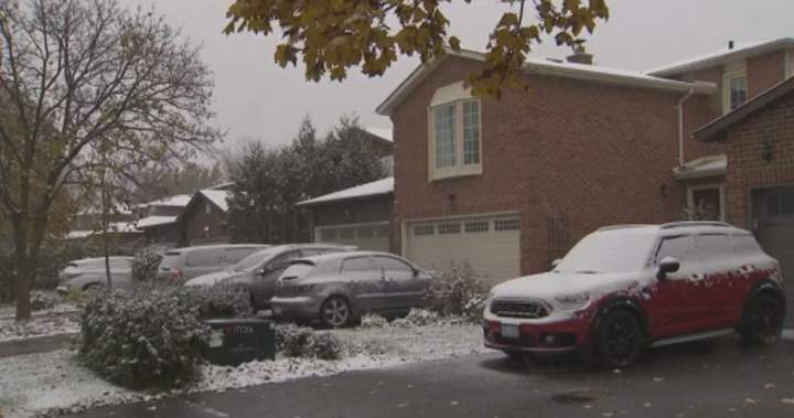
After a warm, dry summer and a rather rainy fall, snow is falling in parts of Ontario and Quebec with forecasts showing some areas could receive a heavy dusting.

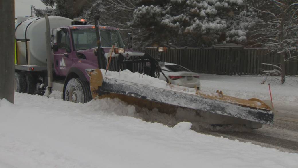
Environment Canada issued a snowfall warning on Sunday for parts of Ontario stretching from Belleville northeast to Ottawa, with between 10 to 20 centimetres of snow expected. Officials caution peak snowfall could fall at a rate of two to five centimetres per hour.
Similar amounts will also be seen in parts of southern and central Quebec, including Gatineau, Montreal, Quebec City all the way up to Baie-Comeau. Montreal, for example, could get nearly 10 centimetres through Monday.
According to officials, both provinces under snowfall warnings should expect the heaviest snow to occur late Sunday afternoon into the evening.
The areas south and east of Ottawa may also see snow mixing with ice pellets or freezing rain later in the day.
Story continues below advertisement
The snowfall is a shift from the drier conditions seen in the late summer and early fall, with significantly less rainfall than normal.
That lack of rain led to lower yields from crops ranging from apples to pumpkins.
According to Agriculture and Agri-Food Canada, 71 per cent of the country was classified as “Abnormally dry” or “Moderate to Extreme Drought” at the end of August, including 70 per cent of the country’s agricultural landscape.

Get daily National news
Get the day’s top news, political, economic, and current affairs headlines, delivered to your inbox once a day.
But with the snowfall, and rain in recent weeks, that dry period may be coming to an end.
Special weather statements have also been issued for much of southern Ontario stretching from Windsor and London up to Kawartha Lakes and Brockville.
1:52
Toronto lays out plan to fix snow clearing issues
Those statements vary in terms of snowfall amounts, with Windsor seeing up to five centimetres while places like London, Niagara Falls and Toronto are at risk of seeing at least five centimetres and up to 15 centimetres in some places. Kingston and its surrounding area could also see ice pellets.
Trending Now

Canadian travellers to Europe face new border measures as security ramps up

Name of founding Hells Angels member appears on Montreal-area tombstone
Story continues below advertisement
In anticipation of the snowfall, the City of Toronto has opened a select number of new shelter spaces for people experiencing homelessness this weekend. Temperatures in the city are expected to plunge to -5C on Sunday.
The snow in Toronto is not only impacting drivers, but sports as well.
On Sunday afternoon, the Northern Super League advised the semifinal matchup between the Montreal Roses Football Club and AFC Toronto at York Lions Stadium has been postponed until Monday.
More on Toronto
More videos
That game will now take place Monday at 6 p.m.
In a post on X on Sunday evening, the OPP said they had responded to about 140 collisions amid the winter weather, though added there had been no serious collisions to report.
Special weather statements are also in effect for some regions of Quebec including the Lower St. Lawrence area, the Bécancour-Villeroy area, and the Sept-Îles – Port-Cartier area.
Officials are urging drivers to expect difficult winter driving conditions and to adjust travel plans as necessary.
“Make sure you brush your vehicle clear of snow and ice,” said Ontario Provincial Police Sgt. Kerry Schmidt. “When you do head out on the roads put your full headlight system on and when you’re driving, hands on the wheel, eyes on the road, you’re focused on the task of driving. Give yourself a little extra time, it may take you a little longer to get where you’re going and when you’re driving, give yourself a little more space behind the vehicle in front of you.”
Story continues below advertisement
—with files from The Canadian Press
© 2025 Global News, a division of Corus Entertainment Inc.