
Squalls continue to intensify on Sunday, with the main focus being off Lake Huron and targeting London-Woodstock, with a secondary focus off Georgian Bay targeting Collingwood to Highway 400 south of Barrie.
Lake Huron squalls will target several counties, but the worst conditions with significant whiteouts are forecast in: Huron, southern Perth, Oxford, eastern Middlesex and Norfolk counties.
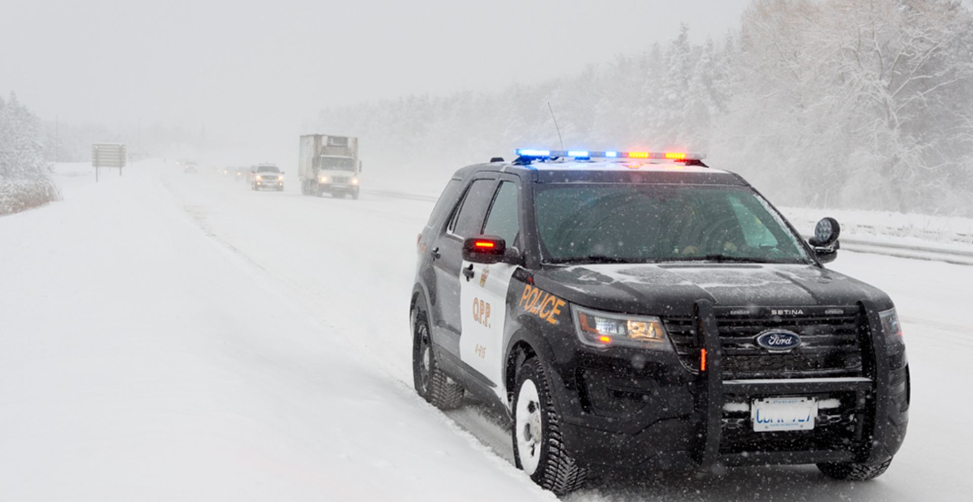
Highway 3, Highway 4, Highway 21, and Highway 401 are some of the routes impacted.
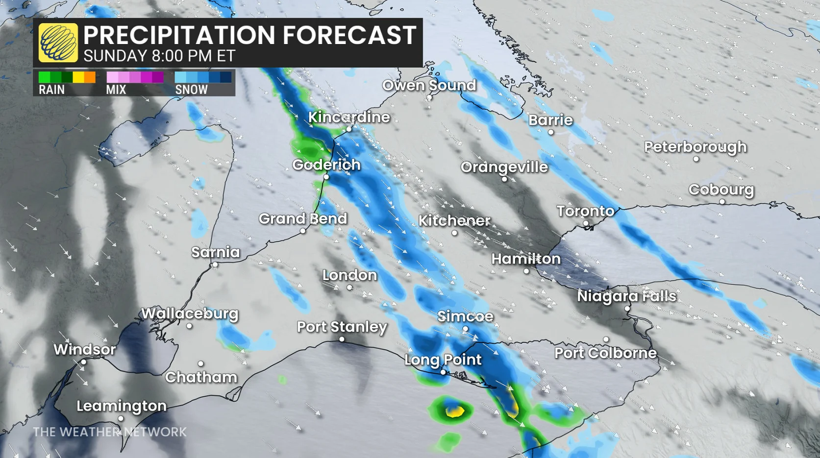
The Georgian Bay squall will be impacting communities and population centres downwind, including Toronto.
Greater Toronto Area
City of Toronto
Vaughan → Richmond Hill, Markham
Pickering → Oshawa, southern Durham
Simcoe County-Georgian Bay Corridor
Barrie → Collingwood, Hillsdale
Innisfil → New Tecumseth, Angus
Midland → Coldwater, Orr Lake
Barrie → Midhurst
Newmarket → Georgina, northern York
Through Sunday evening and overnight, heightened squall activity persists with the Arctic air in place, with the aforementioned dominant squalls. Peak snowfall rates of 3-5 cm an hour and peak wind gusts of 60-70 km/h.
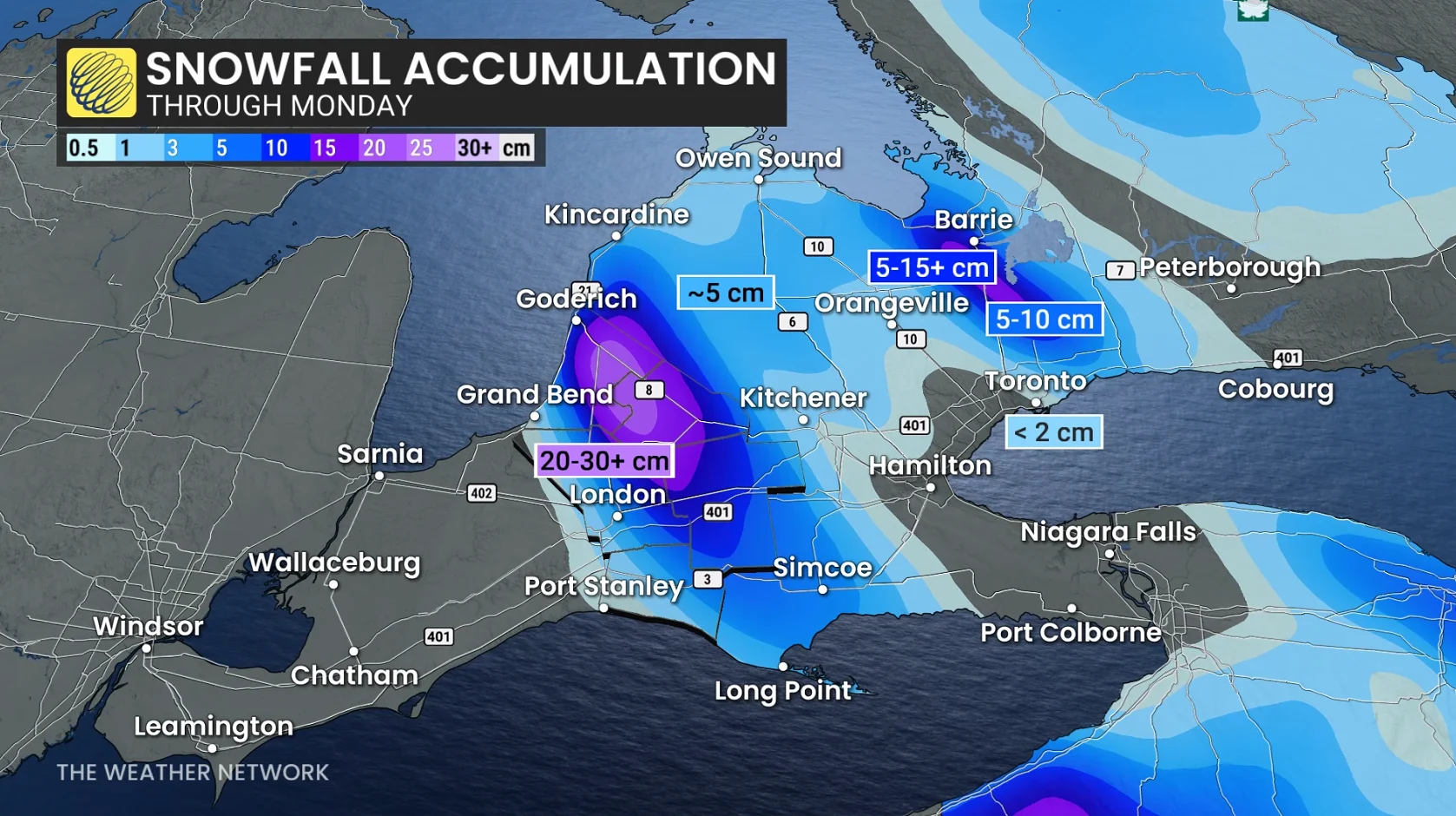
Residents and drivers can expect snow squalls to meander over the region through the day Sunday, continuing into the overnight hours and lingering into Monday.
Through Tuesday, the band of snow off Lake Huron could produce 20-40+ cm of snow for parts of Huron, Middlesex, Elgin, Perth and Oxford counties. Locally higher totals are possible, especially if the band remains stationary for an extended period of time.