
Published on Jul. 28, 2025, 1:07 PM
Large hail pelted Canada’s hail alley on Sunday, but the stormy weather isn’t done yet as Monday sees a renewed storm risk in Alberta.
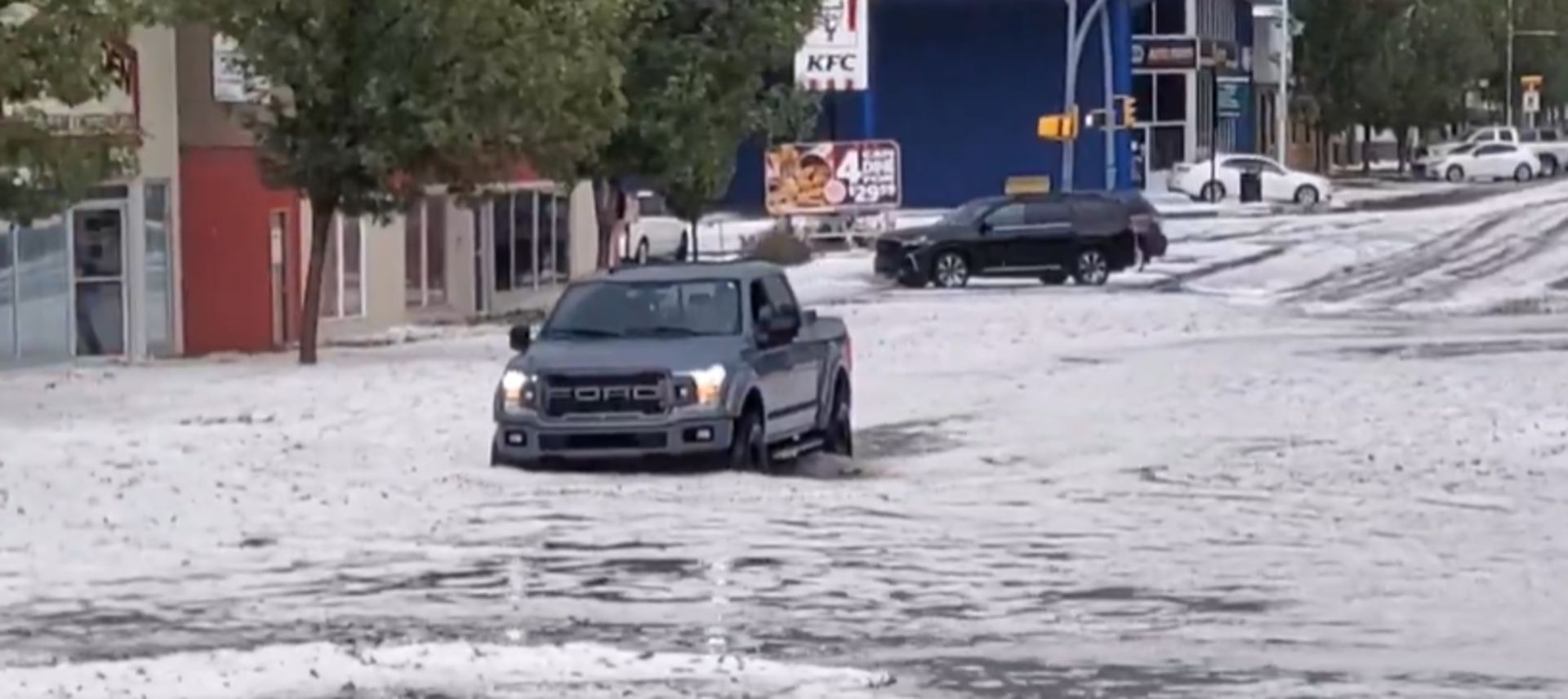
Sunday brought stormy weather to Alberta, resulting in plenty of photos being posted on social media. The province once again lived up to its name of Canada’s hail alley, as large hail battered crop fields and flooded streets.
The thunderstorms developed off of the southern foothills late Sunday afternoon and quickly turned severe, making drivers across southern Alberta have to contend with flooded streets from the heavy rains and hail.
SEE ALSO: From nuisance to nightmare: Huge hail is an extreme danger
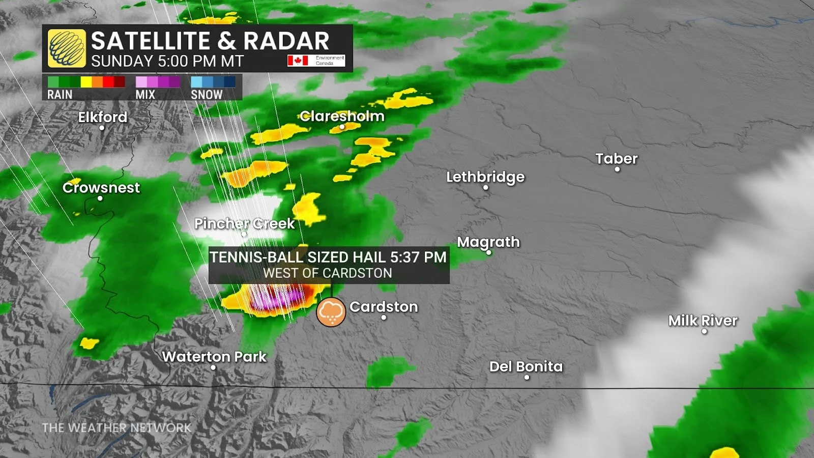
One severe-warned storm in particular, south of Pincher Creek and west of Cardston, dropped hail as big as tennis balls, according to reports.
As images surfaced of streets across the region turning white from the thick hail, looking more like winter roads than summer, images also began to pop up of trees with shredded leaves and battered crops.
Check out the end of the article for images and videos posted to social media of Sunday’s storms.
Unfortunately, the storm risk will continue through Monday across Alberta.
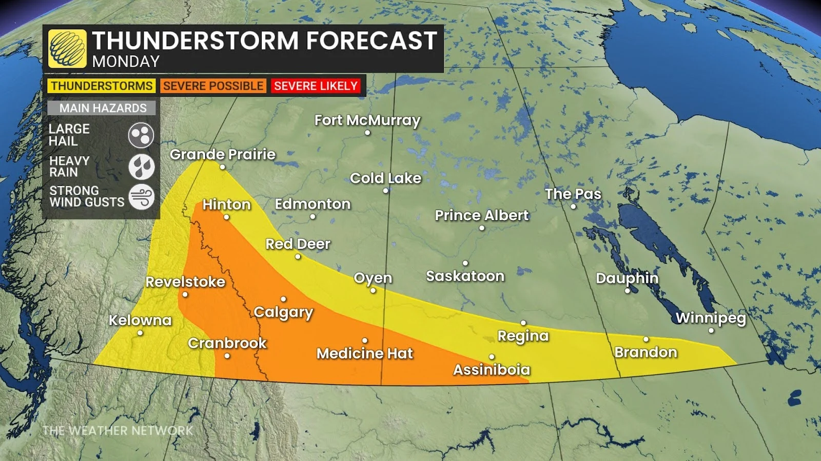 Monday sees a renewed storm risk in Alberta
Storms began to fire up early Monday morning west of Calgary and will continue to trek eastward over the course of the day.