
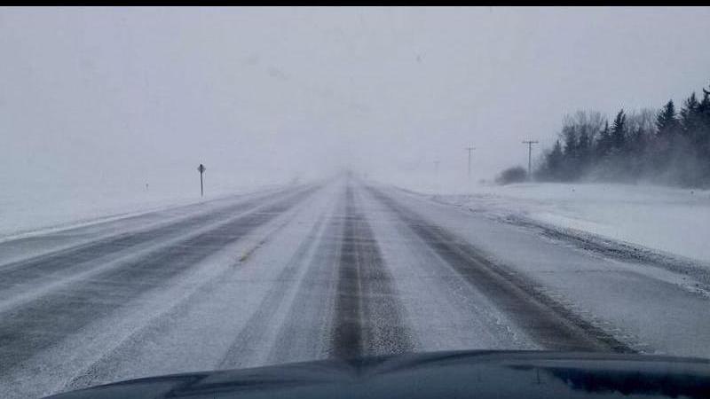
Loose snow caused significant visibility issues Tuesday morning across much of the province, making the drive to work especially treacherous. The strong wind is also causing roads and highways to become icy.

“Those winds should ease this afternoon and go more towards light [winds], and those conditions should be a little bit better,” Lang said. “Then we get back into it tomorrow – even worse.”
The next weather system moving into Saskatchewan will come through starting on Wednesday, as an Alberta Clipper is expected to bring significant wind and snow to much of central and southern Saskatchewan beginning in the morning.
“It’s forecast to…take a path more along the Highway 16 travel route. That’s where the snowiest amounts will be,” Lang said.
A Winter Storm Watch is in effect for the Humboldt area, with 10 to 15 cm of snow expected to fall Wednesday with 60 km/h wind gusts at times.
“That’s really going to blow that snow around, so we are expecting widespread poor travel conditions across most of southern Saskatchewan [on Wednesday] as this weather system makes its way through.”
While the northeast and Prince Albert areas are only expected to have a chance of flurries throughout the day, the wind will be gusting to 50 km/h at times, and that could lead to difficult driving conditions.
North Battleford is also under a Winter Storm Watch, with 5 to 10 cm of snow expected along with wind gusts around 50 km/h.
Lang said Alberta Clippers often follow the same route, as they are formed in either central or southern Alberta and head east. Another Alberta Clipper is expected on Friday, but it is expected to form in southern Alberta and move across southern Saskatchewan.
“Because the prevailing wind direction in the upper atmosphere in western Canada is usually northwesterly or westerly, that’s why it takes [those] routes,” explained Lang.
Highways are usually an easy way to explain the path those storms will take, so with the system on Wednesday they expect it to follow a path similar to that of Highway 16 through central Saskatchewan heading southeast.
Arctic air is behind Wednesday’s weather system, and it will stay cold for a significant time afterward, according to Lang. Forecasters will keep an eye on Friday’s system, but it is not expected to be as strong.
“After that, we’re in a deep freeze, it looks maybe even towards Christmas Eve.”
If you must travel over the next couple of days, Lang suggests having a winter survival kit in your vehicle and ensure that your cellphones are fully charged and your gas tank is topped up in case of emergency.
–
cam.lee@pattisonmedia.com