
Meteorologist Michelle Jobin has on s an update on temperatures across Canada on New Year’s Eve.
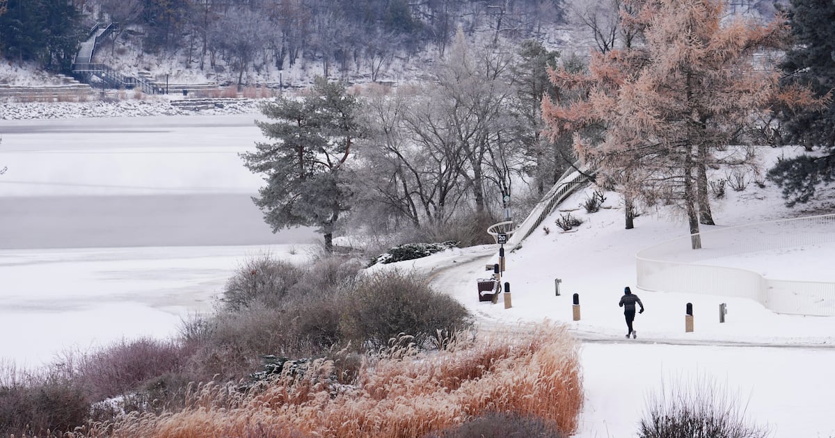
Canadians ringing in the New Year will get their last blast of winter as Environment Canada warns of widespread chilly weather stretching across parts of the country.
Frigid temperatures, snow and icy conditions are shaping celebrations coast to coast.
Here’s a look at New Year’s Eve forecast for Canada.
According to Environment Canada, much of central Canada remains under winter weather advisories and warnings heading into the New Year.
In Toronto, flurries and a risk of snow squalls are expected on Wednesday, with winds gusting up to 40 km/h. There will be a high of -2 C on New Year’s Eve but it will feel closer to -13 in the morning and -8 in the afternoon.
Frigid temperatures have prompted the city to keep five warming centres open.
Snow squall warnings are in effect across central Ontario snowbelt regions, including parts of Simcoe County, Grey-Bruce and Huron-Perth which could see between 10 to 30 centimetres of snow.
For northern parts of the GTA, like Orangeville and Grand Valley, residents could see between 15 to 30 centimetres of snow with near-zero visibility.
As for Ottawa, Environment Canada’s weather forecast calls for sunshine during the day Wednesday with a high of -10 C and a wind chill of -13.
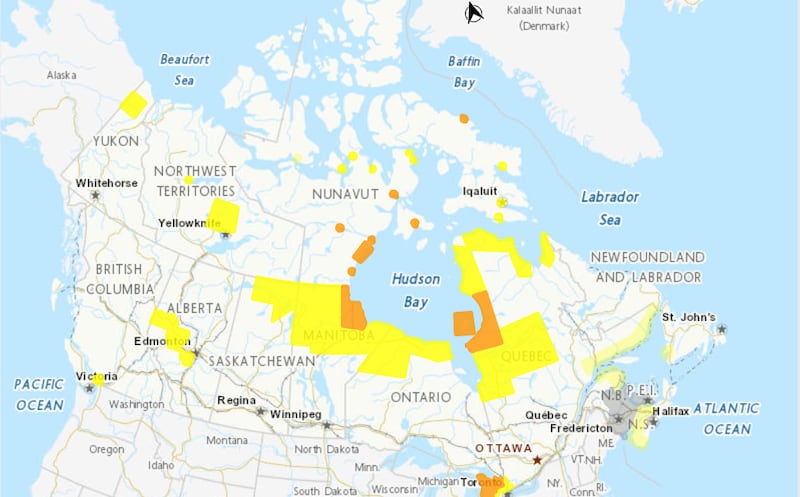 Weather map Environment Canada map shows where weather advisories and statements have been issued as of Thursday morning. (Environment Canada) Quebec
Large parts of northern and eastern Quebec are under active weather alerts.
In eastern Quebec and the Gaspé Peninsula, several areas – including Chandler, Murdichville, Percé, Grande-Vallée – are under winter storm watches. Forecasts call for 15 to 25 centimetres of snow from Thursday evening to Friday evening.
Across northern Quebec communities, strong wind warnings remain in place. Wind gusts up to 90 km/h are expected.
Western Canada
Environment Canada has issued fog advisories for parts of central Alberta, including areas near Drayton Valley, Leduc and Ponoka counties, warning that near zero visibility in patchy fog is occurring.
Similar fog advisories are issued for Vancouver, Burnby and New Westminster. The advisory said a ridge of high pressure is settling over the Vancouver region.
Widespread cold warnings were put in place for norther Manitoba with wind chills between -40 and -50 C. Residents will brace cold temperatures from now with “marginal improvements throughout the day,” and Thursday, according to the advisory.
Northern Saskatchewan will see similar wind chill temperatures with coldest conditions overnight and early Thursday morning.
Atlantic Canada
Special weather statements across much of New Brunswick, including Acadian peninsula, Moncton, Saint John and Fredericton is forecasting 15 to 30 centimetres of snow from Thursday afternoon until Friday morning.
Snow squall watches were issued for much of Nova Scotia, including Shelburne, Yarmouth, Digby and more. Wind gusts of 50 km/h and snowfall of up to 5 centimetres is expected.
In the norther parts of the province, 10 to 20 centimetres of snow is expected. Residents of Prince and Queen counties in P.E.I can expect the same snowfall amounts.
In Bay St. George, Newfoundland and Labrador, two to four centimetres of snow is in the forecast with possibility of it exceeding 10 centimetres in the squall.