

Published on Jan. 12, 2026, 12:29 AM
Updated on Jan. 12, 2026, 10:45 AM
A wintry storm moving through Atlantic Canada will rapidly strengthen on Monday, giving way to very strong winds throughout the region
A snowy and icy mess that blanketed the Maritimes on Sunday will move across Newfoundland, bringing an impactful wintry mix to the island through Monday.
Expect powerful winds to build over the entire region as the storm rapidly deepens over the Gulf. Gusts could peak well over 100 km/h in some vulnerable areas.
DON’T MISS: El Niño incoming? Forecasters see signs of big changes ahead
Wintry mess threatens Newfoundland through Monday
Precipitation will begin to wind down across the Maritimes as the bulk of the wintry storm moves into Newfoundland.
However, heavy snow will develop for extreme eastern New Brunswick, as well as Cape Breton, through Monday morning as the system strengthens over the Gulf.
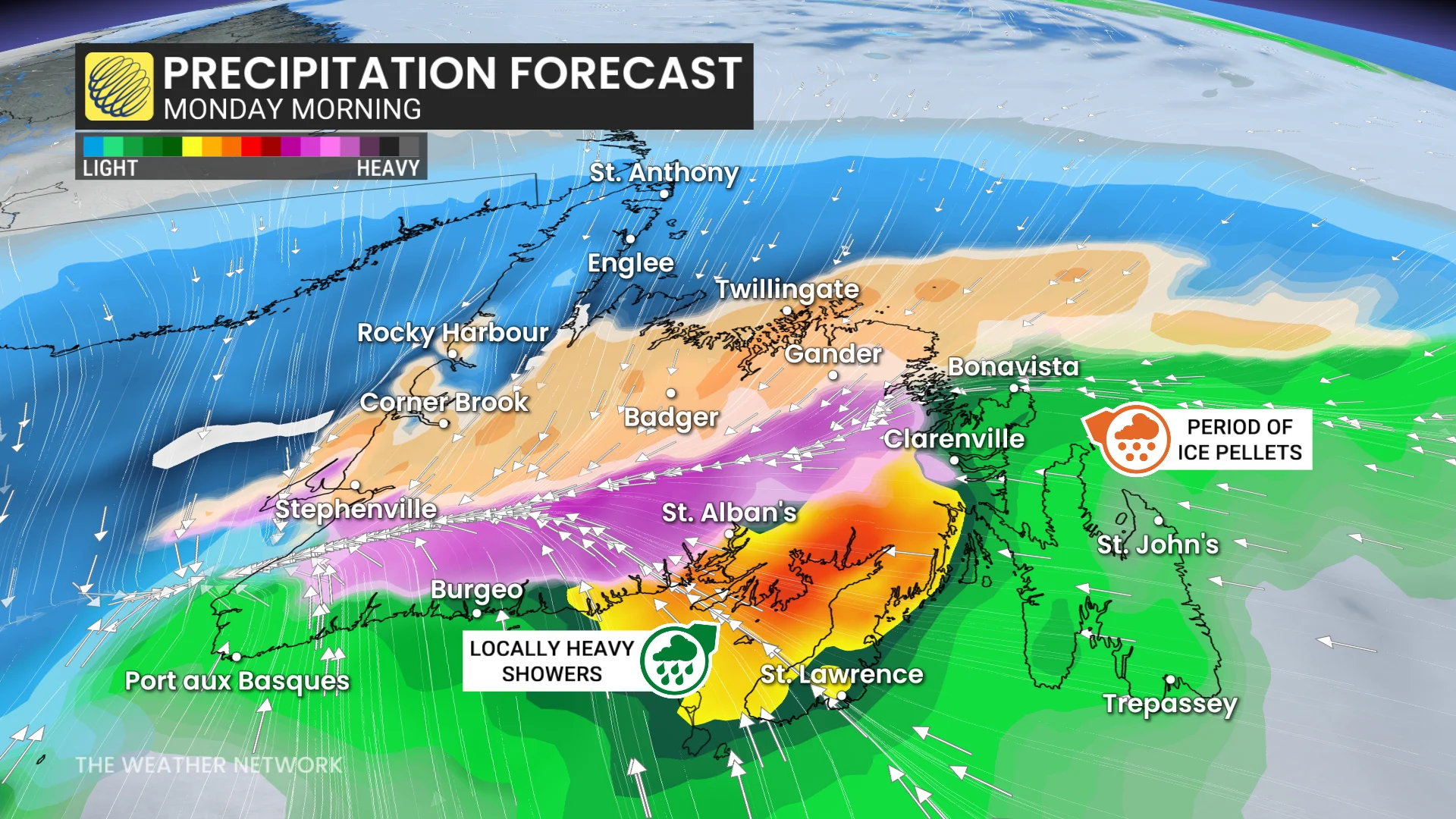
Periods of snow that arrived in Newfoundland on Sunday evening will give way to ice pellets and freezing rain as warmer air aloft pushes into the region. Significant freezing rain is possible across central Newfoundland before transitioning back to snow Monday afternoon.
The Avalon, Bonavista, and Burin Peninsulas will all transition to rain by Monday morning, with stubborn freezing rain lingering in Gander.