

Published on Jan. 24, 2026, 3:03 PM
Updated on Jan. 24, 2026, 4:39 PM
A massive U.S. winter storm is forecast to track into Atlantic Canada late Sunday, forecast to deliver a snowy wallop for a good portion of the region, alongside blustery winds. Expect significant disruptions to travel and possibly power
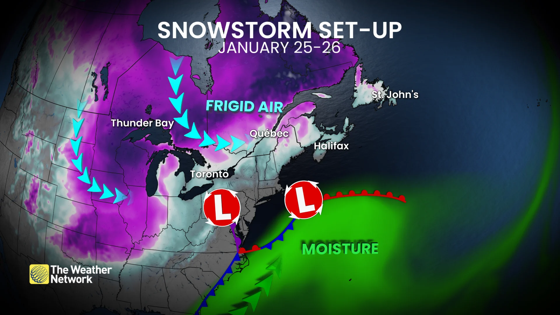
A developing winter storm that could produce a catastrophic ice storm stateside, and deliver a wintry blast to Ontario and Quebec, is expected to bring a period of prolonged snowfall and blowing snow into Atlantic Canada on Sunday night into early next week.
The exact track of the system remains uncertain, but the potential exists for significant snowfall over some locations. Some areas could see 15-30+ cm. The system will also be slower in speed than typical nor’easters, resulting in heavier snow totals.
DON’T MISS: 160+ million at risk for destructive ice, major snowstorm
Strong winds accompanying the snow will cause reduced visibility in blowing snow. Roads and walkways may be difficult to navigate. Consider postponing non-essential travel. Prepare for school and business closures on Monday morning.
A slug of Arctic air settling over the region will bring very cold temperatures for the weekend, with some daytime highs near -20°C possible.
Brace for impacts: Frigid air and heavy snow
A frigid Arctic air mass in Eastern Canada will clash with a warm, moist air mass from the Gulf of Mexico, creating a boundary that will produce heavy snow and ice all the way from Texas to the Atlantic coast.
This weekend, the Maritimes will experience very cold Arctic air, with daytime highs ranging from minus teens to -20°C. Halifax is forecast to see a high of -14°C on Saturday — a rarity, last observed in February 2023, December 2016, and January 2014.