

Impacts will begin in Nova Scotia during the late afternoon or evening hours on Sunday.
RELATED: What turns a snowstorm into a raging blizzard?
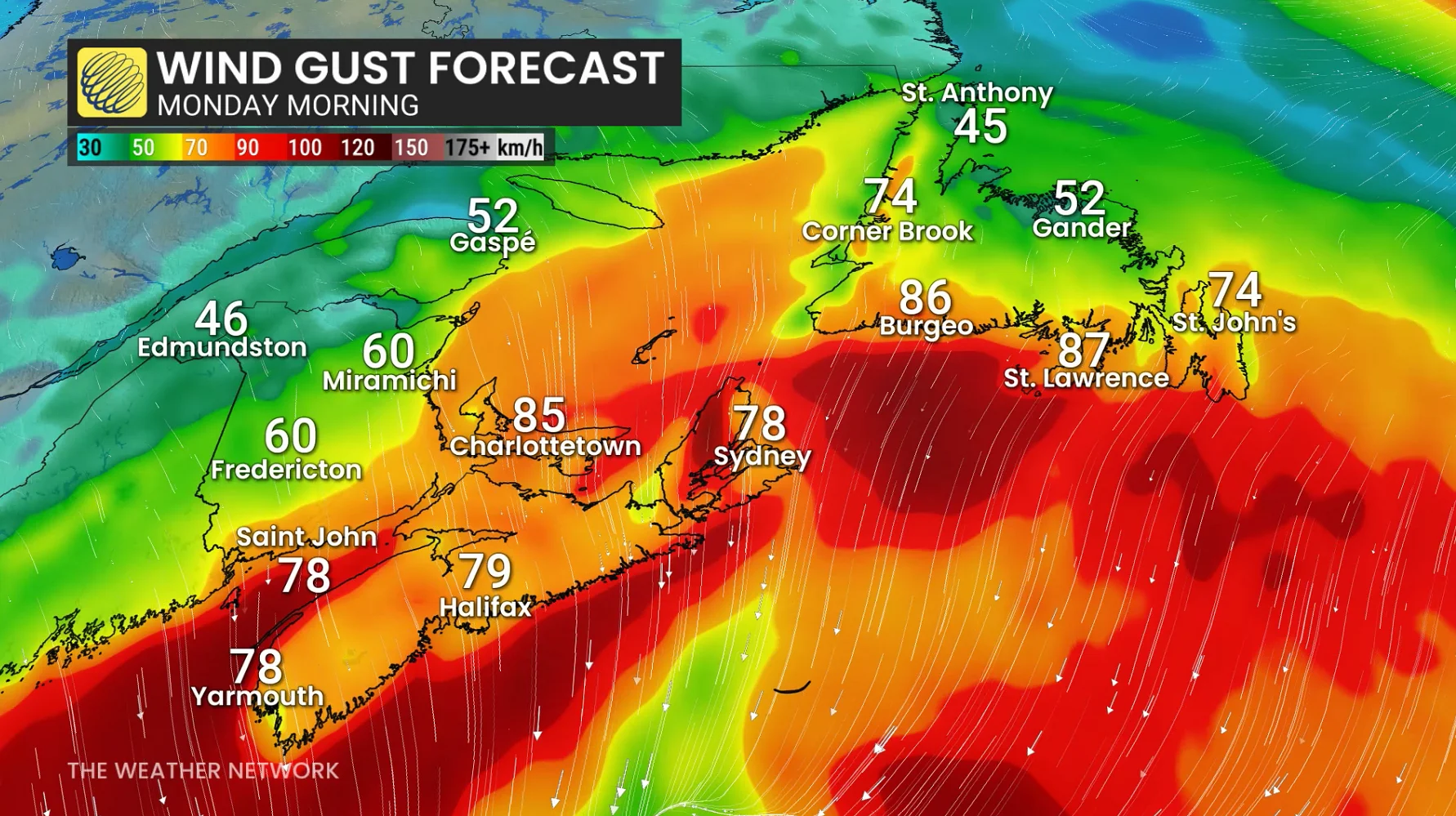
We’ll see snowfall rates and wind gusts intensify as the strengthening storm approaches the coast through overnight Sunday into early Monday. Snowfall rates of 2-3 cm per hour, combined with 60-90 km/h winds, will likely bring whiteouts and blizzard-like conditions.
Disruptions will continue into Monday morning as the snow and wind move toward Newfoundland. Very heavy snowfall rates and winds potentially exceeding 90 km/h will lead to dangerous winter travel across the island. School closures are likely.
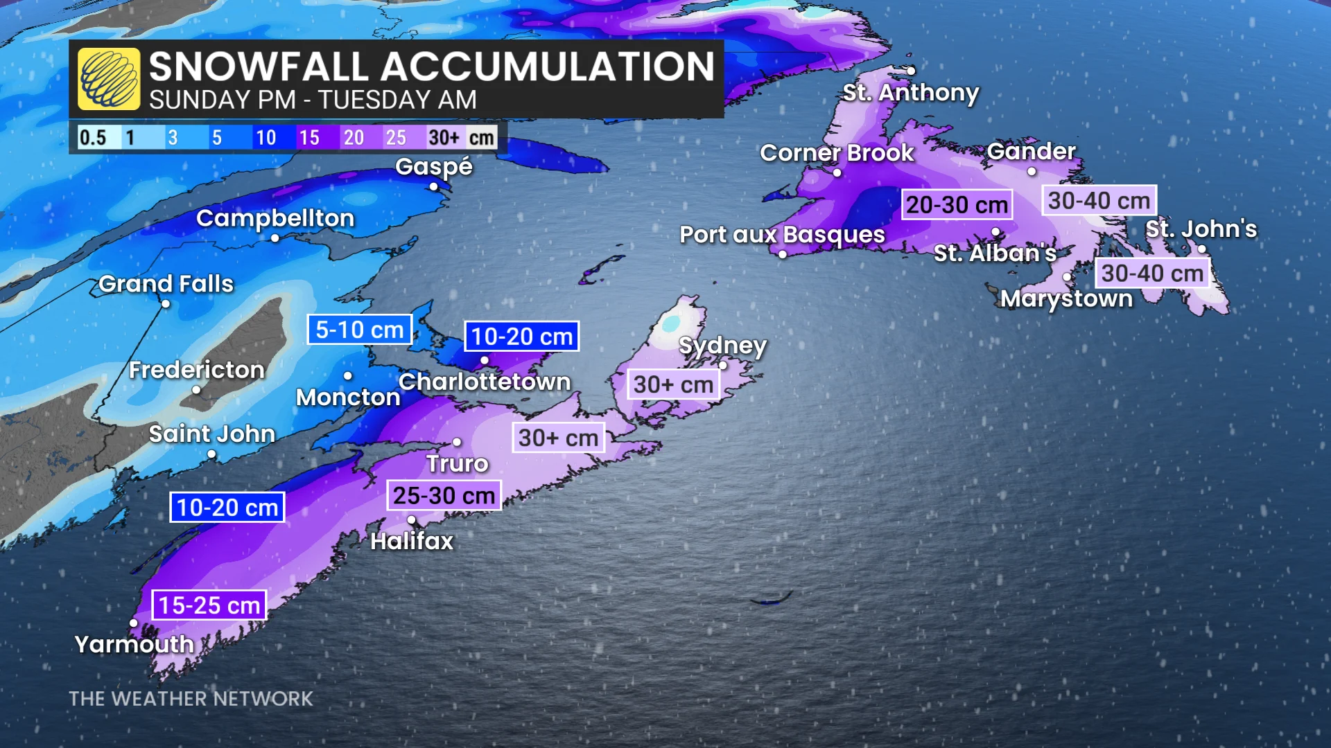
Some uncertainty in the storm’s track could increase or decrease snowfall totals, especially for southern New Brunswick, Prince Edward Island, and central Newfoundland.
Snowfall totals by the end of the storm could approach 20-30+ cm across much of Nova Scotia, with more than 40 cm possible in spots over in Newfoundland.
Header image created using graphics and imagery from Canva.
WATCH: Eastern Canada preps for storm, including Shubenacadie Sam