
![]()
Listen to this article
Estimated 2 minutes
The audio version of this article is generated by AI-based technology. Mispronunciations can occur. We are working with our partners to continually review and improve the results.
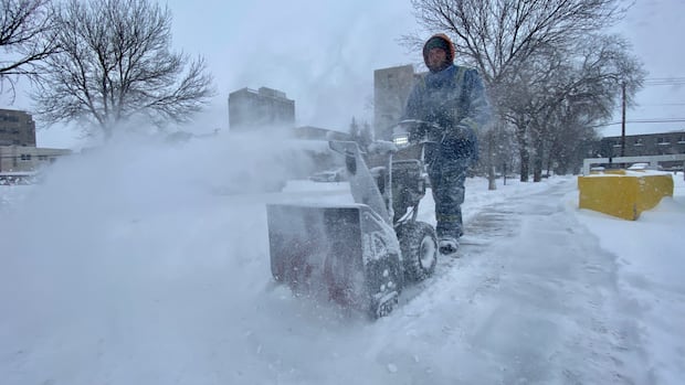
A serious winter storm is on its way for the eastern half of Newfoundland, expected to start overnight Sunday and last until early Tuesday.
Up to 50 cm of snow could fall in some areas, with wind gusts up to 100 km/h, according to Environment Canada. Visibility could be near zero at times.
The Avalon and Burin peninsulas, Clarenville and other parts of central Newfoundland are under an orange winter storm warning.
As it gets warmer on Monday, Environment Canada says the snow will become “wet and dense, unlike the fluffy nature of recent snowfalls.”
Coastal flooding warnings are also in place.
There is a less-severe yellow winter storm warning for other parts of central Newfoundland, which could see up to 30 cm of snow.
Parts of the southern Avalon could see snow mixed with rain or ice pellets Monday morning, before changing back to snow that night.
Environment Canada warns people to avoid non-essential travel and outdoor activities.
St. Bonaventure’s College, a private school in St. John’s, has already cancelled class for Monday.
Download our free CBC News app to sign up for push alerts for CBC Newfoundland and Labrador. Sign up for our daily headlines newsletter here. Click here to visit our landing page.