
Webequie First Nation submits environmental assessment for 107-kilometre road link
The Ford government is speaking with greater confidence that construction on the Webequie Supply Road to the Ring of Fire will commence this summer.
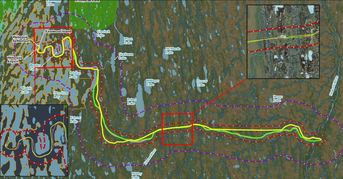
In a Jan. 30 news release, Indigenous Affairs and First Nations Economic Reconciliation Minister Greg Rickford said the environmental assessment (EA) for the proposed 107-kilometre road has been submitted to the province for review.
Through its recent co-operation pact with Ottawa for fast-tracking environmental approvals for major resource and infrastructure projects, the province and Rickford are promising that this submission will be reviewed and stamped for approval in record time under its One Project, One Process format.
“With the submission of the EA and Ontario’s signing of the co-operative agreement with the federal government, we remain on track to get shovels in the ground beginning in June 2026.”
Webequie is located at the top end of the larger Ring of Fire road network. The community is a road project leader, overseeing the engineering and environmental assessment of its section of the road.
This individual stretch of the permanent, all-season, two-lane gravel road will extend east from the Webequie airport into the mineral-rich area around McFaulds Lake.
Australia’s Wyloo has the most advanced project in that area with its Eagle’s Nest nickel deposit.
In late October, Webequie entered into a landmark Community Partnership Agreement with the province that released close to $40 million in community preparedness funds that was to be earmarked for local infrastructure.
The Webequie road is part of the larger proposed road network, of more than 300 kilometres, that would begin in the Aroland First Nation – Nakina area of northwestern Ontario and would proceed north into the James Bay region, to provide year-round access to remote communities of Marten Falls and Webequie for the first time while also supporting mining-related activity in the Ring of Fire.