
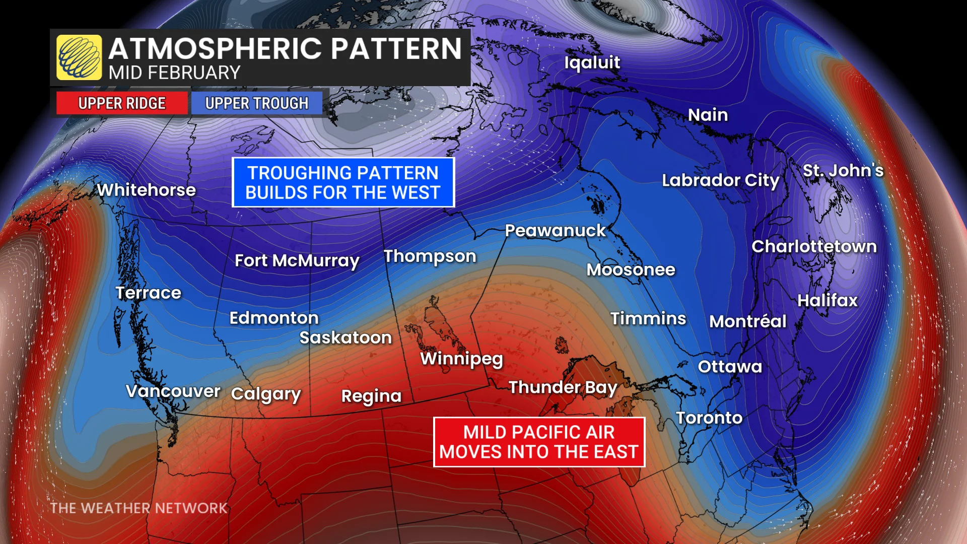
The upper-level pattern responsible for the bursts of extreme cold will finally relax, allowing milder air to spill into Eastern Canada.
Temperatures will trend toward the seasonal mark for a change, and may even climb above seasonal for a few days. It’s important to note that “seasonal” is still cold this time of year, and near- to above-seasonal readings can easily support high-impact winter weather.
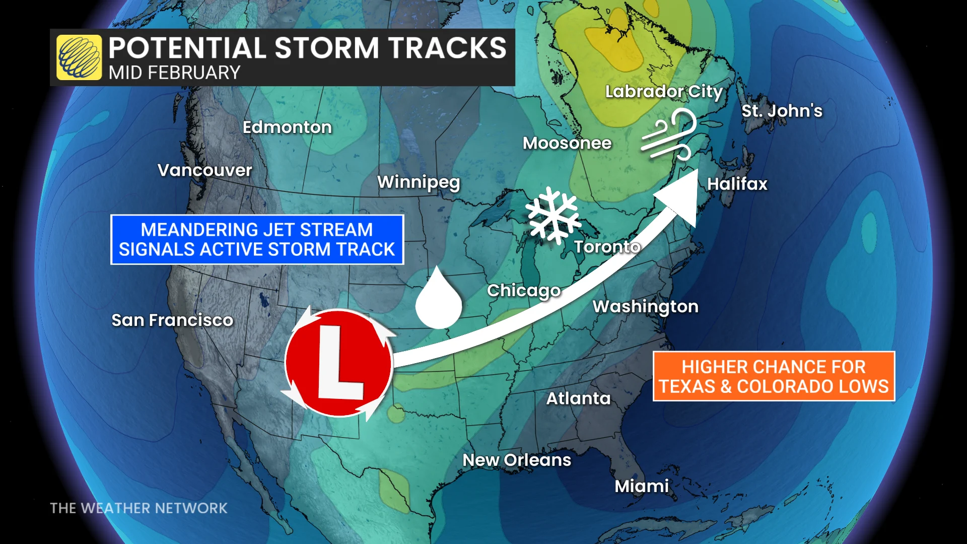
Signals also point toward an active storm track pointing toward the eastern half of the country, with high-impact stateside storms potentially affecting the region.
If the pattern unfolds as expected, folks on the West Coast may finally have the opportunity to experience cooler weather as we see the upper-level ridging finally break down. Wintry conditions have been absent from places like Vancouver so far this season.
This change in the west may arrive with some much-needed alpine snowfall, which could also lead to travel impacts throughout the region.
WATCH: Canada records its first 20°C of the year