
Snowplows and salt trucks will be at the ready — and on the road — throughout the day on Wednesday as Mississauga braces for what’s expected to be an icy, snowy and potentially treacherous winter weather wallop, the city says.
“City crews will be actively monitoring conditions and responding as required, including clearing and treating roads, sidewalks and bus shelters as needed,” the City of Mississauga said in a public advisory in advance of a storm that’s forecast to hit much of southern Ontario with a mix of snow, ice pellets and potentially hours-long freezing rain.
The nasty weather “could create hazardous conditions throughout the day,” the advisory continued.
“With the significant snowfall Mississauga has received, snow piles have encroached onto roadways in many areas of the city, which can temporarily block melted snow and rainwater from reaching catch basins,” city officials said. “In most cases, water will naturally drain beneath the snow piles toward the nearest catch basin where it will slowly drain. Areas of significant water ponding and localized flooding can be reported to 311.”
The city added it’s also monitoring local waterways and low‑lying areas in coordination with conservation authorities as part of a yellow flood alert.
Environment and Climate Change Canada has issued yellow and orange winter storm warnings for various parts of the Greater Toronto Area and southern Ontario on Wednesday.


Yellow indicates hazardous weather may cause damage, disruption or health impacts. An orange warning denotes severe weather is likely to cause significant damage, disruption or health impacts.
Snow and ice pellet amounts of up to five centimetres are possible in Toronto, Mississauga, Brampton, Burlington and Oakville, according to the national weather agency. Amounts of up to 15 centimetres are possible in Durham, York and areas north and west of the GTA.
Multiple hours of freezing rain is possible, predominantly for areas west of Toronto, the warning stated.
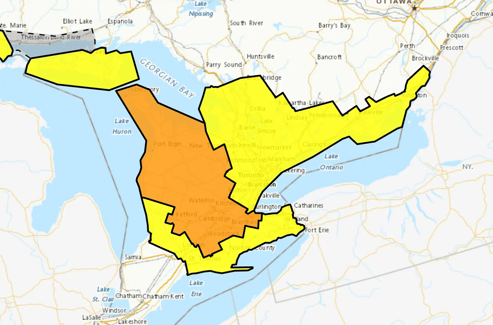
Areas in yellow are under a weather warning on Wednesday. Areas shaded in orange indicate more severe weather warnings due to the winter storm. (Map: Environment and Climate Change Canada)
City officials noted such winter weather “can be unpredictable, and conditions may change quickly. Environment Canada has issued a special weather statement for Mississauga forecasting several millimetres of freezing rain or ice pellets possible, and snowfall amounts near five centimetres. The system is expected to begin Wednesday morning and continue into the evening, which may lead to icy and slippery roads and sidewalks, reduced visibility and potential travel delays.”
People are urged to avoid unnecessary travel, if possible, officials added.
“If travel is required, use caution whether walking, cycling, taking transit or driving. Stay alert, slow down and travel to conditions.”
Residents are also advised to stay away from lakes, rivers, creeks, stormwater ponds and culverts today and in the next several days.
As the storm moved into southern Ontario, more than 15 per cent of flights scheduled to depart Toronto Pearson Airport in Mississauga on Wednesday morning were cancelled, according to flight tracking website FlightAware. About 15 per cent of arrivals were also cancelled.
To report downed trees, blocked roads or sidewalks, or other safety hazards, the city advises residents to call 311.
Power outages should be reported to Alectra at 1-833-253-2872 or via X @alectranews.
For information and updates about weather impacts, including potential closures or cancelled city programming, follow @citymississauga, @mississaugalib and @saugaparksrec.
For snow-clearing and other road maintenance updates, follow @MississaugaSnow on X.
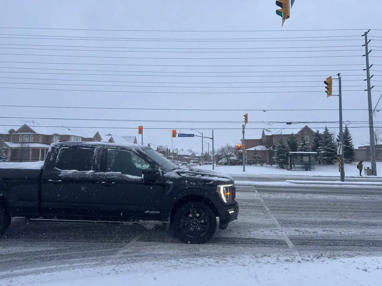
(Cover photo: City of Mississauga)
INsauga’s Editorial Standards and Policies
Last 30 Days: 65,091 Votes
All Time: 1,229,207 Votes
2726 VOTES
Should bike lanes stay or be removed?
WIN A $100 GIFT CARD
Subscribe to INsauga’s daily email newsletter for a chance to win a $100 Amazon gift card.