
Toronto’s transit network is on the brink of a major transformation — thanks to forthcoming extensions and routes like the Ontario Line — and a new map offers a glimpse of what the TTC’s network could look like a decade from now.
Henry Lin, who boasts a professional background in architecture, created the futuristic TTC map using Adobe Illustrator. Lin recently uploaded the map on the TTC subreddit, where the post quickly amassed over 150 comments and 600 upvotes.
The map includes all projects that are currently under construction, including the Ontario Line and the Yonge North Subway extension, as well as recently finished projects like Line 6 Finch West LRT and Line 5 Eglinton Crosstown LRT.
“I’ve been making maps for many years using this program. I used the base transit map from the TTC website. You can just download it and open it in the design software, and manipulate the lines, colours, and shapes. That’s why my map looks eerily close to the actual TTC map,” Lin told blogTO.
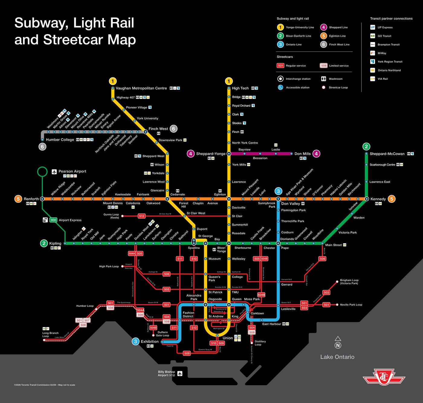
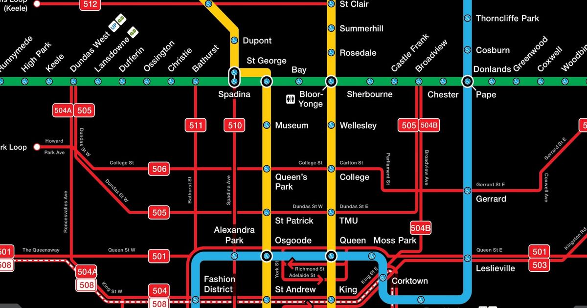
Future TTC map. Photo: Henry Lin.
“The response has been overwhelmingly great! People have taken note of how many projects (Richmond Hill Subway, Scarborough Subway, Eglinton West LRT, and Ontario Line) are in construction right now and are hopeful for Toronto’s transit future after decades of slow movement (figuratively and literally).”
On Wednesday, the provincial government announced that it had officially broken ground on four stations and an elevated guideway for the Ontario Line. According to the province, crews have started to work on the raised stretch of track that will connect Don Valley, Flemingdon Park, and Thorncliffe Park stations.
During the event, Metrolinx CEO Michael Lindsay confirmed that the line would likely be built by the early 2030s; however, testing will follow suit, which may push the line’s opening date further into the future.
“We think we’re still trending toward the early 2030s to be done with civil infrastructure and then to start the testing and commissioning phase,” Lindsay said.
“We’re trying right now to think about how we front-load systems integration considerations to reduce that testing and commissioning time. Once we know more with our private partners about how that’s going, we’ll be able to be even more precise.”
Another key component of Lin’s future map is the Yonge North Subway extension, which will extend the TTC’s Line 1 subway service north from Finch Station to Vaughan, Markham, and Richmond Hill.
According to Metrolinx’s website, the line will go into service “after the Ontario Line is complete,” and will make for easier travel between York Region and downtown Toronto.
While Lin’s map highlights the massive projects already underway in Toronto, it also shows areas where the city’s transit network is still lagging. Many users on Reddit immediately noticed that Line 4 appears to be in desperate need of an east and west extension.
TTC Map Including All Under Construction Projects
by u/Sagaris88 in TTC
Along with this, Lin offered several suggestions for what the TTC should prioritize next, highlighting the need for an Eglinton West extension to Pearson Airport, an Eglinton East LRT, an Ontario Line extension to Dundas West, and a Waterfront East LRT, which will be “necessary to connect to the Port Lands and all the condos built along the waterfront.”
Lin plans to create another map soon with more future projects.