
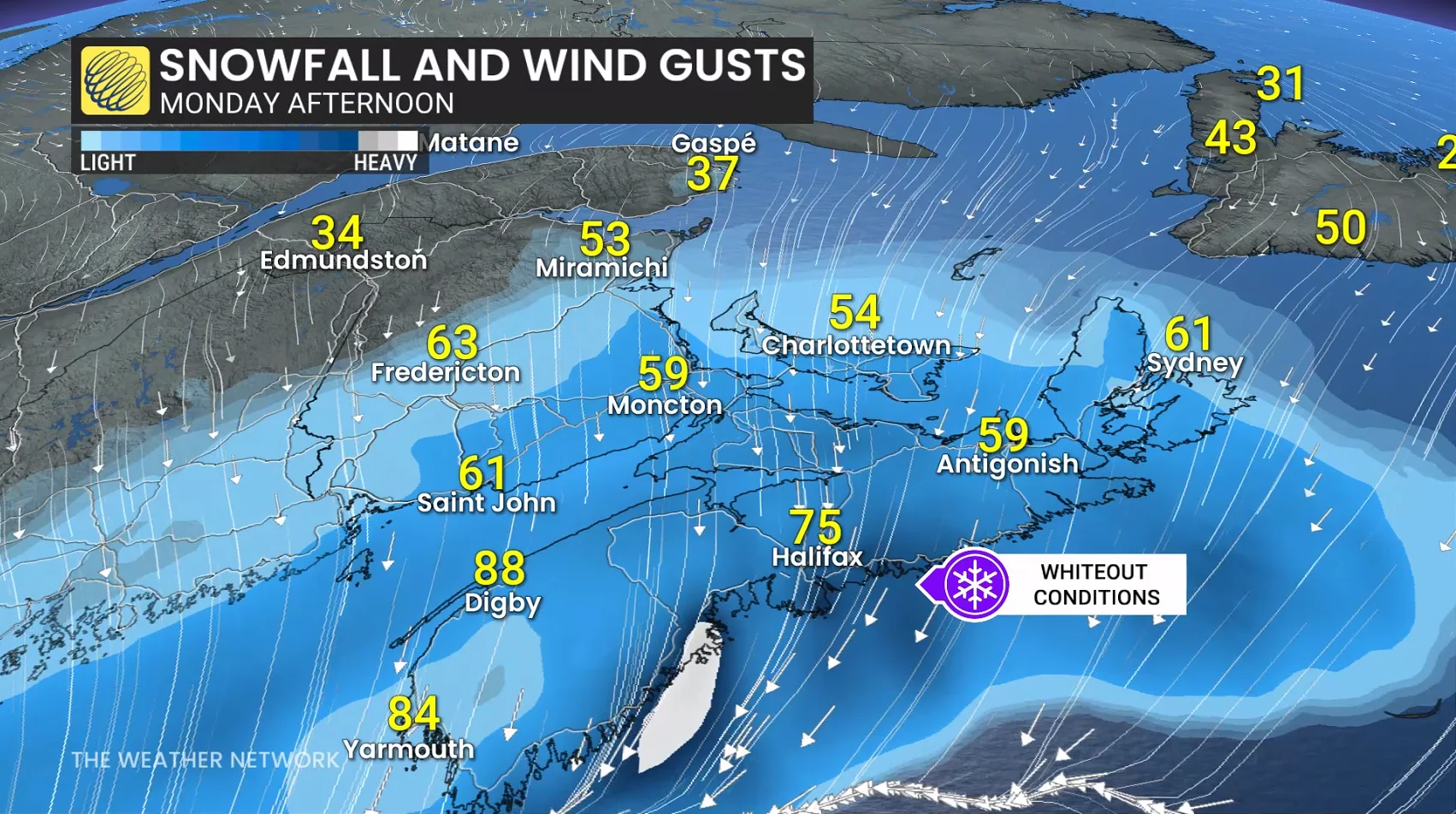
Snowfall rates as high as 5 cm per hour are possible along the eastern shores of Nova Scotia through Monday afternoon, leading to fast accumulations.
High winds are likely for the duration of the storm, with gusts up to 90 km/h for exposed coastal areas. The combination of heavy snow and high winds will lead to whiteouts and a potential period of blizzard conditions for portions of Nova Scotia and Prince Edward Island.
Dangerous travel is expected for the evening commute. Prepare for school and business closures on Monday and Tuesday. Flight cancellations are almost certain. Power outages are possible. High winds may also lead to coastal flooding in some locations.
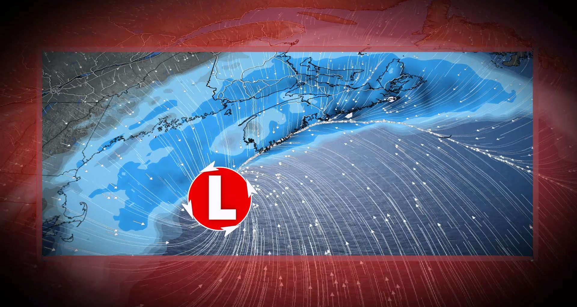
RELATED: What is a ‘weather bomb’?
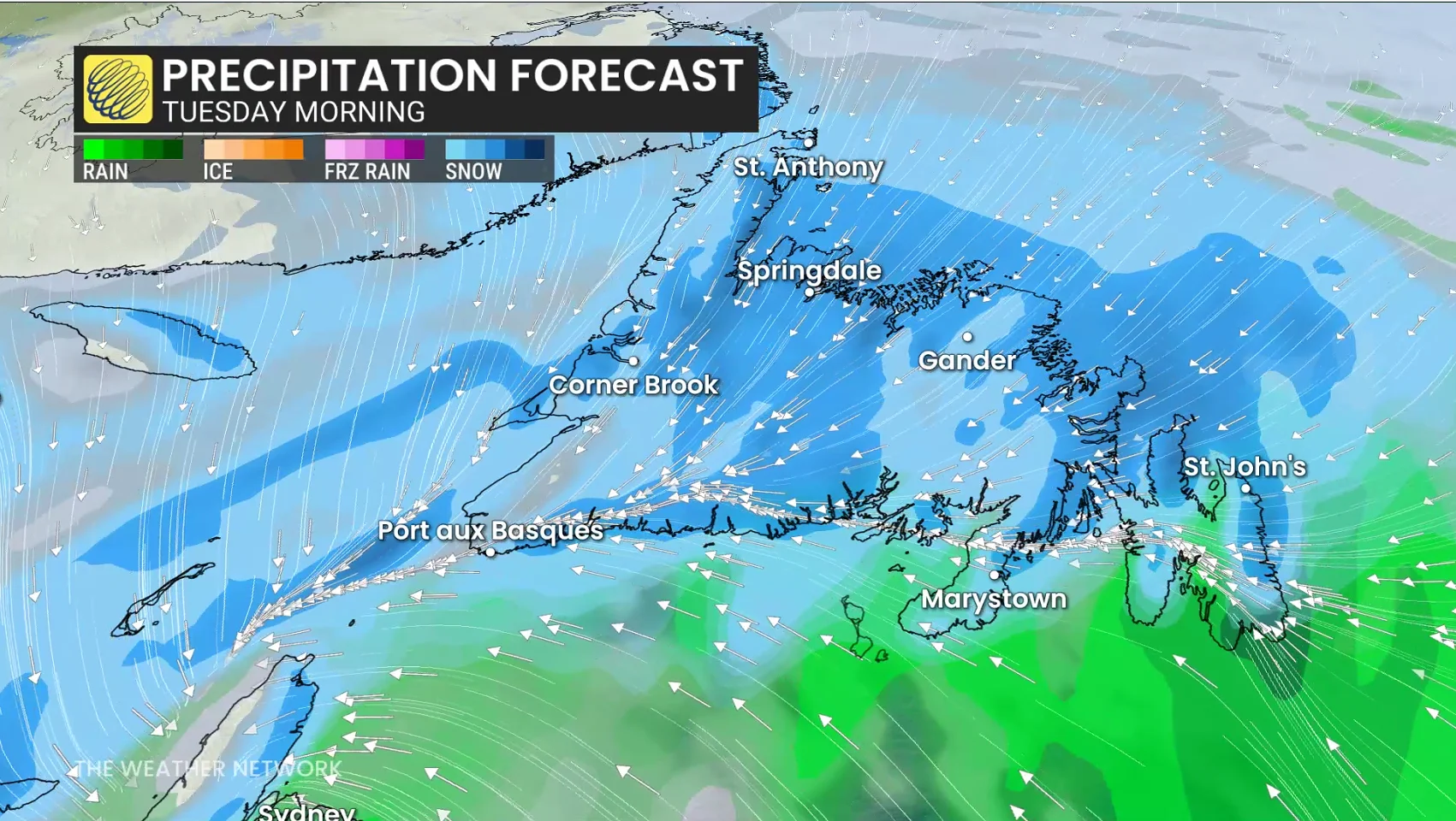
The storm will lift toward Newfoundland overnight Monday and into Tuesday, bringing significant winter weather impacts to central portions of the island. Whiteout conditions and school cancellations are likely here, as well.
Depending on the storm’s track, a transition over the road is expected across the Avalon Peninsula into Tuesday afternoon.
SEE ALSO: Car stuck in a snow pile? Proceed with caution
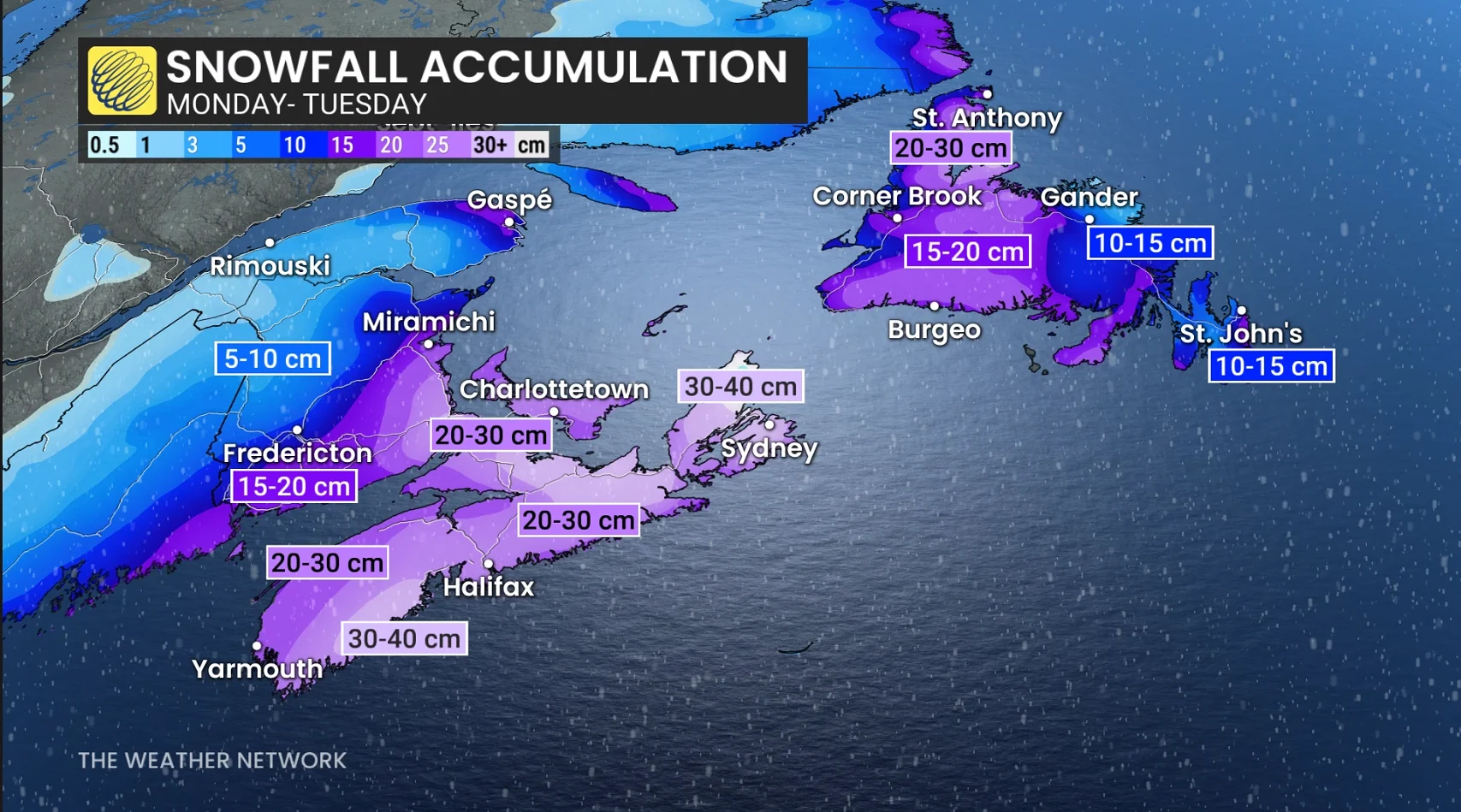
All told, widespread snowfall totals of 20-30 cm are in the forecast for Nova Scotia, Prince Edward Island, and eastern portions of New Brunswick. Totals of 30 to 40 cm are possible across southern Nova Scotia and Cape Breton.