
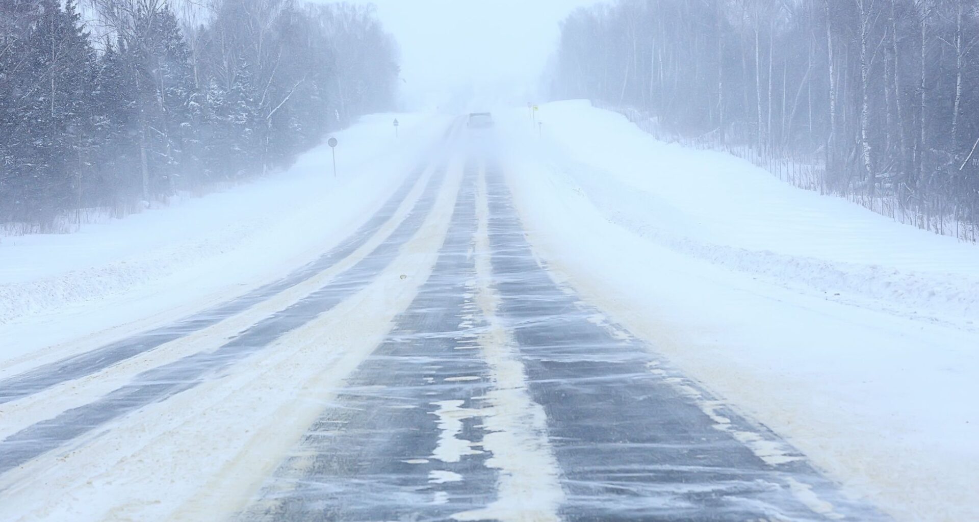
A blast of winter weather is on the way for Calgary, with plenty of snow in the cards for the city as we near the weekend.
A snowfall warning has been issued for the City of Calgary by Environment and Climate Change Canada (ECCC), along with numerous communities surrounding the city.
The ECCC warning stated that heavy snowfall with total amounts of 15 to 30 cm is expected tonight and Friday. Snowfall will begin over west central Alberta this evening, and snowfall will intensify early Friday morning and continue through the day.
The heaviest snow will be in the Foothills regions, and snowfall will end near midnight Friday night.
“Travel will likely be challenging. Visibility will likely be reduced at times. Prepare for quickly changing and deteriorating travel conditions. Allow extra time for travel. Take frequent breaks and avoid strain when clearing snow,” the warning added.
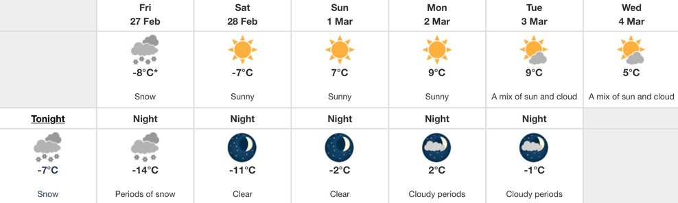
Looking at the seven-day forecast for Calgary, temperatures are set to take a steep dive as we roll towards the weekend, with snow tonight until Saturday.
As of writing, Calgary is sitting at 9°C; however, things will cool down to -7°C tonight and will not recover on Friday with a daytime high of -8°C and an overnight low of -14°C.
Saturday will also be brisk, with a high of -7°C and an overnight low of -11°C. Things will surely turn around on Sunday, with a high of 7°C, kicking off a stretch of daytime highs above freezing through to Wednesday, March 4.
Environment and Climate Change Canada
According to ECCC, the average high for Calgary around this time of year is 1°C, while the average low is -10°C.
You can check all current ECCC weather watches and warnings online.