
UPDATE: Credit Valley Conservation issued a third flood watch just after 2 p.m. on Thursday. The conservation authority said another 20 mm of rain is expected in some areas Thursday afternoon and evening in addition to 30-50 mm of rain that has fallen over the past two days. (Earlier story appears below)
A second flood watch issued in 24 hours urges people to steer clear of all watercourses in Mississauga, Brampton and Caledon as water levels continue to rise — and overflow — in the Credit River and its major tributaries.
The latest flood watch, issued Wednesday evening by Credit Valley Conservation, noted “at several locations, water levels exceeded the top of the bank” and that “localized flooding risk will continue” as heavy rain continues to fall across much of the region onto ground that’s already saturated.
“People are warned to stay away from all watercourses and to keep children and pets away (too),” CVC’s latest flood watch statement, to remain in effect until end of day Friday, added. “Soil in the watershed is currently saturated and water levels of the Credit River and major tributaries are elevated and continue to rise.”
A flood watch is issued when flooding is possible in specific watercourses or municipalities.
“Municipalities, emergency services and individual landowners in flood-prone areas should prepare” during such periods, the conservation authority said.
Credit Valley Conservation, the organization that protects natural areas and watercourses in Peel’s three municipalities and several other communities, issued a similar flood watch for areas across the region on Tuesday evening.
In the latest flood watch, CVC officials said as much as 20 mm of rain was expected late Wednesday into Thursday — with greater amounts possible in areas impacted by thunderstorms — in addition to the similar/higher amounts received earlier this week.
The conservation authority noted some areas in the Credit River watershed received 15-30 mm of rain on Tuesday followed by 15-25 mm overnight into Wednesday morning.
Areas where water had overflowed the Credit River’s banks included Highway 7 and, in Mississauga, the Mississaugua Golf Club at the QEW.
CVC said it will continue to closely monitor both the weather and water levels across the region.
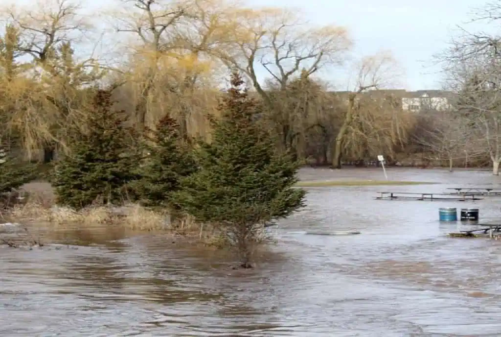
Meanwhile, a number of locations near the Credit River in Mississauga continue to be overwhelmed by floodwaters and have been temporarily closed to the public.
A section of the river is “close to topping its banks” as flooding has been reported along the Culham Trail, between River Grove Community Centre and Bristol Road (see photos below). That section of the trail is closed until further notice, the City of Mississauga said late Wednesday.
On Tuesday, a section of Derry Greenway Park, located on Derry Road East just west of Goreway Drive, was also closed due to flooding.


(Photos: City of Mississauga)
INsauga’s Editorial Standards and Policies
Last 30 Days: 26,643 Votes
All Time: 1,287,126 Votes
1615 VOTES
Do you plan on selling your house this year?
WIN A $100 GIFT CARD
Subscribe to INsauga’s daily email newsletter for a chance to win a $100 Amazon gift card.