
Researchers have found that humans were deliberately crossing open seas in the Philippine islands by about 40,000 years ago and sustaining long-term coastal lifeways.
That finding reframes these islands not as isolated outposts but as active corridors where movement, survival, and knowledge depended on repeated maritime skill.
Traces in Mindoro

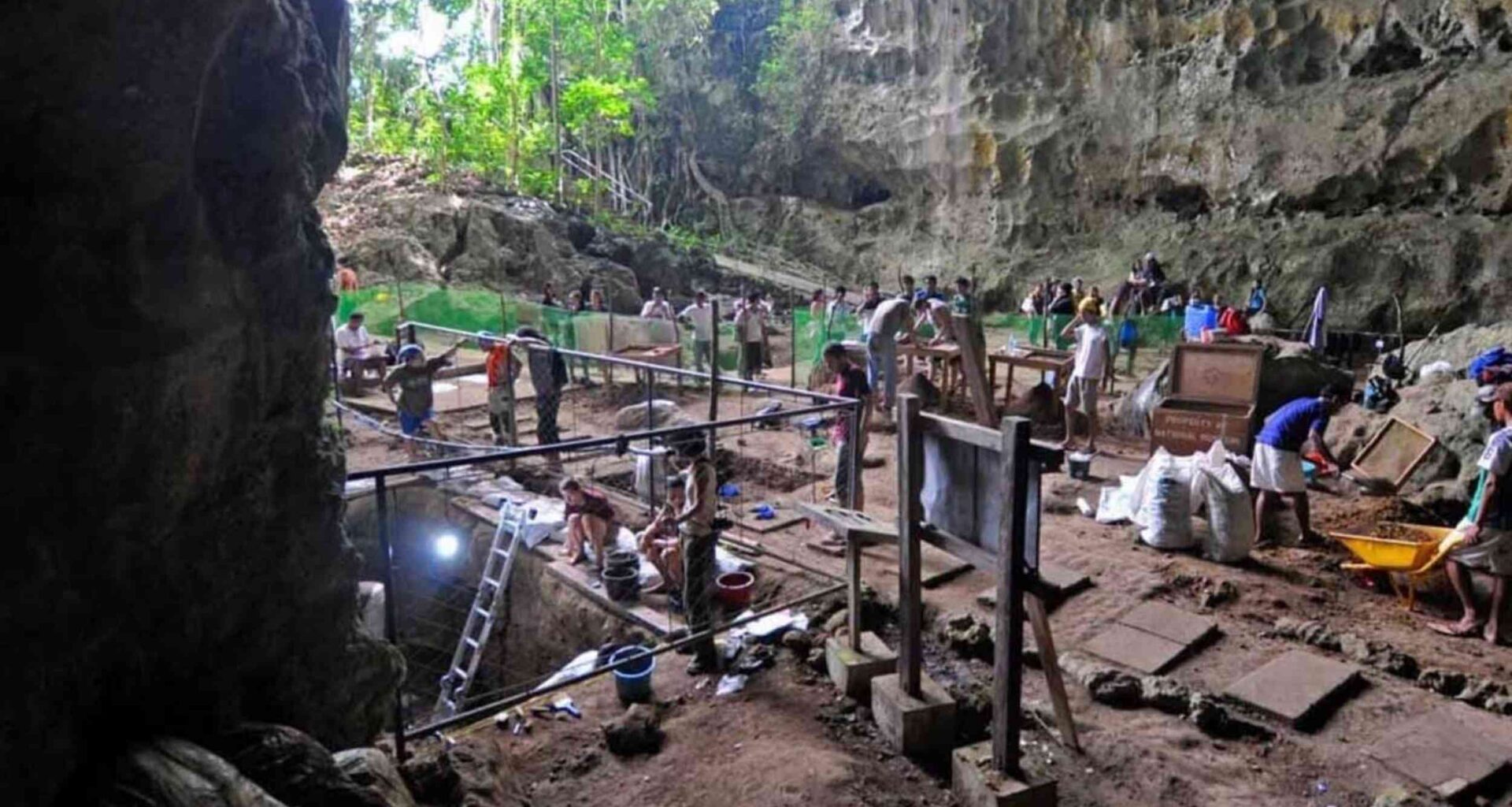
In caves and rockshelters on Mindoro, an island in the western Philippines, layers of shell, stone, and ash preserve a record of life.
At Ateneo de Manila University, archaeologist Alfred Pawlik tied four key sites to occupation spanning roughly 40,000 years.
By reading those caves as connected stops rather than isolated sites, Pawlik showed that people kept returning there across changing shorelines.
That continuity turns scattered finds into evidence of planning, memory, and shared know-how, not a few lucky drifts at sea.
No land bridges
During the Ice Age, most Philippine islands still stood apart, so reaching them demanded sea travel rather than simple overland wandering.
Northern Luzon offers the strongest sign: butchered Rhinoceros philippinensis, an extinct Philippine rhinoceros, appears with stone tools hundreds of thousands of years old.
That deep timeline makes accidental drift harder to believe, because repeated arrivals required people to survive, adapt, and return.
It does not reveal every boat design, but it narrows the argument toward deliberate crossings and learned maritime skill.
A sea corridor
Across western Philippine waters, Mindoro sits along a path from Borneo through Palawan, a long island to the west, toward larger northern islands.
That position helps explain why surveys since 2010 have mapped more than 40 caves and rockshelters there.
Material from multiple cave sites shows habitation unfolding over at least 35,000 years.
Instead of a remote endpoint, the region starts to look like a corridor where movement carried ideas as well as people.
Fishing far offshore
Fish bones from Mindoro show that these communities did not stay trapped along reefs or sheltered shallows.
Open-water species including tuna and sharks appear in the record, pointing to successful trips into pelagic waters – the open ocean beyond reefs.
Different fishing patterns across sites suggest people adjusted gear and timing to local habitats instead of repeating one fixed approach.
That flexibility matters because offshore food is risky, and reliable harvests usually grow from shared knowledge and practiced routines.
Stone was not the only raw material shaping daily life on these islands, and shorelines supplied other workable resources.
Ancient craftspeople turned giant clam shells into adzes, sturdy tools used for cutting and shaping wood, a local innovation seen on Mindoro.
Those tools show careful selection, shaping, and edge grinding, which points to woodworking needs that stone alone did not solve.
Once people could shape wood more effectively, stronger paddles, handles, frames, and shelters became easier to make and maintain.
Networks across islands
Movement between islands left quieter clues too, especially in materials that had to come from somewhere else.
Finds from Mindoro also point to maritime networks that moved technology, information, and ideas across long water gaps.
Repeated crossings turned travel into connection, allowing skills and habits to spread beyond a single beach or bay.
Sea travel here was not only about reaching land, it also supported exchange strong enough to keep relationships alive.
Plants and coastal living
Ocean skill alone could not sustain island life, because ropes, baskets, boats, shelters, and fires all began on land.
New work on plant working, the shaping of fibers and wood, links prehistoric cutting traces to watercraft and cordage.
That helps explain why coastal survival depended on forests as much as shorelines, even when the most visible food came from the sea.
Many of those plant technologies rot away, which is exactly why a few durable clues can change the whole story.
What ArchaeoBot sees
Modern archaeology faces its own problem: delicate clues are easy to miss when excavation depends on tired eyes and steady hands.
ArchaeoBot, a crawler robot with a camera and brush, was designed to detect and brush artifacts during testing.
Inside that system, machine learning, software that learns patterns from examples, helps the robot flag shapes before brushing begins.
It is not a replacement for field judgment, but it can standardize repetitive tasks and reduce damage to fragile finds.
Why precision matters
Archaeological meaning often hides in tiny differences of depth, position, and association that can disappear with one careless scrape.
When recovery improves, buried hearths, holes from old posts, and small tools stay tied to the layers that give them meaning.
“We owe the anthropologists and their scholarship that we get a better picture of generations and civilizations to which we would otherwise have no access,” said Dr. Vilches.
Better excavation will not answer everything, but it can keep future debates grounded in cleaner, richer evidence.
Past and precision
Seen together, the caves, fish bones, shell tools, coastal plants, and robot-assisted recovery describe a society built on constant adjustment.
As ArchaeoBot improves, archaeologists may recover more missing links, especially the fragile evidence that rarely survives ordinary digging.
The study is published in Archaeological Research in Asia.
—–
Like what you read? Subscribe to our newsletter for engaging articles, exclusive content, and the latest updates.
Check us out on EarthSnap, a free app brought to you by Eric Ralls and Earth.com.
—–