

Water is lapping up against several parks in the nation’s capital after the rising Ottawa River burst its banks over the weekend.
Officials have been warning people who live by the river to take action to prevent flooding for several days, as constant precipitation and fast snowmelt caused the river to swell quickly in the last week.
According to the Ottawa River Regulation Planning Board, the levels for Pembroke, Lake Coulonge, Chats Lake, Britannia, Gatineau-Hull marina, and Thurso on Monday are close to 2023 measurements.
“Water levels and flows are expected to continue increasing from Mattawa to Pembroke over the next few days and are expected to start stabilizing Monday between Lake Coulonge and Lake Deschenes, and Wednesday between Gatineau-Hull and Carillon,” it notes.
The water is about 10 cm lower than in 2023.
Minor flooding, defined as water impacting lawns and parks, can be seen in low-lying areas in Ottawa close to the river.
Gatineau mayor says 250 residences impacted
The situation is more severe in Gatineau, where water levels have increased rapidly.
Gatineau Mayor Maude Marquis-Bissonnette said that emergency teams have been deployed to monitor conditions and support residents. On Tuesday, she said that about 250 residences are impacted by the flooding, and 41 streets have been closed.
“It was a difficult moment for people, it’s not the news we hoped for,” Marquis-Bissonnette said in French on her social media, noting that the emergency centre gave an update saying the river increased by 20 cm in only a few days. “I think there’s a lot of solidarity in this moment.”
It is possible, the mayor noted, that the river could increase by another 10 cm by Wednesday.
Officials at the City of Ottawa echoed the warning, saying a second peak could happen with the melt of a snowpack in northern portions of the river. They are asking people to stay cautious over the next few days.
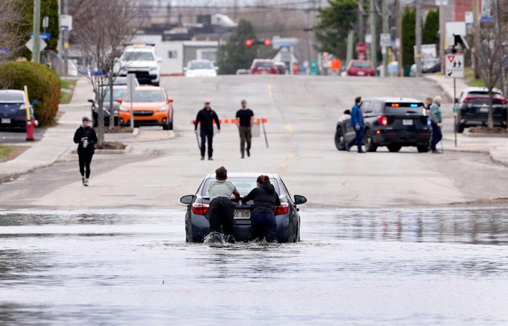 People help push a car out of floodwaters on Rue Saint-Louis in Gatineau, Que., on Sunday, April 19, 2026. (Justin Tang/The Canadian Press via AP)
Weather cooperating with flooding
The forecast for the National Capital Region from Environment Canada is promising.
There are no major rain systems expected over the next five days. Based on this, experts believe water levels should “plateau or slowly decline over the next two weeks.”
Wednesday through Sunday should be dry in Ottawa, the weather agency’s forecast notes. It should be sunny and temperatures are expected to hover around 12 C, peaking at 15 C on Sunday.
As of Tuesday afternoon, there is a 30 per cent chance of showers overnight that could switch into flurries.
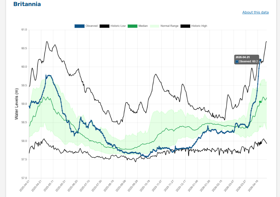 This graph from the Ottawa River Regulation Planning Board shows water levels peaking on Tuesday at Britannia. Historic highs are indicated in the black line, which is from the 2019 floods.
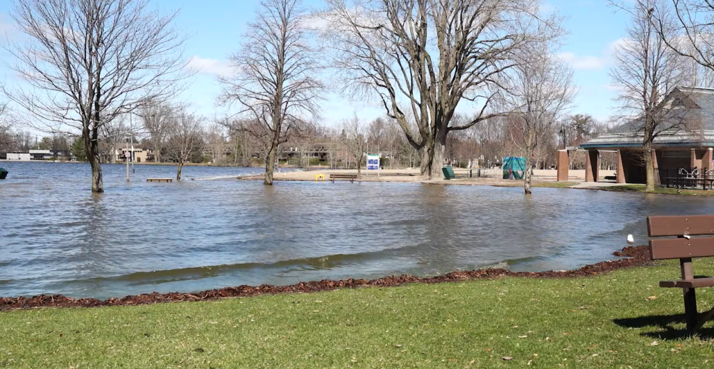
A park in Ottawa is submerged after the river crept past its banks. (CityNews)