
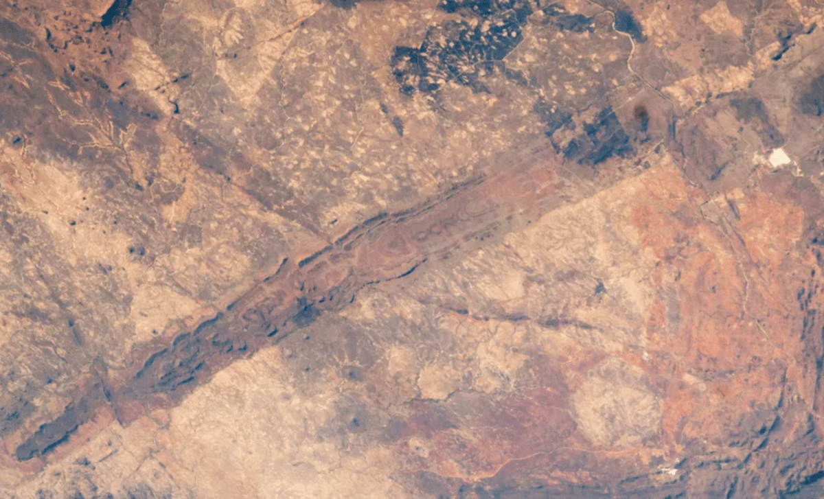
An astronaut photograph highlighted by NASA’s Earth Observatory offers a striking perspective on the Great Dyke of Zimbabwe, a 2.5-billion-year-old geological formation that ranks among the most significant igneous structures on Earth. Visible from orbit as a long, nearly continuous line across the landscape, this massive feature preserves a record of early planetary activity while concentrating vast reserves of strategic minerals, making it both a scientific landmark and an economic powerhouse.
A Gigantic Geological Feature Hidden In Plain Sight
From orbit, the Great Dyke appears as a long, subtle line etched across Zimbabwe’s landscape, yet its scale is extraordinary. Stretching roughly 342 miles from near Harare to close to Bulawayo, this massive formation cuts diagonally across the country, shaping both its terrain and its natural resources.
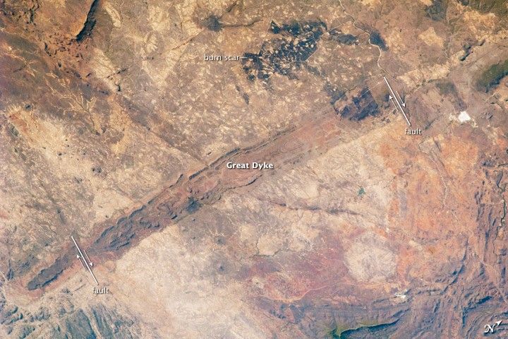 Image credit: NASA/ISS program
Its width varies between 2 and 8 miles, with hills rising up to 1,500 feet above the surrounding plateau, forming a chain of elevated land that can be difficult to fully appreciate from ground level. Despite its name, the structure is not a traditional dike but a lopolith, a type of igneous intrusion that forms parallel to existing rock layers and takes on a broad, saucer-like shape. The astronaut image highlights the southern portion with striking clarity, revealing contrasts in color and texture that hint at its deep and ancient origins, shaped by forces that operated billions of years ago.
NASA’s Earth Observatory Sheds New Light On Its Origins
According to NASA’s Earth Observatory, the Great Dyke formed around 2.5 billion years ago, during a period when Earth’s internal dynamics were far more active than today. Molten rock from the mantle slowly moved upward through fractures in the crust, cooling over immense spans of time to create this continuous igneous body. The result is considered one of the longest such formations on the planet.
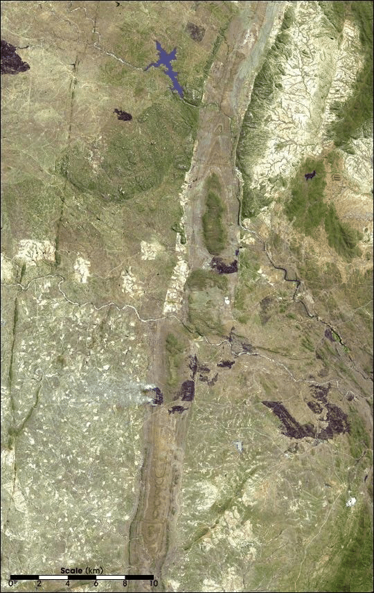 Image courtesy NASA/GSFC/MITI/ERSDAC/JAROS, and U.S./Japan ASTER Science Team
Earlier imagery from the Space Shuttle Challenger and later from NASA’s Terra satellite captured different sections of the dyke, yet the latest astronaut photograph refines our view, offering a more cohesive perspective of its southern reach. This continuity across vast geological time makes the formation a valuable archive, preserving evidence of processes that shaped the early Earth and influenced the distribution of minerals across continents.
A Treasure Trove Of Strategic Minerals
Beneath its rugged surface lies one of the richest mineral corridors on the planet. The Great Dyke hosts vast deposits of platinum, ranking among the largest globally, along with significant quantities of gold, nickel, copper, iron, titanium, vanadium, and tin. Particularly notable is its abundance of chromite, prized for its high chromium content used in stainless steel production.
These resources have transformed the region into a major mining hub, with multiple large-scale operations running along its length. The concentration of such diverse and valuable minerals in a single geological structure is exceptionally rare, making the dyke not only a scientific curiosity but also a cornerstone of Zimbabwe’s economy. Its mineral wealth originates from the same ancient magma that formed the structure, bringing deep-Earth elements closer to the surface where they could eventually be accessed.
A Living Record Of Earth’s Deep Past
The Great Dyke stands as more than a geological structure; it is a preserved narrative of Earth’s internal evolution. Its age, scale, and composition provide scientists with critical insights into how continents formed and how valuable minerals became concentrated in specific regions. The astronaut image reinforces its status as a global natural landmark, one that continues to reveal new details with each observation. As satellite and orbital imaging technologies advance, formations like this are being reexamined with increasing precision, uncovering patterns that deepen our understanding of planetary history. What once appeared to be a simple line across a map now emerges as one of the most significant geological features on Earth.