
Published on Jun. 17, 2026, 12:53 AM
Heavy rain and thunderstorms could swiftly cause hazardous conditions throughout the region
Southern Ontario may be in for a hard stretch of weather as an exceptionally powerful June storm approaches the province, causing flooding rain, destructive winds and hazardous thunderstorms overnight Wednesday and Thursday.
The intensifying low-pressure system is forecast to deepen to 990 millibars or lower by Wednesday night, potentially challenging records near Windsor for the lowest June pressure ever recorded in the region.
The first round of rain is projected to arrive Wednesday evening, with warm frontal showers developing throughout southwestern Ontario and along the Lake Huron shoreline before extending eastward into the Greater Toronto Area overnight.
RELATED: Exceptionally strong, and potentially record-breaking low set to hit Ontario
A soaking setup takes shape
As the storm moves into southern Ontario, it will draw into a rush of atmospheric moisture, resulting in heavy rainfall and embedded thunderstorms.
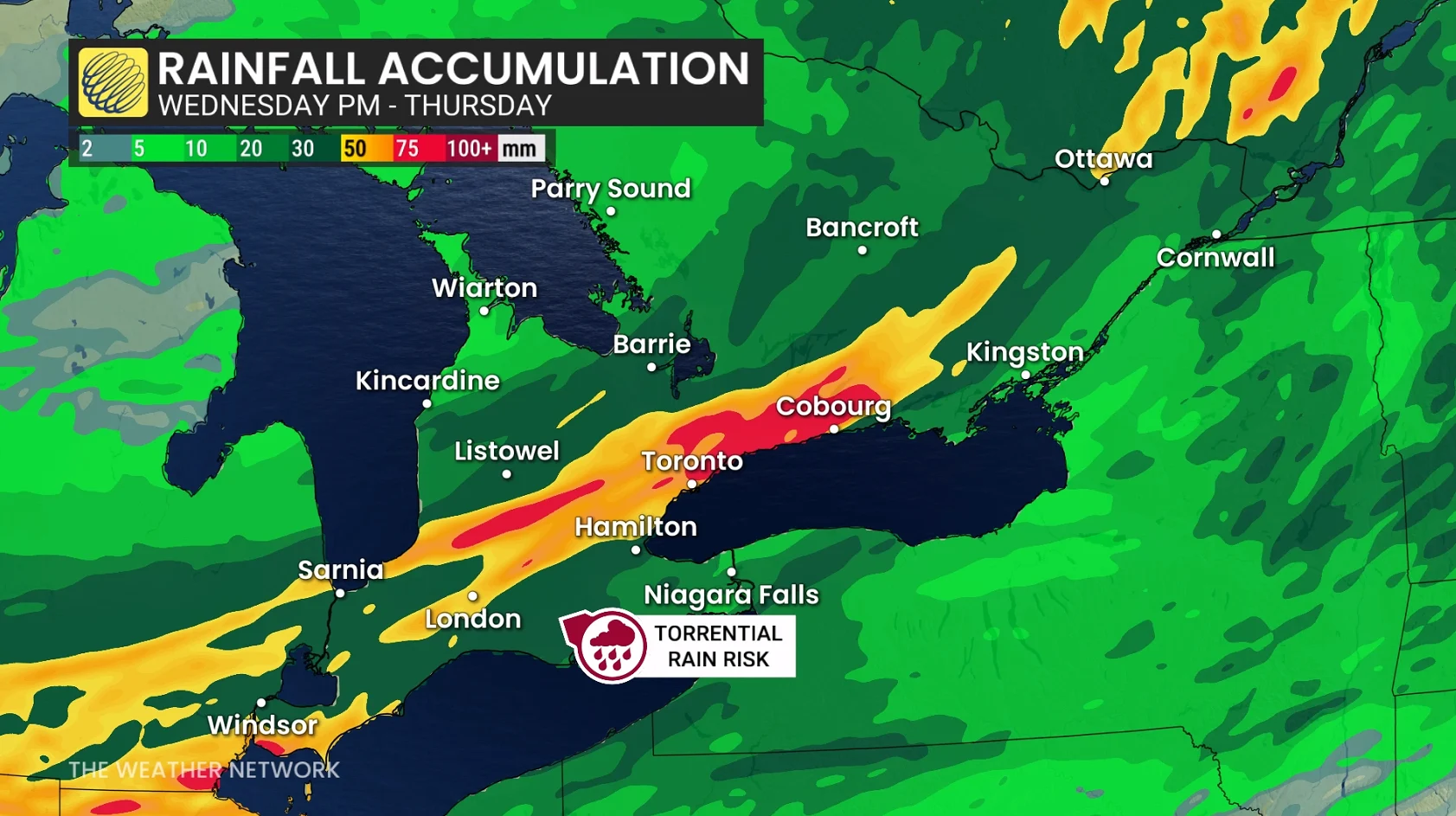
The most powerful storms could dump 50 to more than 60 mm of rain in some areas, raising fears about flooding in low-lying and poorly draining areas.
According to forecasters, thunderstorms may also bring frequent lightning, tiny hail and bursts of damaging wind, producing hazardous conditions throughout the night. However, it is possible that the wind makes the most lasting effect.