
Descrease article font size
Increase article font size
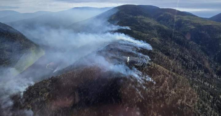
Canadians are projected to face another severe wildfire season due to rising temperatures and dry conditions across the country.

More than four million hectares have burned in Canada this season and thousands of firefighters are working across the country to contain the blazes
Global News’ live and interactive map above shows you where wildfires are burning, along with their size and status.
Get daily National news
Get the day’s top news, political, economic, and current affairs headlines, delivered to your inbox once a day.
It is constantly updating and provides up-to-the-minute information.
The magenta circles are wildfires that are out of control, the yellow circles are fires that are being held and the green circles are fires under control.
As you zoom into the map and explore, you will also see magenta outlines, which show wildfire perimeters. These are fires, often thousands of hectares in size, which indicate fires that have merged and become clusters.
Please note that anyone using the map should still check with their local government or authority for the latest evacuation orders and alerts.
Interactive Map developed by William Howell
More on Canada
More videos