
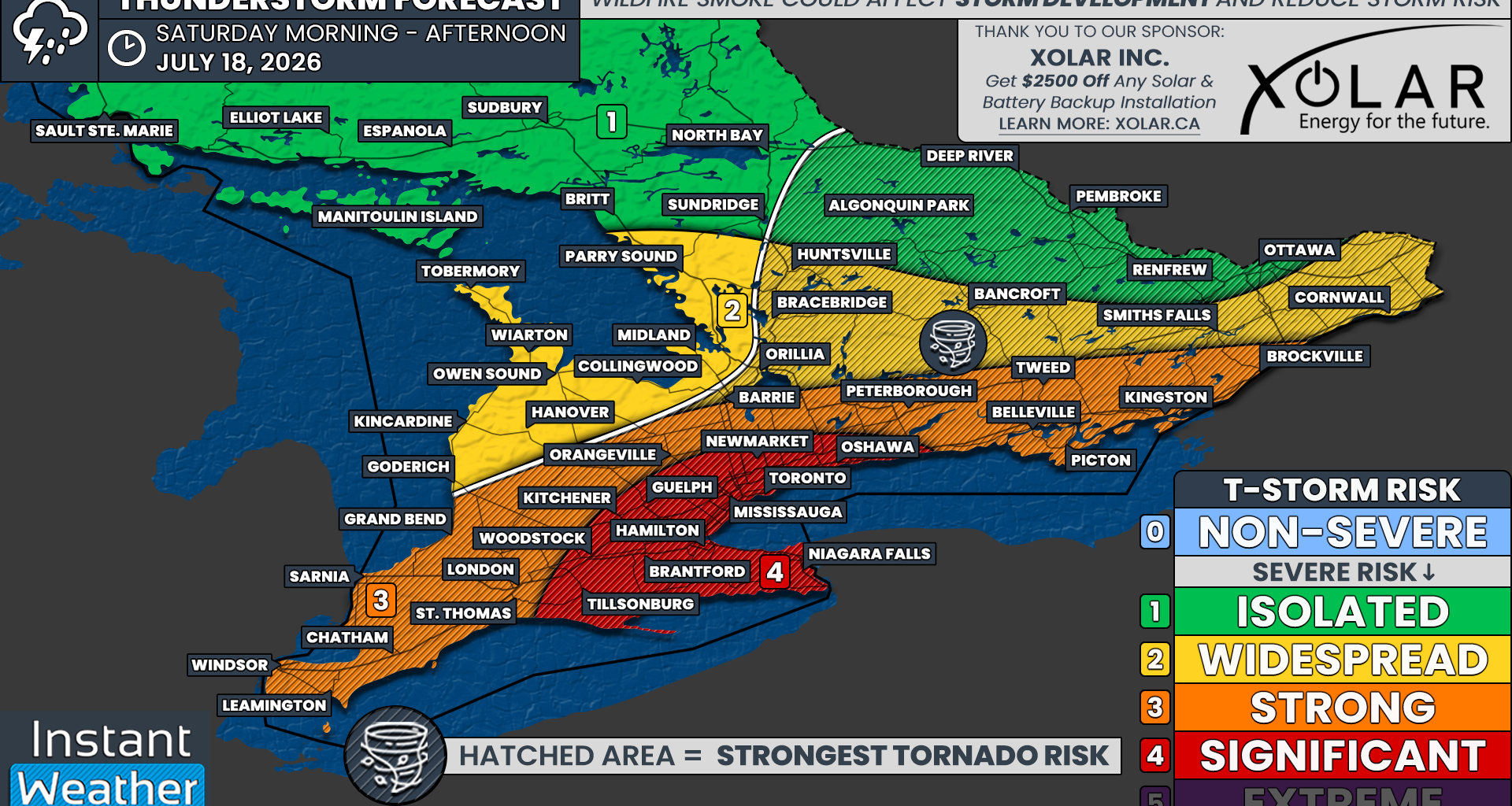
The highest severe risk on Saturday is currently focused on the Golden Horseshoe, including Toronto, Hamilton, Mississauga, Kitchener, Guelph, Brantford, Niagara Falls, Newmarket and Oshawa.
We have placed these areas under a “significant” risk, which is level four out of five on our severe weather risk scale.
This risk is primarily driven by the potential for widespread destructive wind gusts accompanying an intense squall line during the early to middle afternoon.
Several tornadoes will also be possible within this region, especially if isolated supercells develop ahead of the main line. Hail up to the size of toonies or Timbits will also be possible.
Flash flooding could become a major concern, particularly throughout heavily urbanized areas. These locations are more vulnerable to significant rainfall over a short period because pavement and other hard surfaces prevent water from quickly soaking into the ground.
A fairly expansive “strong” risk, which is level three out of five, includes Windsor, Chatham, Sarnia, London, Grand Bend, Orangeville, Barrie, Peterborough, Belleville, Kingston and Brockville.
These areas could see one or two tornadoes, along with widespread damaging wind gusts. Large hail up to the size of Timbits will also be possible.
The “widespread” risk, which is level two out of five, covers Grey and Bruce counties, areas east of Georgian Bay, Muskoka, Bancroft, Smiths Falls and Cornwall.
Damaging wind gusts and large hail up to the size of toonies will be possible. An isolated tornado cannot be ruled out, especially east of Georgian Bay through cottage country.
While we have assigned an isolated risk to the Ottawa Valley and Algonquin Park, this is mainly because storm development is more uncertain in these areas. They are also not expected to be directly affected by the intense squall line.
Any severe threat here will likely come from isolated storms developing during the late morning or early afternoon, potentially after the cold front moves through. An isolated tornado will be possible across Algonquin Park and the Ottawa Valley if storms are able to develop.