
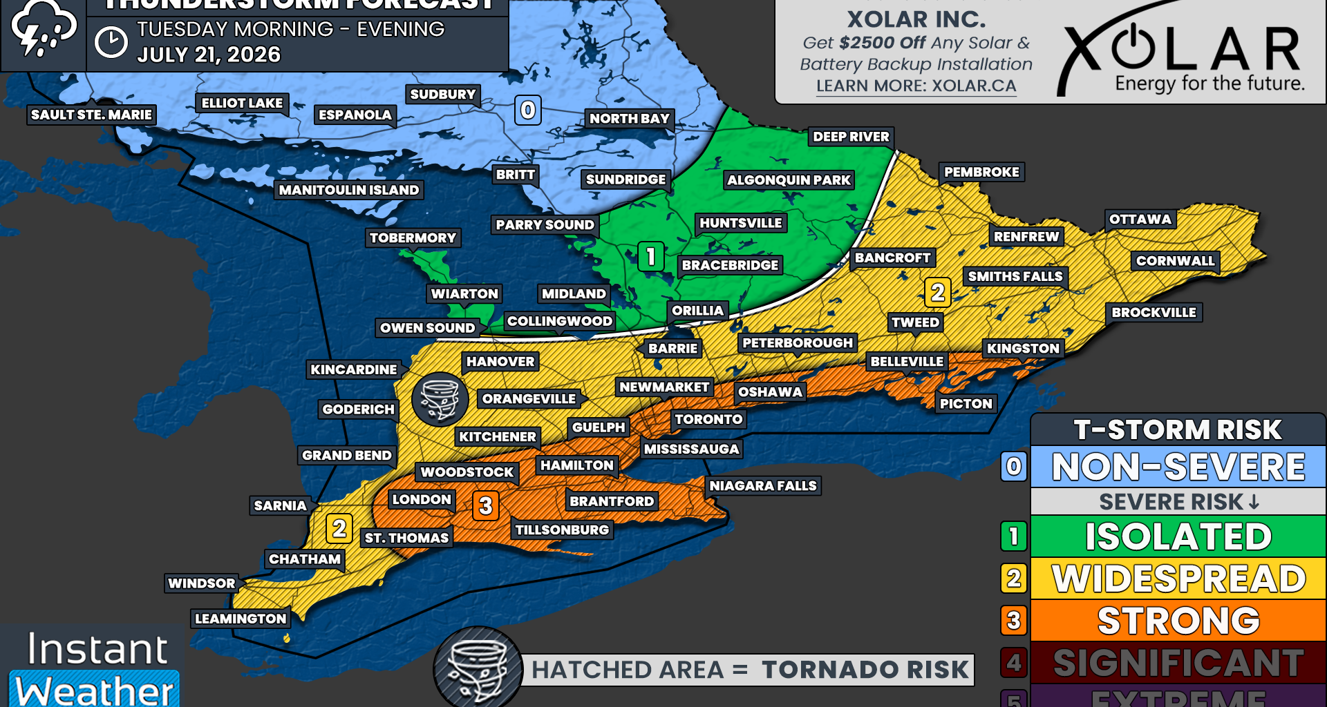
Based on the potential for widespread damaging wind gusts, we have introduced a ‘strong’ severe risk for London, St. Thomas, Woodstock, Tillsonburg, Brantford, Kitchener, Hamilton, Niagara, Guelph, Mississauga, Toronto, Newmarket, Oshawa, Belleville, Picton and Kingston.
Other hazards within this zone include hail up to the size of a toonie and the potential for one or two tornadoes.
Localized flash flooding may also be a concern, particularly in urban areas that receive multiple rounds of storms within a short period.
Outside the strongest risk zone, we have an expansive ‘widespread’ risk covering the remainder of Southwestern Ontario, southern portions of Central Ontario and the Ottawa Valley.
This includes Windsor, Chatham, Sarnia, Goderich, Hanover, Orangeville, Barrie, Peterborough, Bancroft, Pembroke, Renfrew, Smiths Falls, Ottawa, Brockville and Cornwall.
Storm hazards in this zone include damaging wind gusts, hail up to the size of a toonie and the possibility of an isolated tornado.
For the Bruce Peninsula and areas east of Georgian Bay, including Muskoka and Algonquin Park, we have introduced an ‘isolated’ severe risk. However, most of the severe thunderstorm activity is expected to remain south and east of this region.