
After a few days of below-seasonal temperatures across Southern Ontario, with daytime highs making it feel more like early September, temperatures are back on the upswing over the next few days.
The cooler weather also brought a quieter period for thunderstorm activity, with our last widespread severe weather event occurring on Tuesday.
While no extreme heat is expected in the near future, temperatures will climb slightly above seasonal levels to start the week. Many areas will see daytime highs in the upper 20s or even low 30s on Monday.
That will be enough to increase instability and bring the potential for multiple rounds of thunderstorms beginning Sunday.
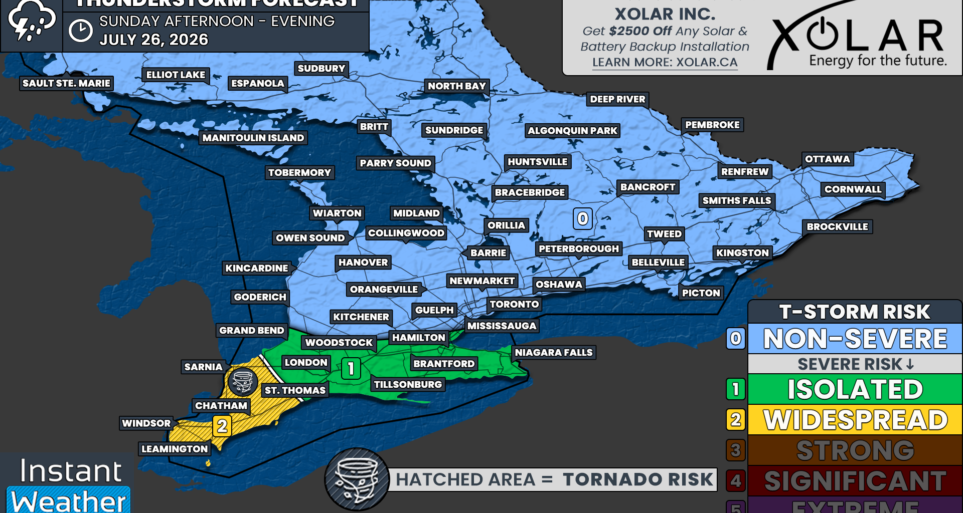
Sunday’s severe thunderstorm threat is expected to be mostly confined to Deep Southwestern Ontario, including Windsor, Chatham and Sarnia. Moderate instability combined with strengthening wind shear could create an environment capable of supporting severe storms.
However, there is still some uncertainty about whether storms will develop and exactly where they might form, as there is no obvious trigger such as a cold front.
Instead, storm development will depend on whether isolated cells can form along smaller-scale boundaries, including lake breezes.
Lake breeze-driven pop-up storms will be possible across Southern Ontario. However, outside of the Lake Erie shoreline and Deep Southwestern Ontario, the environment is not expected to be strong enough to support anything more than isolated, non-severe storms.