
Published on Aug. 19, 2025, 3:16 PM
Updated on Aug. 20, 2025, 12:06 AM
Tropical storm alerts have been extended farther north along the U.S. Eastern Seaboard as Hurricane Erin begins its northward trek, threatening to bring hazardous surf and rip currents to parts of North America’s East Coast including some Atlantic Canada areas
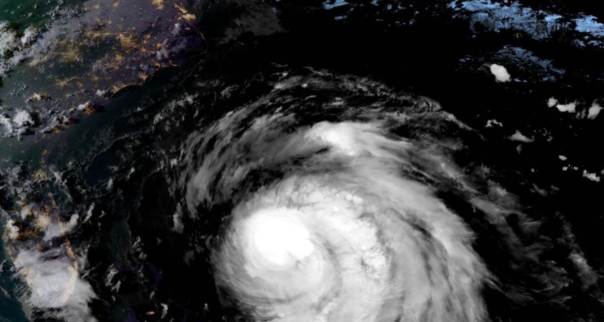
Hurricane Erin is forecast to generate dangerous surf and rip currents over the next several days, affecting beaches in the Bahamas, much of the U.S. East Coast, Bermuda, and Atlantic Canada.
DON’T MISS: An inside look at Hurricane Erin’s astounding rise to Category 5
The U.S. National Weather Service is warning beachgoers in these regions to heed guidance from lifeguards, local authorities, and posted beach warning flags.
Despite dropping to a Category 2 storm on Tuesday, Erin is expected become even larger while moving over the Western Atlantic throughout the week.
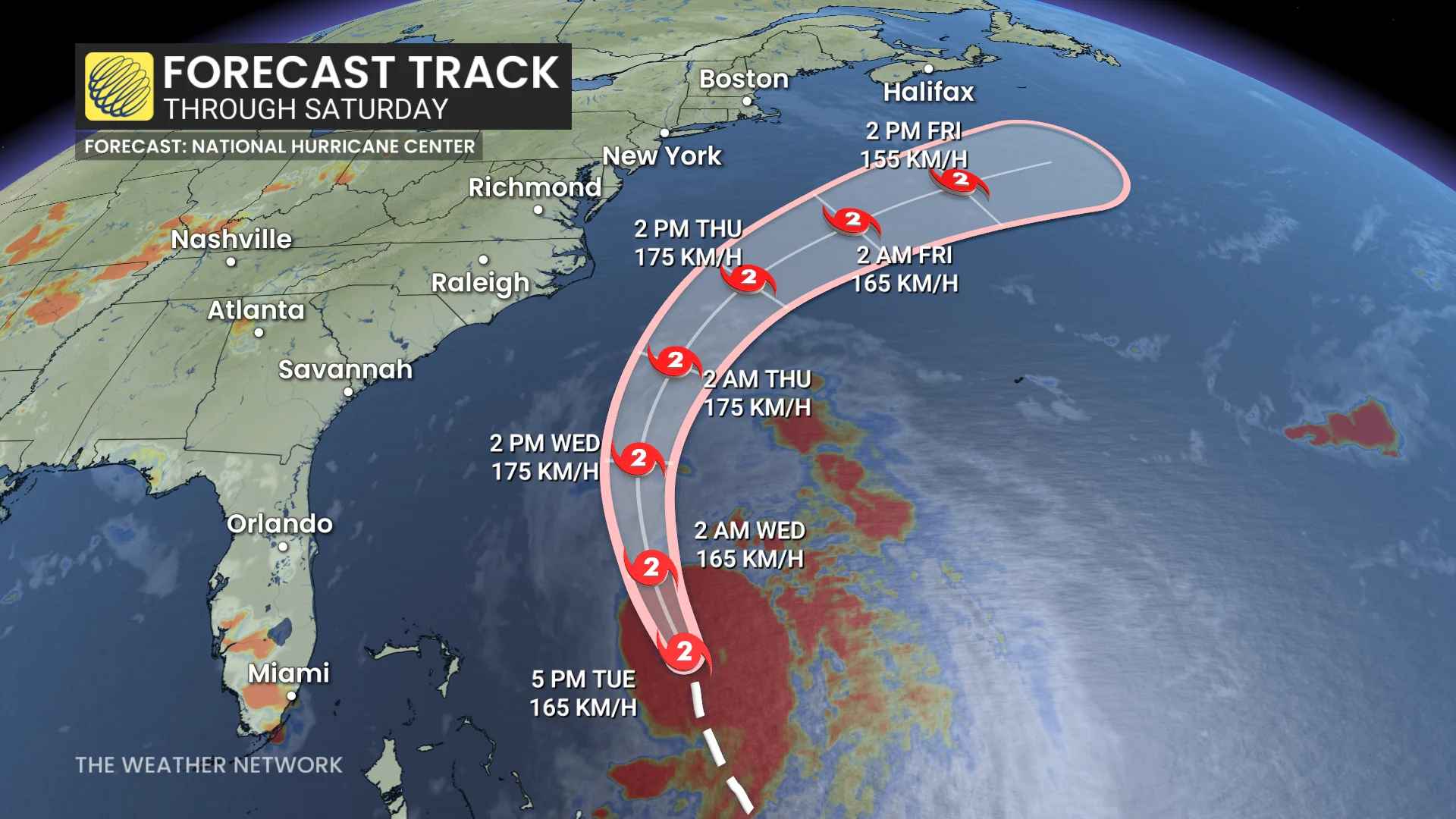
A tropical storm warning is in effect from Beaufort Inlet to Duck, N.C., including Pamlico and Albemarle sounds. A storm surge warning is currently in effect for Cape Lookout to Duck, N.C.
Meanwhile, the tropical storm watch has been extended northward along the U.S. Atlantic coast, from north of Cape Charles Light, Va., to Chincoteague, Va. It is also in effect for Bermuda.
SEE ALSO: Powerful, dangerous Hurricane Erin could generate 100-foot waves
According to the forecast track, the centre of Erin will pass east of the Bahamas on Tuesday night before moving over the Western Atlantic between the U.S. East Coast and Bermuda on Wednesday and Thursday.