
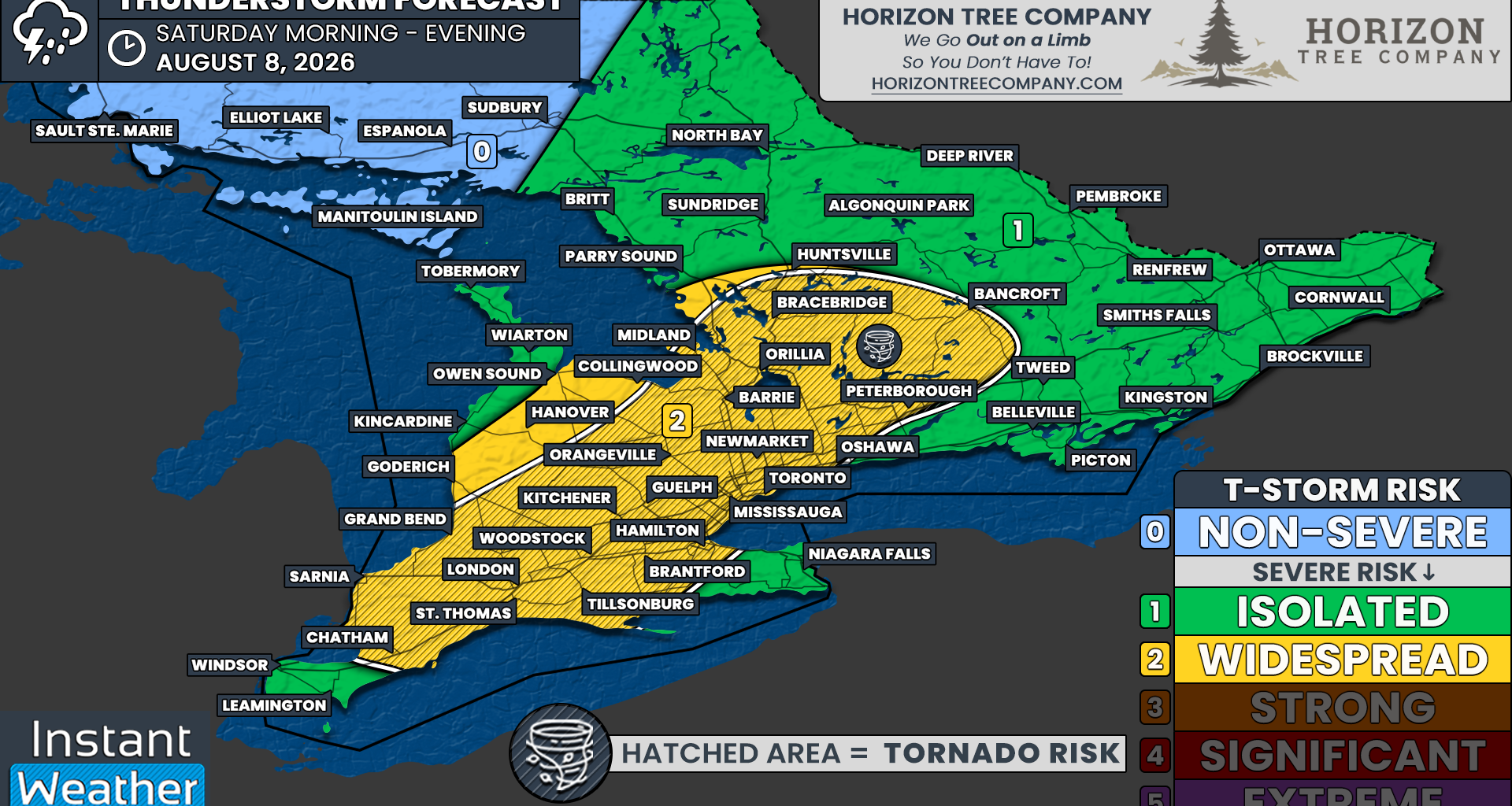
The main focus of Saturday’s severe thunderstorm risk is Central Ontario, particularly around Lake Simcoe, extending southward into Southwestern Ontario.
This risk zone includes Bracebridge, Peterborough, Orillia, Midland, Barrie, Collingwood, Orangeville, Newmarket, Toronto, Hamilton, Guelph, Kitchener, Woodstock, Brantford, London, Grand Bend, Sarnia and Chatham.
These areas are included in a widespread severe thunderstorm risk, which is level 2 out of 5 on our scale.
The main threats will be damaging wind gusts and hail up to the size of a toonie. An isolated tornado cannot be ruled out, particularly while storms remain discrete during the earlier stages of development.
Flash flooding could also become a significant concern. Many areas have already received substantial rainfall over the past few weeks, leaving the ground saturated and less able to absorb additional water.
Thunderstorms could produce torrential rainfall over a short period, especially if they repeatedly track over the same locations. This may lead to localized flooding in low-lying areas, poor drainage locations and urban communities.
The rest of Southern Ontario is included in an isolated severe thunderstorm risk, which is level 1 out of 5.
This includes Deep Southwestern Ontario around Windsor and Leamington, the Niagara Region, northern portions of Central Ontario and much of Eastern Ontario.
Isolated thunderstorms will be possible in these areas, including some pop-up activity across Eastern Ontario during the afternoon ahead of the main storm zone.
However, it remains questionable whether the environment in these areas will support anything more than localized pulse thunderstorms. While a few storms could briefly approach severe limits, the most serious and widespread threat is expected to remain focused from Southwestern Ontario through the Lake Simcoe area and into the Greater Toronto Area.