
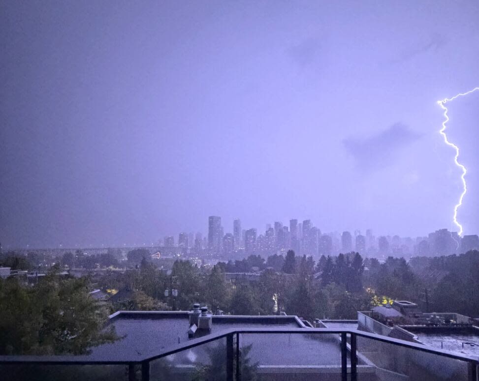
Lightning strikes lit up the skies across B.C.’s South Coast overnight in a rare display as a severe thunderstorm passed over the region, snarling traffic at Vancouver International Airport and causing flight issues in the process.
“This was quite the system, hundreds of cloud to ground strikes … mainly in Vancouver/Richmond,” CBC meteorologist Johanna Wagstaffe said.
Wagstaffe said the centre of a low-pressure system pushed onshore near Richmond after travelling from the equator, loaded with moisture.
A preliminary count from Environment Canada reported more than 1,800 incidences of lightning over the Lower Mainland on Friday night and Saturday morning, while the B.C. Wildfire Service said it recorded more than 7,000 strikes provincewide.
B.C. Hydro reported numerous outages overnight. As of Sunday morning, over 3,800 customers were without power in the Lower Mainland and Sunshine Coast regions.

Cancellations, delays at Vancouver airport
The storm created havoc at Vancouver International Airport (YVR), causing multiple overnight delays and cancellations between about 9 p.m. Saturday and 3 a.m. PT on Sunday.
That left hundreds of passengers like Simone McCallum stranded at the airport terminal overnight.

Several lightning strikes were observed from the University of British Columbia’s Vancouver campus. (Submitted by Parsa Nourian/@parsanourian5)
McCallum said passengers were directed to head back to the check-in area for new boarding passes, but were not allowed back through security again — leaving them to sit or sleep on the ground.
“It was horrible, there was no place to stretch out at all, almost every surface where you could put yourself down was hard as rock,” she said.
“I can’t even imagine what that would have been like with children, or if you had some kind of physical disability. It would have been just a complete nightmare.”
YVR spokesperson Stephen Smart apologized to travellers who were inconvenienced, and said the airport called in extra staff as quickly as it could to help deal with the situation.
Smart said the storm delivered lightning for more than five hours and dumped 64 millimetres of rain on the airport, more than double the precipitation the facility usually gets in the entire month of August.
Videos posted to social media also appeared to show flooding in parts of the airport.
“Normally when we see something like that, it lasts for 20-30 minutes, operations get back to normal. Last night our operations were effectively paused,” Smart said.
“We can land aircraft during a storm like that, that’s not a problem. But we can’t have employees out on the airfield, we can’t have aircraft taking off.”
The airport said some flights are also being impacted Sunday as the airport works with airlines to get back to normal operations.
YVR’s website showed multiple delays and cancellations Sunday. People are urged to check their flights before going to the terminal.
Wildfire crews on alert
B.C. Wildfire Service (BCWS) information officer Sarah Budd said it recorded about 2,000 lightning strikes in the Coastal Fire Centre, with another 5,000 in the B.C. Interior, mostly in the Kamloops and Cariboo fire centres.
Budd said lightning was responsible for at least 48 wildfires in the last 48 hours, though 60 per cent of them were already being held.
“In anticipation of this pattern coming through, we had pre-positioned our crews and resources, just allowing for an efficient initial response to any new starts because we knew this was coming,” she said.
Budd said the storm also brought a “generous amount of precipitation,” which helped firefighters — both by dampening fire activity and reducing the likelihood that lightning would start new fires.
But she said the rain wasn’t enough to offset months of drought, and that new fires could yet pop up from lightning strikes that cause fuel to smoulder for days before flames break out.
Thunderstorm watch moves east
Environment Canada issued severe thunderstorm watches on Sunday for most of southeast B.C., including the Kootenays, Boundary and East Columbia regions, Arrow Lakes and Yoho Park.
The storm system also triggered a high streamflow advisory for the Central Interior, including the Pemberton area and its upstream watersheds, the Chilcotin River, the Bridge River and the Cariboo River.

Environment Canada says the storm dumped significant rainfall across southern B.C., including a whopping 43.4 millimetres at Horseshoe Bay.
Forecasters measured 37.4 millimetres at the Coquihalla Summit, 25.4 millimetres in North Cowichan, nearly 23.8 millimetres in Merritt, and 20.6 millimetres in Lillooet.
A travel advisory issued for most of the stretch of Highway 99 between Pemberton and Lillooet due to heavy rains near Pemberton also warned that the road could close on short notice.