

Published on Aug. 23, 2025, 11:43 PM
Updated on Aug. 24, 2025, 12:20 AM
The forecast is a welcome change for some and a painful reminder for others that summer is fading
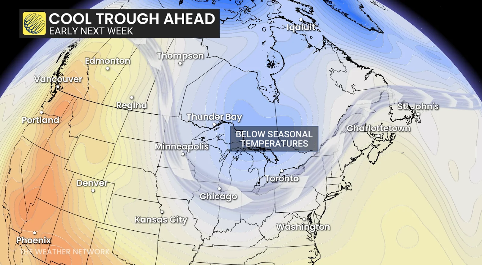
Hints of fall are on the horizon for southern Ontario as a strong cold front makes its way through the area.
Temperatures throughout the region will come in 5-10+ degrees below seasonal, which is more typical of late September than the end of August.
DON’T MISS: Sunsets growing earlier across Canada as summer starts to fade
It’s been a long summer with plenty of heat to go around. Toronto made it to 30°C or warmer 24 times this season, while Ottawa hit that mark on 22 different occasions. Windsor hit 30 degrees or warmer an impressive 29 days this summer.
Are you ready for the cooldown?
For folks in Ottawa, Toronto, and Windsor, this Monday through Friday will be the coolest five-day stretch we’ve seen since the last week of May.
Temperatures will cool in northern Ontario beginning Sunday and Monday, where daytime highs will struggle to climb out of the middle to upper teens. Expect some of the chilliest temperatures since the start of June for communities north and east of Lake Superior.
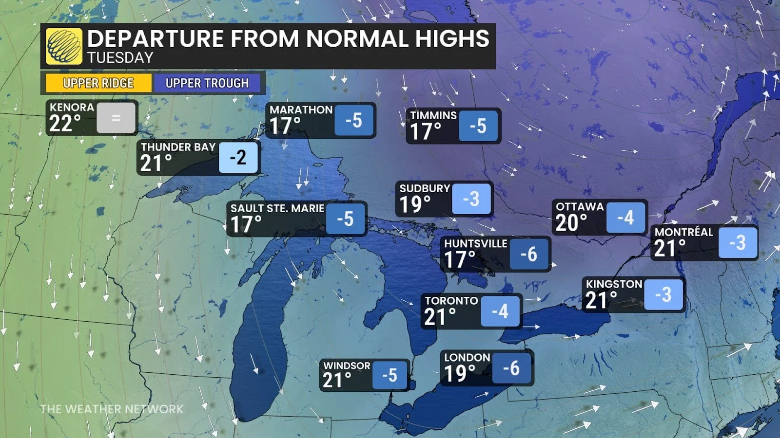
Readings will likely come in 5 or more degrees below seasonal for many communities in southern Ontario for the final week of August. It’ll be tough to crack 20°C on Tuesday around cottage country and the Huron shores.