
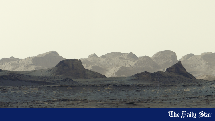
NASA’s Curiosity rover has captured a remarkable image of the Martian landscape at dawn, revealing ancient, wind-sculpted cliffs as sunlight spreads across the surface of the Red Planet.
The image, taken on August 11, 2026, and released by NASA in October, shows rugged geological formations known as yardangs on Mount Sharp, a mountain rising approximately five kilometres above the floor of Gale Crater.
Taken about an hour after sunrise, the rover’s Mastcam camera captured the photograph, revealing jagged cliffs and distant ridges.
The formations are particularly interesting to scientists because their geological composition differs from surrounding rock layers. Researchers believe they may have originated from windblown sediments, potentially including volcanic ash, before billions of years of erosion shaped them into ridges.
The yardang layer stretches approximately 16 kilometres across the northwestern section of Mount Sharp. Scientists believe examining the rocks could provide further evidence of how Mars changed from a planet that once supported lakes and flowing water into its present cold, dry environment.
The formations probably developed about three billion years ago, although scientists believe the rocks were deposited after some of the mountain’s earlier layers had eroded.
Curiosity has been exploring Mars since landing in 2012 and began ascending Mount Sharp in 2014. The rover has now climbed approximately one kilometre above the crater floor, setting a Martian exploration record.
NASA scientists hope Curiosity will reach the unusual formations in 2027 or 2028, allowing its scientific instruments to examine their composition directly.
The rover’s ongoing mission seeks to understand Mars’s geological history and determine whether the planet once had environmental conditions suitable for microbial life.