
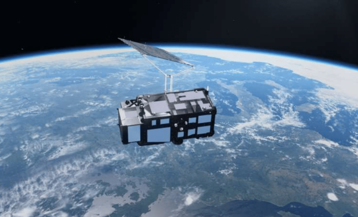
Europe’s newest Earth-observation satellite has delivered its first images and measurements just two weeks after launch. According to the European Space Agency (ESA), Sentinel-3C has already captured detailed views of Italy, the Canadian Arctic, and the Caribbean while measuring Greenland’s ice sheet and ocean surface heights, providing an early indication that its instruments are functioning as intended.
A New Satellite Begins Watching Earth’s Changing Surface
Launched in September 2026, Sentinel-3C is the third satellite in the Copernicus Sentinel-3 series, a European program designed to continuously monitor the planet’s oceans, land, atmosphere, and frozen regions. Its arrival strengthens a long-running observation system that provides scientists with consistent measurements of environmental change.
The spacecraft carries several instruments, including an ocean and land color instrument (OLCI) and a synthetic aperture radar altimeter (SRAL). Together, they allow researchers to examine coastal waters, track vegetation, measure sea-surface height, and observe changes in polar ice.
These capabilities extend beyond producing images. Sentinel-3 observations support weather forecasting, drought monitoring, wildfire assessment, and studies of marine heat waves. They also help scientists build long-term records of environmental conditions.
The satellite remains in its commissioning phase, which is expected to continue for approximately five more months. Its first observations nevertheless provide encouraging evidence that two of its principal instruments are operating properly.
From Italy’s Mountains to the Turquoise Waters of the Caribbean
One of the first images, acquired on September 30, 2026, reveals Italy and surrounding regions in natural color. The snow-covered Alps stand out above the agricultural plains of the Po Valley, while the Adriatic Sea stretches along the country’s eastern coastline.
Subtle differences in water color reveal additional information. Lighter blue areas near the Adriatic coast are likely associated with river sediments transported into the sea. Such observations can help researchers examine coastal processes and changes in marine environments.
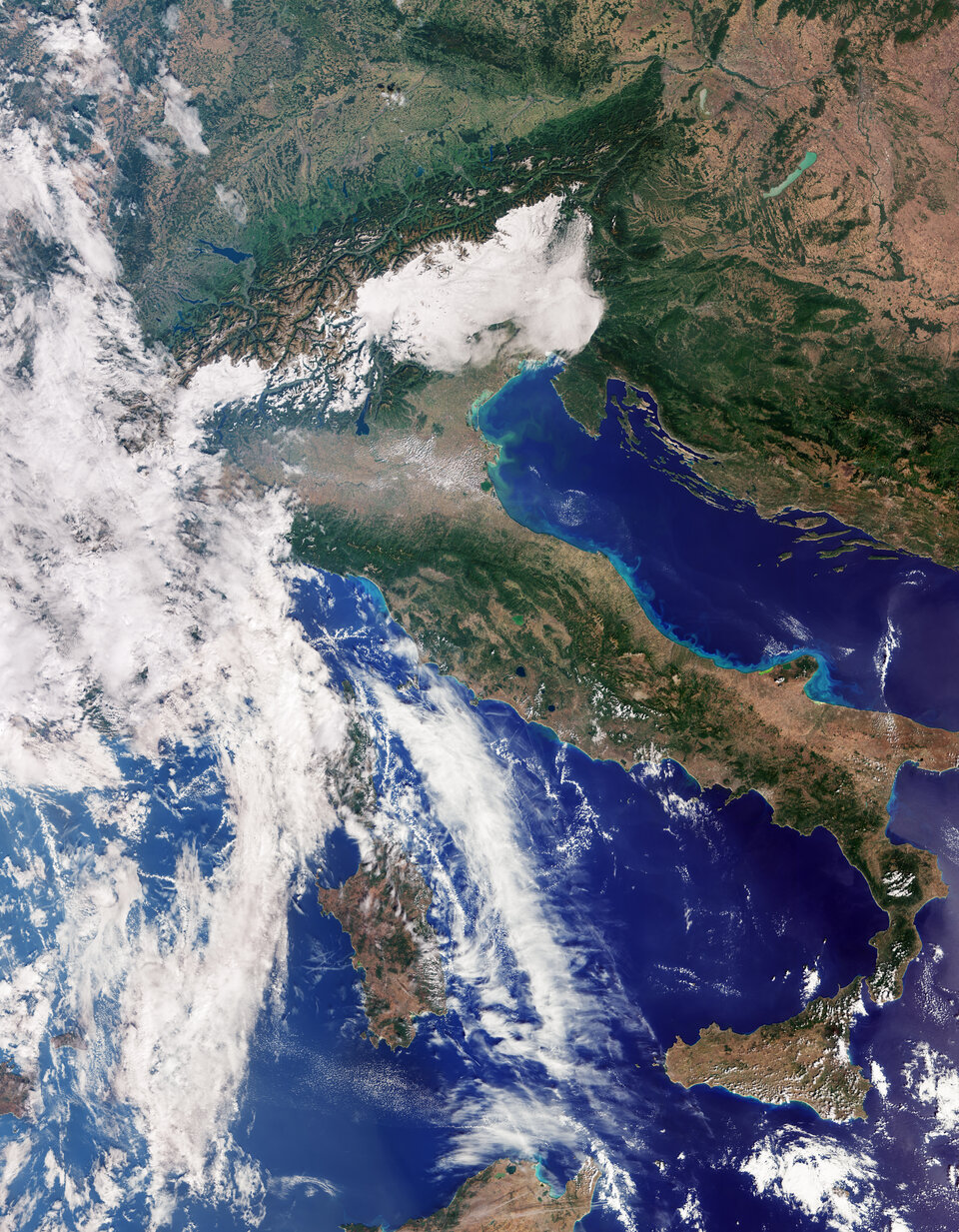 Italy and beyond imaged by Sentinel-3C
Credit: contains modified Copernicus Sentinel data (2026), processed by ESA
Another image, captured the same day, shows part of the Canadian Arctic Archipelago, west of Greenland. Snow-covered islands, exposed rock, deep fjords, and fragmented sea ice form a landscape that illustrates the region’s complex geography.
The Arctic is warming considerably faster than the global average, making repeated satellite observations particularly valuable for tracking changes in sea ice and surrounding environments.
A third image, acquired on September 29, focuses on the Caribbean, including Cuba and the Bahamas. Turquoise shallow waters contrast with darker offshore regions, demonstrating the instrument’s ability to distinguish different marine environments from orbit.
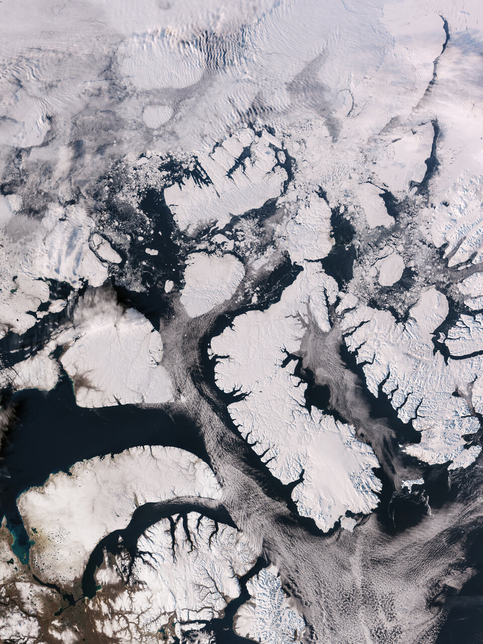 Canadian Arctic from Sentinel-3C
Credit: contains modified Copernicus Sentinel data (2026), processed by ESA
ESA Confirms Promising Results From Greenland and the Atlantic
Beyond its optical imagery, Sentinel-3C has begun producing radar measurements that could prove particularly valuable for climate research.
According to ESA, observations collected between September 30 and October 4 show that the satellite’s radar altimeter successfully measured the elevation of the Greenland ice sheet. Its measurement tracks closely matched an established digital elevation reference model.
This agreement provides an early technical validation of the instrument, although it does not yet establish a new trend in Greenland’s ice loss.
The satellite also measured sea-surface heights across the Atlantic Ocean and Mediterranean Sea. These initial results were compared with the Copernicus Marine Service multimission sea-level anomaly dataset and showed encouraging consistency.
Satellite altimetry has already established that global mean sea level has risen by an average of approximately 3.64 millimeters per year since 1999, with the rate increasing over time.
By extending these observations, Sentinel-3C will help researchers monitor ocean changes while complementing established missions such as Sentinel-6 and Jason.
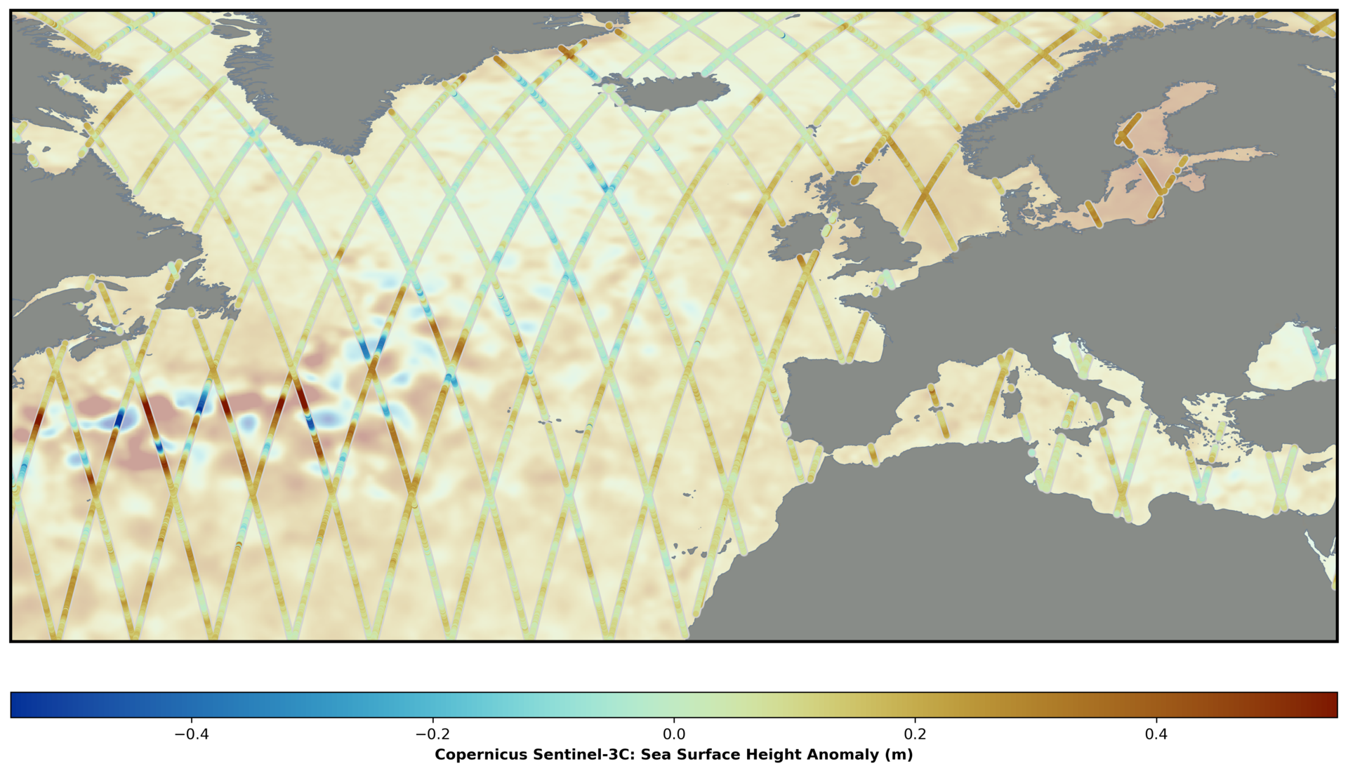 Sea-surface height from Sentinel-3C
Credit: contains modified Copernicus Sentinel data (2026), processed by Eumetsat
Why These First Measurements Matter for Earth’s Future
The significance of Sentinel-3C lies in its ability to provide repeated measurements over many years rather than isolated snapshots of Earth’s surface.
Tracking the elevation of Greenland and Antarctic ice sheets can help scientists estimate changes in ice mass and improve projections of future sea-level rise. Monitoring ocean heights also contributes to understanding the risks facing low-lying islands and coastal communities.
Over land, the satellite’s observations will support assessments of vegetation health, drought conditions, and wildfire impacts. Its altimeter can also measure water levels in rivers and lakes, expanding its usefulness beyond oceanography.
The mission will eventually complement Copernicus CRISTAL, a forthcoming satellite designed to improve observations of polar ice.
For now, Sentinel-3C’s first images and radar measurements represent an initial technical success, not the completion of its validation process. With several months of commissioning still ahead, the satellite is moving toward a role in maintaining the continuous environmental records scientists rely on to understand how Earth is changing.