
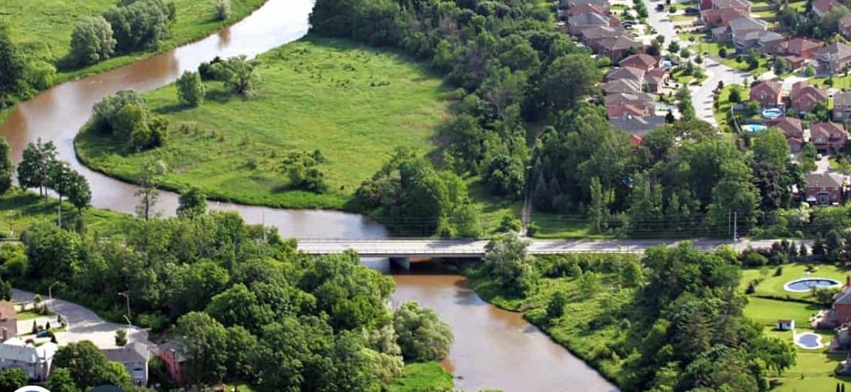
Credit Valley Conservation is breathing fresh life into a decades-old document as it looks to better protect the Credit River Watershed from the northern reaches of the Greater Toronto Area to the mouth of the 90-kilometre-long river in Mississauga’s south end.
The first Credit River Watershed plan was created in 1956, and CVC officials are currently nearing the end of a multi-year update to protect the diverse natural area for decades to come.
“This new plan will use the latest science and data, as well as partner, stakeholder and community input to establish long-term priorities for CVC and municipal partners,” Credit Valley Conservation said in an update to the community.
“It will set the stage for our scope of work for years to come,” CVC added.
A watershed plan, conservation authority officials say, “is a tool that helps us understand the past and plan for the future health of the watershed. It identifies current and future conditions in forests, wetlands, streams and groundwater, and proposes solutions to address any identified issues.”
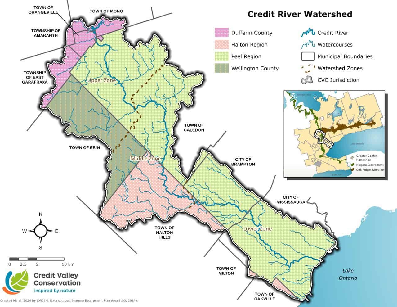
Credit Valley Conservation protects natural areas and watercourses in Mississauga, Brampton and Caledon in addition to several other communities including Orangeville, other places in Dufferin County and Halton Hills.
(Image: Credit Valley Conservation)
The conservation authority says it’s developing the new watershed plan “to help protect and improve the health of the Credit River, streams, wetlands, forests and groundwater for future generations.”
As it updates the document, CVC is asking members of the public to complete an online survey to provide feedback that “will help guide priorities and actions that support both healthy ecosystems and thriving communities.”
The survey closes Dec. 1.
“Situated within one of the most-densely populated regions of Canada, the Credit River Watershed contains some of the most diverse landscapes in southern Ontario,” CVC said in its update. “It includes all the land that drains into the Credit River, along with several smaller watersheds that flow directly into Lake Ontario — ranging from Applewood Creek in Mississauga to Clearview Creek in Oakville.”
At more than 90 kilometres in length, the Credit River flows southeast from the headwaters near Orangeville and Mono, over the Niagara Escarpment in Caledon and Halton Hills, through the urban areas of Brampton, Milton, Oakville and Mississauga to Lake Ontario, Credit Valley Conservation officials said.
Credit Valley Conservation said this past summer it reached a milestone on another important project — a 100-kilometre trail that will run from Mississauga’s Lake Ontario shoreline through Brampton to north of the Greater Toronto Area.
The decades-long project is nearly at the halfway mark following the official opening in August of a new 40-metre pedestrian bridge along the developing Credit Valley Trail at the Upper Credit Conservation Area in Caledon.
Credit Valley Conservation, which owns the property, called the new bridge “a major new infrastructure project that will help connect the trail from the Credit River headwaters in Orangeville to Port Credit at Lake Ontario” in Mississauga.
The conservation authority said at the time that the latest achievement along the burgeoning walking/cycling trail is “an important milestone towards creating the 100-kilometre continuous pathway through the Credit River Valley.”
(Cover photo: Credit Valley Conservation)
INSAUGA Canada’s Editorial Standards and Policies
Last 30 Days: 50,302 Votes
All Time: 1,600,495 Votes
1645 VOTES
Are you happy with the election results in your town or city?
Stay in the know.
Subscribe now to receive our daily email of today’s top stories in your city!