
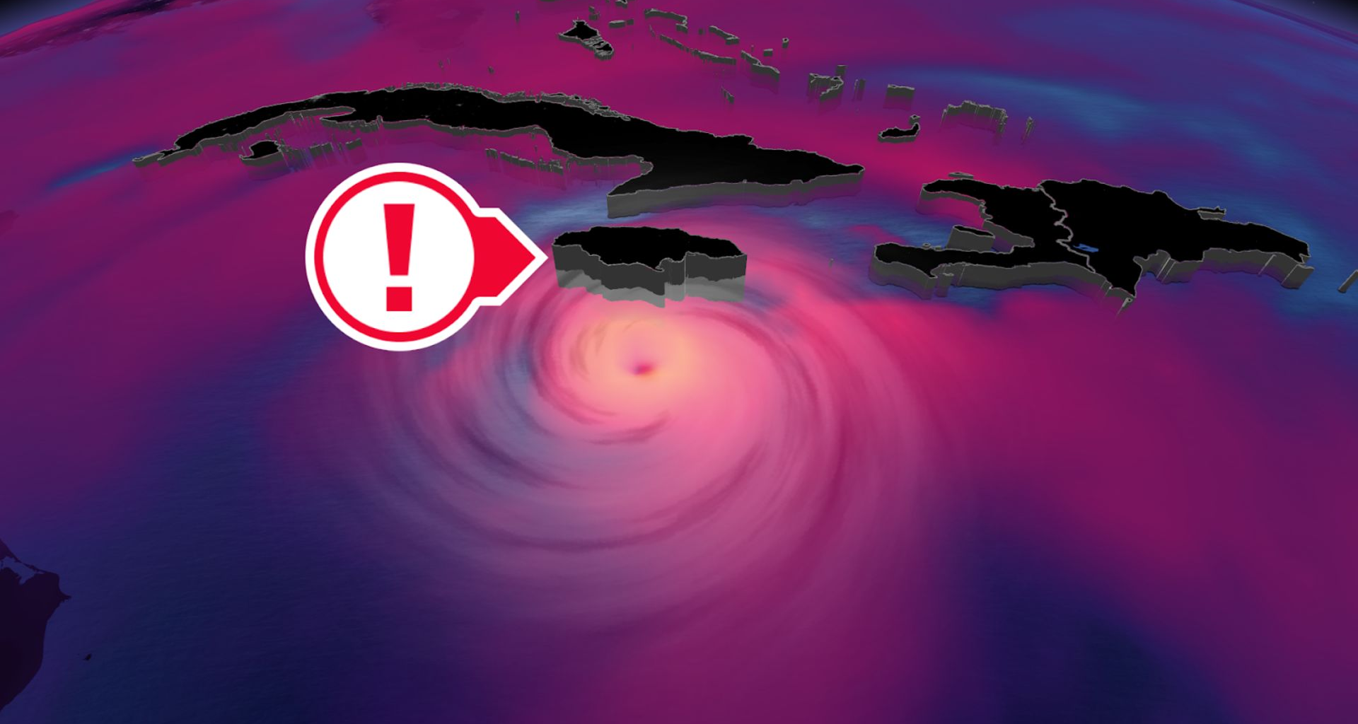
A slow-moving hurricane could prove destructive
Weak steering currents around Melissa will force the storm to slowly drift west this weekend and into the beginning of next week, allowing high winds and drenching rains to wash over the mountainous terrain of Jamaica and southwestern Haiti for days at a time.
RELATED: What does a hurricane’s ‘cone of uncertainty’ mean?
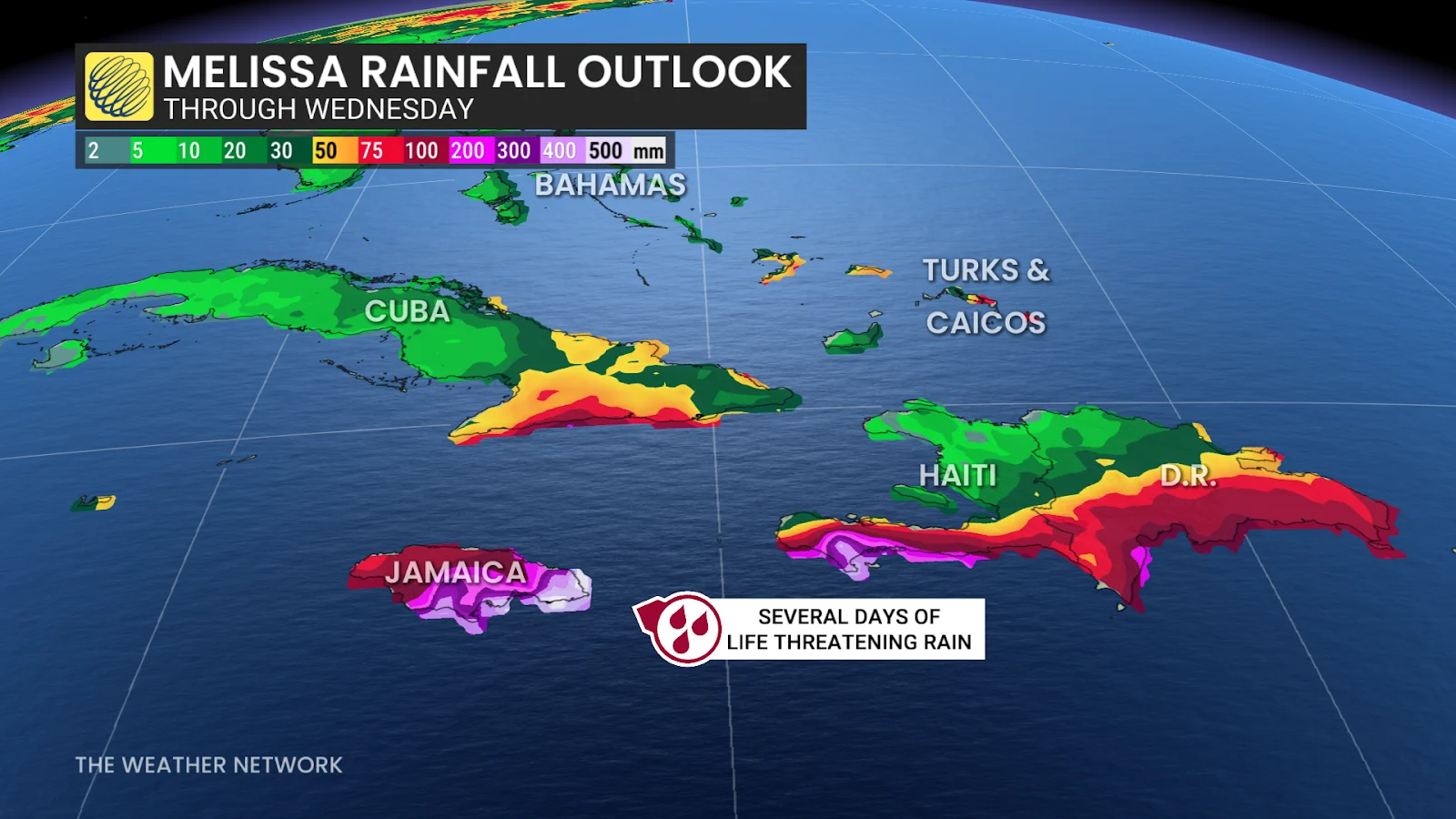
Rainfall totals of 500+ mm are possible across portions of the region, which could lead to potentially devastating flash flooding and landslides. A persistent storm surge along Jamaica’s southern coast could also lead to dangerous coastal flooding, including around the capital of Kingston.
A trough swinging over the eastern U.S. will likely provide Melissa an escape route by Tuesday, forcing the storm to turn northeast and potentially make landfall in Jamaica before moving on toward eastern Cuba.
Based on current predictions, Melissa could become one of the strongest storms on record to strike Jamaica. The island nation’s current recordholder is 1988’s Hurricane Gilbert, which struck with 200 km/h winds and rainfall totals that topped 800 mm in some locations.
Potential Canadian impacts remain uncertain
It’s likely that the storm will exit the Caribbean and begin accelerating into the western Atlantic by the middle of next week.
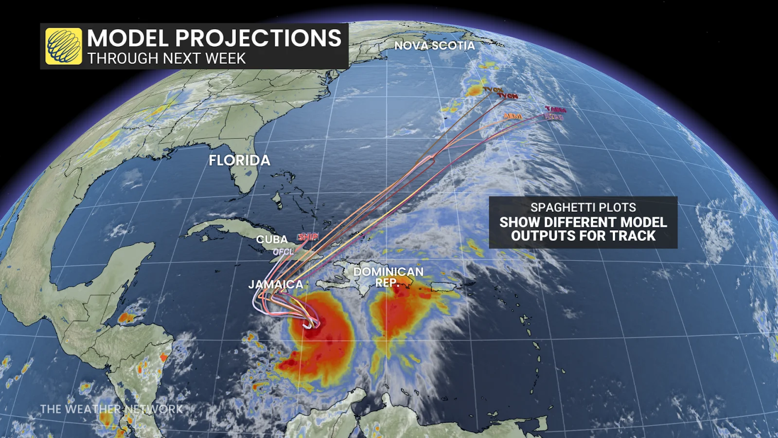
Forecasters are watching the potential for some of Melissa’s moisture and energy to transfer to a developing centre of low pressure off the East Coast. This could fuel heavy rainfall across portions of Eastern Canada around Halloween.
Stay with The Weather Network for all the latest updates on the tropics. Header image courtesy of NOAA.
WATCH: Follow these tips to prepare for a hurricane before one arrives