
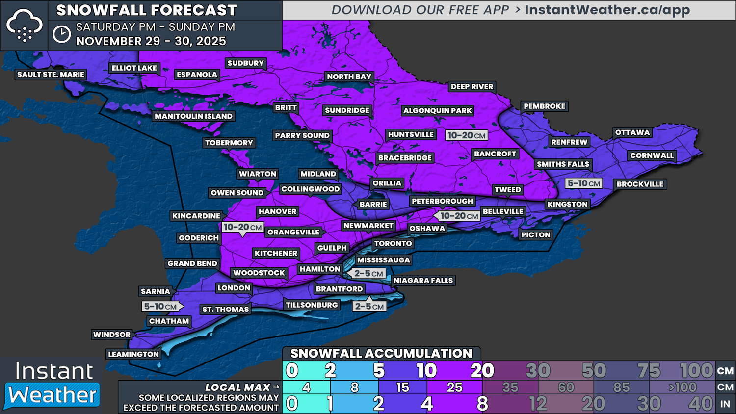
When it comes to the distribution of precipitation, we expect it to fall fairly evenly across the province. However, snowfall totals will vary based on temperature differences, which will influence how efficiently the snow can accumulate.
The higher snowfall totals from this event are expected in the more northern sections of Central Ontario and extending into the Sudbury and North Bay region. This includes Parry Sound, Muskoka, Algonquin Park and Bancroft.
These regions will see more sustained below freezing temperatures throughout the event, along with lake effect enhancement late Sunday. With this, we are looking at around 10 to 20cm, with locally up to 25cm possible in the heavier lake effect pockets.
A similar situation is expected east of Lake Huron and along the higher elevations of the Dundalk Highlands and Oak Ridges Moraine, where slightly colder temperatures will help accumulations. Expect 10 to 20cm in these areas as well, with localized totals around 25cm, especially east of Lake Huron.
Everyone else, with the exception of the Lake Erie and Lake Ontario shorelines, is looking at a general 5 to 10cm. Some areas could see locally up to 15cm if temperatures end up just a bit cooler than expected. This includes the rest of Southwestern Ontario into Windsor, Chatham and Sarnia, the Lake Simcoe region and parts of the Ottawa Valley.
For communities exposed to the shorelines of Lake Erie and Lake Ontario, which includes Toronto, Oshawa, Oakville, Hamilton, Niagara-on-the-Lake, Port Colborne and Rondeau, snowfall totals will likely be closer to the 2 to 5cm range due to the warmer air intrusion and rain mixing during the latter part of the system.