

A big portion of southern Ontario is expected to be hit with snow this week.
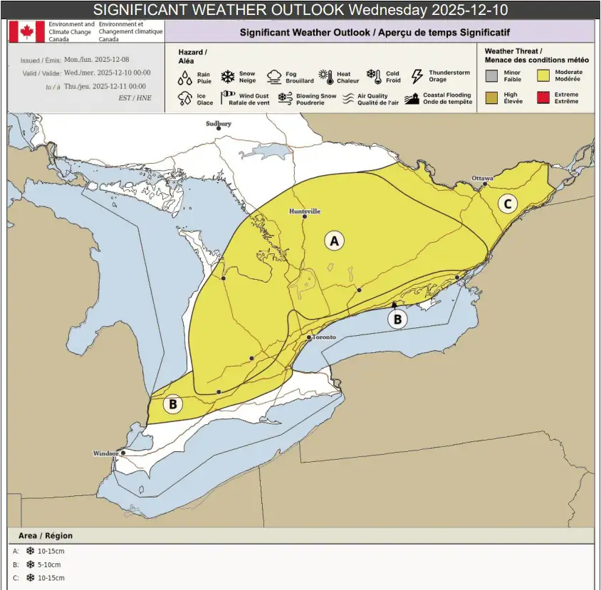
Overall, 5 to 15 cm is expected for much of the region on Wednesday, according to a weather outlook from Environment Canada.
The weather agency said that portions of southern Ontario, from Sarnia, to the GTA, extending east to Kingston, can expect to see snow beginning early Wednesday morning.
Five to 10 cm could fall before a switch to a rain-snow mix or just rain by the afternoon.
“The morning commute will likely be impacted,” Environment Canada said.
Environment Canada
“There is some uncertainty with the track of this system, so snowfall amounts in this area may need adjustments in the coming days.”
Areas north of Highway 401 can generally expect to see 10 to 15 cm, with impacts starting Wednesday morning as well.
In parts of eastern Ontario, including the Ottawa area, the snow is expected to begin in the mid-to-late morning and continue into the evening or overnight, Environment Canada said.
The afternoon commute may be impacted there, where 10 to 15 cm is expected, though some areas may see even more than that by the time it’s all done.
Prior to Wednesday’s snowfall, some areas off of Lake Superior and Lake Huron are expected to see lake-effect or lake-enhanced snow on Tuesday.
INsauga’s Editorial Standards and Policies
WIN $100 WORTH OF GROCERIES
Subscribe to INsauga’s daily newsletter for a chance to win a $100 PC gift card