

Strong winds will develop as the low rapidly strengthens, with gusts peaking near 100-120+ km/h on Monday evening and into Monday night.
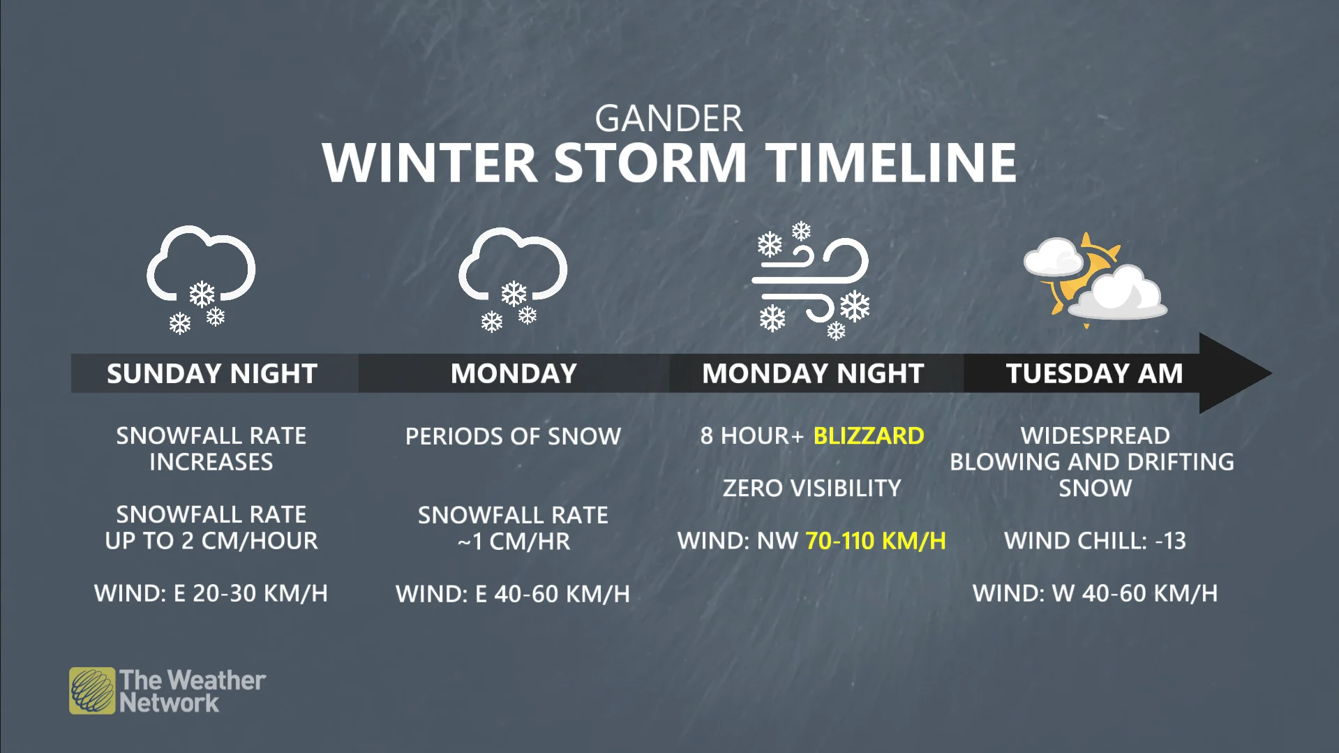
The combination of heavy snowfall rates and intense winds will lead to a blizzard in central and northern Newfoundland. Communities including Gander, Grand Falls-Windsor, St. Anthony, and Twillingate could see up to 8 hours of blizzard conditions during this storm. 30-40 cm of snow will fall in the hardest-hit areas.
Farther east, communities on the Burin and Avalon Peninsulas can expect snow at the beginning of the storm. Precipitation will transition to a messy wintry mix early Monday, which will then swiftly change over to all rain as southerly winds drag warmer air into the region.
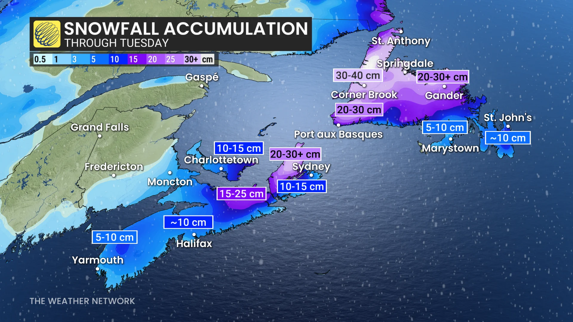
We could see up to 10 cm of snow on the Avalon Peninsula before the precipitation change arrives.
Likely impacts include closures, outages
Areas expecting blizzard conditions will see little to no visibility during periods of heavy snow and strong winds. Anyone can easily become disoriented in near-zero visibility, even just venturing a short distance away from safe shelter.
Power outages and tree damage are likely amid the storm’s high winds.