
Published on Jan. 25, 2026, 11:37 PM
Expect heavy snow and reduced visibility beginning Sunday night and lasting through Tuesday morning
A major winter storm trekking across North America will make its final stop in Atlantic Canada with widespread heavy snowfall and gusty winds to begin the week.
Prepare for difficult to near-impossible travel at times as heavy, blowing snow reduces visibility to near zero. The rapid rate of accumulation will make it difficult for plows to keep up during the heavier bursts.
This will be a long-duration snowfall event for the region, as the system is moving slower than a typical winter storm.
DON’T MISS: US storm leaves 850,000 without power, forces 10,000 flight cancellations
Widespread heavy snowfall on the way
Frigid air spilling south out of the Arctic met up with ample moisture streaming in from the south to create a once-in-a-generation winter storm across the U.S. and Eastern Canada. This system’s snow and ice caused more than one million power outages stateside.
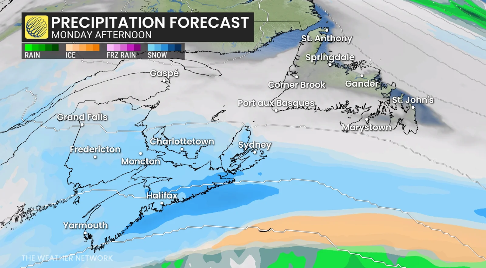
Snowfall arriving in the southwestern Maritimes late Sunday will spread across the region through the overnight hours into Monday morning. During that time, expect snowfall rates and wind gusts to both increase. Rates of 3-4 cm per hour are possible in southern Nova Scotia.
The heaviest snowfall will be centred over Halifax and southern sections of Nova Scotia by Monday morning. Prepare for widespread school closures and extremely difficult travel conditions on Monday and possibly into Tuesday.